Otrobanda
The name says it plainly, in Papiamentu: otro banda. The other side. When the walled city of Punda grew too crowded in the early eighteenth century, Willemstad spilled across Sint Anna Bay and founded this district in 1707 as an overflow suburb with a personality all its own. Otrobanda became the cultural heart of the capital, the side with the churches and the hospitals and the museums, the side where the street grid loosened into something less Dutch and more Caribbean. Today its pastel facades and UNESCO-listed buildings face Punda's candy-colored waterfront across the narrow bay, two halves of the same city staring at each other like mismatched bookends. Between them swings the Queen Emma Bridge, connecting the district that calls itself the city and the district that calls itself everything the city is not.
The Spanish Side
In the colonial shorthand of old Willemstad, Punda and Pietermaai were the Holland side. Otrobanda was the Spanish side -- not because Spain governed it, but because its character felt less rigidly Northern European, more loosely Caribbean. Founded as an extension of the capital, it absorbed the population that Punda's walls could no longer contain. By 1816, some 2,527 people lived here. The Basilica of St. Anne rose as the first Roman Catholic church on the island, a statement of faith in a colony administered by the Protestant Dutch. In 1856, the Sint-Elisabeth Hospital opened its doors, the first hospital in the country. The district was not merely an overflow; it was becoming the place where civic institutions took root. When Willemstad needed to build something new, it often built it on the other side.
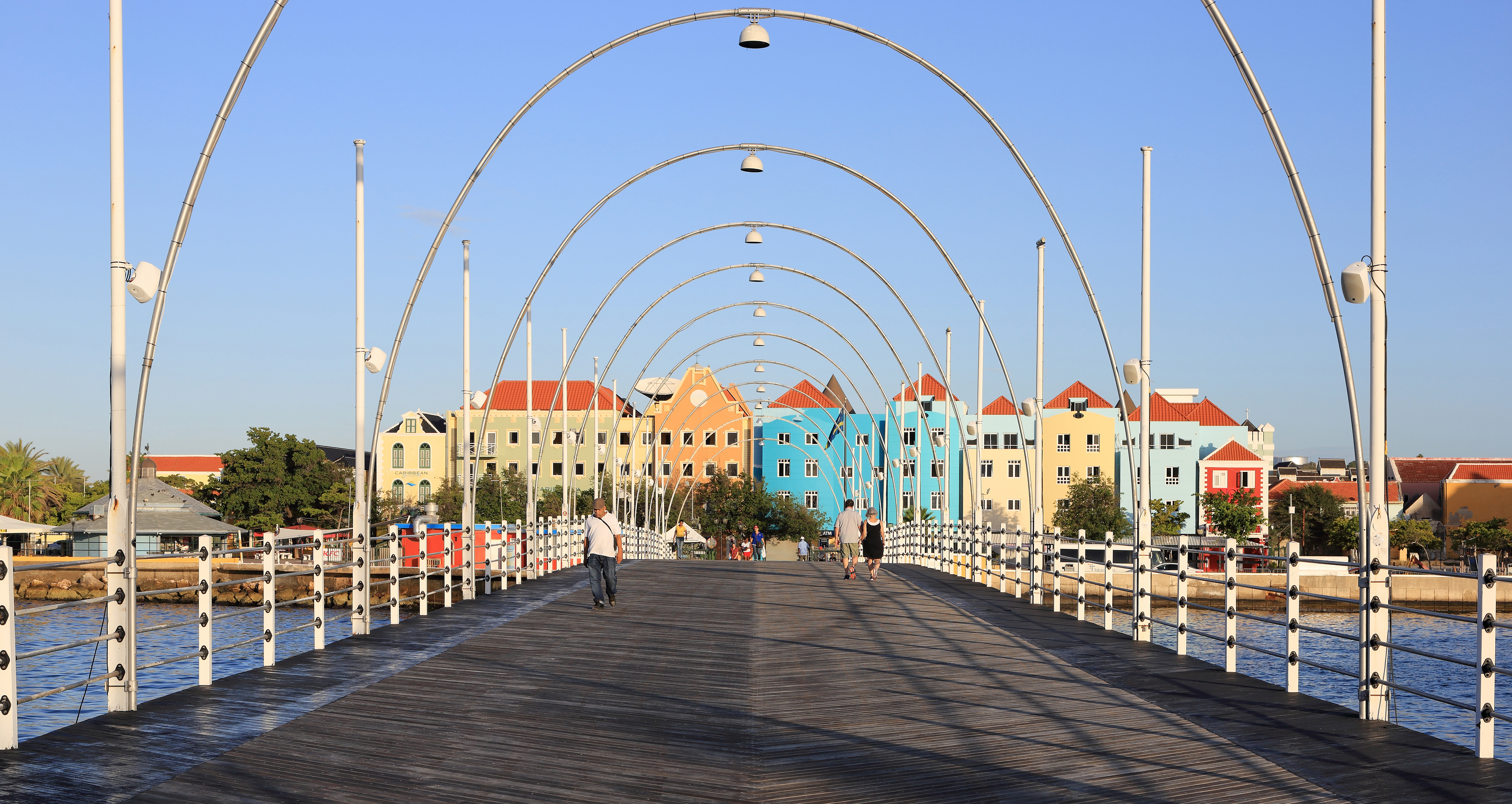
Bridges and Belonging
For nearly two centuries, crossing from Otrobanda to Punda meant taking a boat across Sint Anna Bay. That changed in 1888 with the completion of the Queen Emma Bridge, the pontoon span the locals call the Swinging Old Lady because it literally swings open to let oceangoing ships pass. The bridge transformed the relationship between the two quarters. Otrobanda was no longer the other side -- it was the other half, connected by a walkway that bobbed gently on the water. In 1974, the Queen Juliana Bridge added a high-arching road connection further inland, lifting motor traffic above the bay on a span that rises 56 meters at its peak. But the older bridge remains the emotional link. Walk across it at dusk and the light hits the waterfront facades at their best: Punda's row of narrow merchant houses in yellow and turquoise and terracotta, Otrobanda's broader blocks in muted pastels.
Where Memory Is Preserved
Otrobanda's museums do not let the past be comfortable. The Kura Hulanda Museum, housed in a restored courtyard complex, specializes in the Atlantic slave trade that shaped Curacao and the wider Caribbean. The courtyard itself sits near one of the places where enslaved Africans were held before being sold -- the museum is built, literally, on the ground where the history it documents took place. A few blocks away, the Curacao Museum occupies the former military hospital, a quieter institution that opened on March 7, 1948, and holds paintings, furniture, glass, and textiles from across the island's colonial centuries. Together, the two museums frame the full scope of Otrobanda's past: the brutality of the trade that built this city's wealth and the culture that emerged from it.
Coral Walls and Cannon Slots
At the district's western edge, Rif Fort hunches against the sea. Built in the nineteenth century to defend the harbor from pirates and hostile navies, its walls are a meter and a half of solid coral stone, once bristling with more than 56 cannons aimed at the open water. The fort's military career ended long ago. Today its thick walls shelter restaurants, bars, and shops, and the waves that once would have carried enemy vessels now crash dramatically through gaps in the ramparts while diners eat under string lights. The Renaissance Curacao Resort redeveloped the fort into Rif Fort Village, a shopping and entertainment center whose panoramic views look back across the bay to Punda. Brionplein, the waterfront plaza named for Admiral Luis Brion, anchors the district's public life with a space that feels more Mediterranean than Dutch Antillean.
The Other Side, Still Becoming
More than 700 buildings in Willemstad carry UNESCO World Heritage designation, and many of Otrobanda's are among them. The restoration effort has been uneven but persistent, turning crumbling colonial structures into hostels, offices, and homes without stripping away the patina that makes them worth preserving. Walk a few blocks inland from the waterfront and the renovation thins out. Paint peels. Iron balconies rust in the salt air. Otrobanda is not a museum piece frozen in amber but a working neighborhood where the work of reinvention continues block by block. The district that started as Willemstad's overflow has spent three centuries becoming something the original city never quite managed: a place where history, culture, and daily life share the same streets without pretending the past was tidy.
From the Air
Located at 12.109°N, 68.937°W on the western shore of Sint Anna Bay in Willemstad, Curacao. Otrobanda is easily identified from the air by its dense cluster of pastel colonial buildings facing Punda across the narrow bay. Rif Fort is visible at the district's southwestern tip, jutting into the sea. Curacao International Airport (ICAO: TNCC) lies approximately 12 km to the north. Best viewed at 2,000-3,000 feet for waterfront detail. The Queen Emma pontoon bridge and the high-arching Queen Juliana Bridge are unmistakable landmarks connecting the two halves of the city. Visibility is typically excellent in Curacao's arid, trade-wind climate.