Outeniqua Mountains
The Portuguese sailors who first charted these peaks from the sea called them Serra de Estrella -- the Mountain of the Star. The Khoikhoi who had lived among them for centuries had a different name: Outeniqua, derived from the Khwemana word meaning 'they who bear honey.' Both names capture something true. Seen from the coast, the range catches the light in ways that justify any poetic impulse. Up close, in the forests of the southern slopes, indigenous bees still work the fynbos blossoms. But the Outeniqua Mountains have also been a barrier, a challenge, and -- for at least one aircraft -- a fatal obstruction.
The Honey Bearers
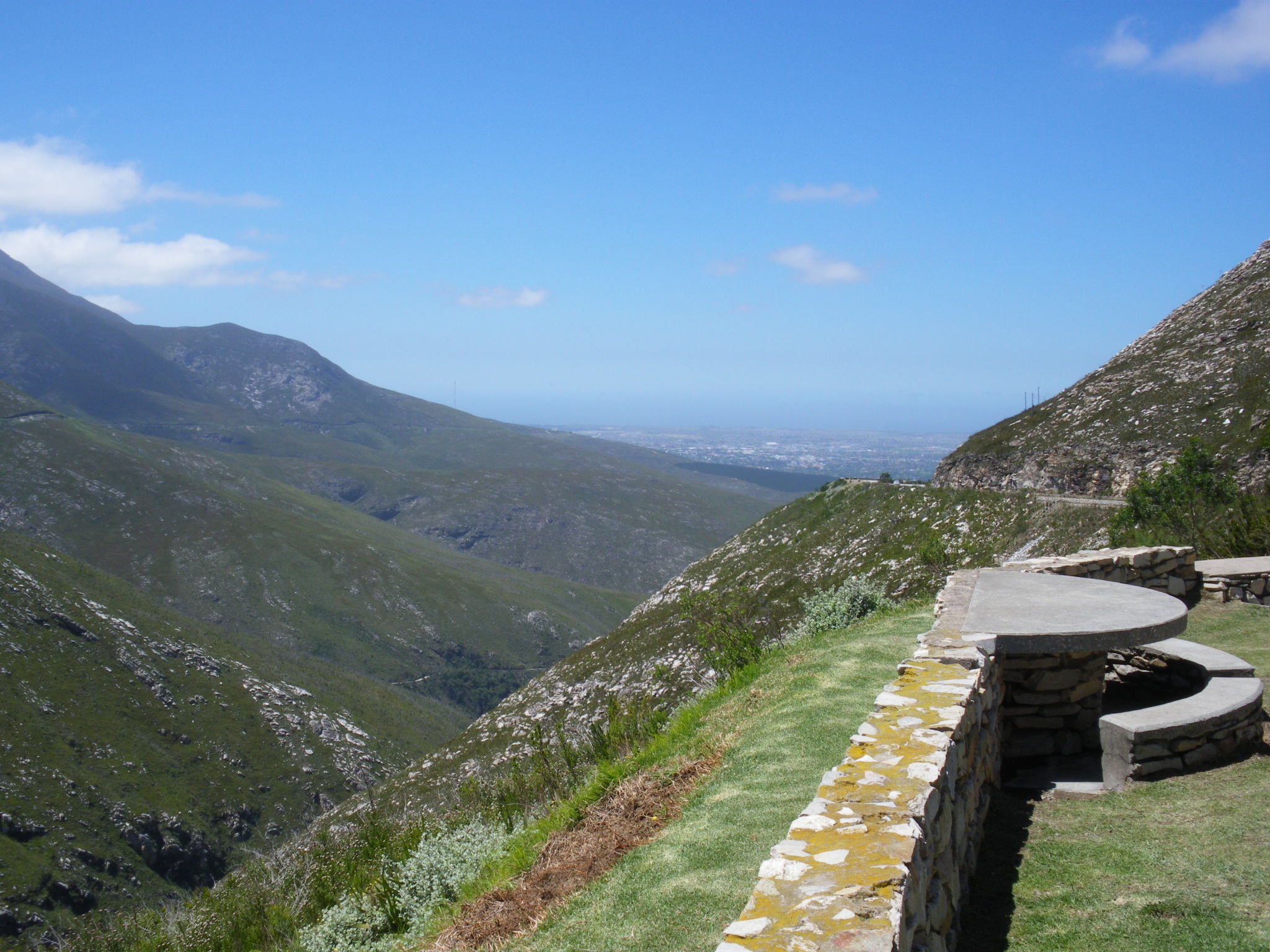
The Outeniqua range runs parallel to South Africa's southern coast, forming a continuous mountain wall with the Langeberg to the west and the Tsitsikamma Mountains to the east. It is the backbone of the Garden Route, separating the lush coastal strip from the arid Klein Karoo to the north. The range's highest point is Cradock Peak at 1,578 meters, with George Peak reaching 1,370 meters directly north of the town of George. The southern slopes are gentle, catching moisture from the Indian Ocean and supporting montane fynbos at higher altitudes and Afromontane gallery forests in sheltered ravines. The northern face drops steeply into the Karoo, creating entirely different habitats -- karroid shrubland and renosterveld -- on what amounts to the other side of the same mountain.
Roads That Defeated Everyone
For centuries, the Outeniqua Mountains were effectively impassable by wheeled vehicle. The Khoekhoe and other indigenous peoples knew the routes through, as did the elephants whose herds created paths that early European settlers followed in the late 1600s. The first formal road, Cradock Pass -- named after Governor Sir John Cradock -- earned a reputation as one of the worst roads in the colony. In 1831, a magistrate inspected it and declared it a 'complete bar' to all trade. Others described it as 'the most formidably bad' road they had ever seen. In 1847, the Montagu Pass replaced it, constructed by convict labor and named after Colonial Secretary John Montagu. But even that proved insufficient. In 1943, construction began on the modern Outeniqua Pass, using the labor of Italian prisoners of war. When the war ended, the Italians went home with the pass unfinished. It finally opened in September 1951 at a cost of approximately 500,000 pounds.
Wings and Weather
The mountains create weather as effectively as they block roads. High rainfall on the southern slopes feeds perennial streams that irrigate the Olifants River valley below. Summer temperatures average 20.5 degrees Celsius along the range, but conditions shift quickly -- winter can bring temperatures down to 5 degrees on the southern slopes, and snow falls on the higher peaks. These conditions have consequences for aviation. The Outeniqua range rises directly north of George Airport, and the combination of steep terrain, sudden cloud cover, and strong mountain winds has made the area challenging for pilots. The mountains have been the site of aircraft accidents, including a crash involving a plane that lost visibility in clouds while attempting to circle near the airport and flew into the mountainside.
Leopards, Eagles, and a Lone Elephant
The Outeniqua range harbors a surprising density of wildlife for mountains so close to human settlement. Klipspringers navigate the rocky outcrops, grey rhebuck graze the upper slopes, and leopards -- secretive but present -- patrol territories through the forest and fynbos. Verreaux's eagles ride the thermals along the ridgeline, while Knysna turacos flash emerald and crimson through the forest canopy. Cape sugarbirds work the protea blooms in the fynbos zones. For years, there was hope that the Knysna elephants -- once widespread through these forests -- might reestablish a population in the Garden Route National Park that encompasses much of the range. By 2019, surveys confirmed that only a single female elephant survived. Two road passes besides the Outeniqua also cross the range: Robinson Pass, west of George, and Prince Alfred's Pass, connecting Uniondale with Knysna through some of the most remote and beautiful mountain terrain in the Western Cape.
From the Air
The Outeniqua Mountains run roughly east-west at 33.75S, 23.00E, parallel to the southern coast. Cradock Peak (1,578 m / 5,177 ft) and George Peak (1,370 m / 4,495 ft) are the highest points. George Airport (FAGG) sits at the southern foot of the range -- exercise extreme caution as mountains rise sharply to the north. Terrain can generate turbulence, rapid weather changes, and obscured approaches. The southern slopes are green and forested; the northern face drops steeply to the Klein Karoo. Outeniqua Pass, Robinson Pass, and Prince Alfred's Pass are visible road corridors through the range. Recommended minimum safe altitude: well above 6,000 ft MSL when crossing.