Overtown: The Harlem of the South
When Ella Fitzgerald finished her set at the Fontainebleau on Miami Beach, she could not stay the night. Segregation law barred her from sleeping in the hotel where she had just brought the audience to its feet. So she crossed the causeway to Overtown, where the Mary Elizabeth Hotel kept rooms for Black performers who headlined the white venues but were forbidden from lingering once the music stopped. Count Basie, Cab Calloway, Josephine Baker, Billie Holiday, Nat King Cole -- they all knew the route. Overtown was not just a fallback. By the 1940s and 1950s, it was Miami's other entertainment district, rivaling Miami Beach itself, a neighborhood of hundreds of Black-owned businesses humming with nightlife, commerce, and a fierce cultural identity forged under Jim Crow's restrictions.
Built by the Railroad, Named by Segregation
Overtown's origins trace to the very founding of Miami in 1896. Henry Flagler's Black railroad construction workers, the laborers who extended the Florida East Coast Railway south, settled just north of Flagler's Royal Palm Hotel on the Miami River. Of the 362 men who voted to incorporate the new city, 168 were counted as "colored" -- nearly half the electorate. But segregation laws dictated that Black residents live north and west of the FEC railroad tracks, in a zone the city officially designated "Colored Town." It was the second-oldest continuously inhabited neighborhood in the Miami area after Coconut Grove, and it thrived despite the constraints imposed on it. Northwest Second Avenue became the main street, anchored by the Lyric Theatre, completed in 1913, which served as the social and cultural heart of the community.
Black Millionaires and the Florida Boom
During the Florida land boom of the 1920s, Overtown produced D. A. Dorsey, one of the first Black millionaires in the American South -- a man who once owned Fisher Island. Booker T. Washington High School became the first high school educating Black students south of Palm Beach. By the 1940s, hundreds of mostly Black-owned businesses lined the avenues: libraries, social organizations, a hospital, popular nightclubs. Luminaries beyond the entertainment world passed through as well. W. E. B. Du Bois lodged here. Zora Neale Hurston visited. Joe Louis and Jackie Robinson entertained in the neighborhood. The community was self-sustaining, proud, and vital, operating a parallel economy because the mainstream one would not have them.
The Expressways That Broke a Neighborhood
In the 1960s, highway engineers drove I-95, the Dolphin Expressway, and the Midtown Interchange straight through Overtown's heart. The expressways did not just pass through -- they shattered the neighborhood's street grid, demolished homes and businesses, and severed the connections that held the community together. The population plummeted from roughly 50,000 to just over 10,000, a loss of nearly eighty percent. What had been a thriving center became economically destitute as businesses closed and productivity stagnated. In 1982, a riot erupted following a police shooting. The neighborhood that had once hosted America's greatest performers was reduced to a few blocks of historic buildings surrounded by elevated concrete.
What the Concrete Could Not Erase
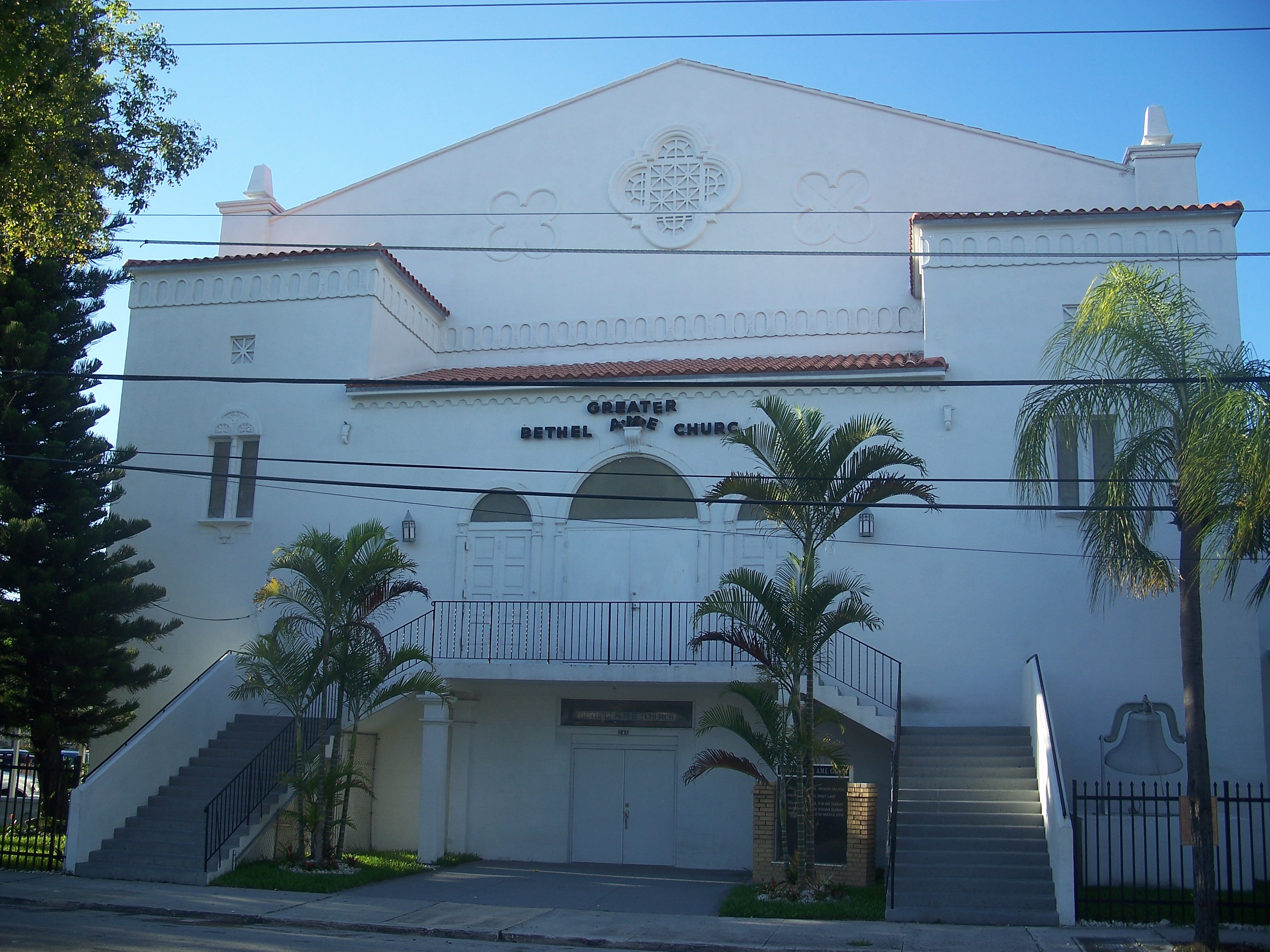
Overtown's landmarks survived the expressways. The Lyric Theatre, built in 1913, was renovated and reopened. The D. A. Dorsey House, built in 1913, still stands at 250 NW 9th Street. Greater Bethel African Methodist Episcopal Church, constructed between 1927 and 1943, anchors one of Miami's oldest Black congregations. The Ward Rooming House from 1925 now serves as a gallery and visitor center. Even the X-Ray Clinic, built in 1939 as the office for South Florida's first Black radiologist, Dr. Samuel H. Johnson, remains. Community gardens have reclaimed vacant lots -- Marvin Dunn's Roots in the City project turned overgrown, littered ground into a flourishing garden providing fresh produce to low-income families. The residents who stayed -- they call themselves "Towners" -- are rebuilding Overtown from the landmarks that refused to fall.
From the Air
Located at 25.79N, 80.20W, Overtown sits just northwest of Downtown Miami's skyline, bounded visibly by the elevated interchange where I-95 meets the Dolphin Expressway (SR 836). From low altitude, the expressway interchange dominates -- a concrete tangle that contrasts sharply with the historic neighborhood grid below. The Miami River curves along the western edge. Nearest airports: Miami International (KMIA) approximately 5 nm west, Opa-Locka Executive (KOPF) 8 nm north. Best viewed at 2,000-3,000 ft AGL to see the relationship between the expressway infrastructure and the surviving neighborhood fabric.