Owens Lake: The Dead Sea Los Angeles Murdered
Los Angeles killed Owens Lake and left the body to rot in the sun. In 1913, the city opened the Los Angeles Aqueduct, diverting the Owens River before it could reach the lake. Within a decade, 100 square miles of water had evaporated, leaving a dry lakebed of salt, arsenic, and fine sediment that the wind picks up and throws across the Owens Valley. By the 1980s, Owens Lake was the single largest source of particulate pollution in North America - dust storms so thick they closed highways and sent residents to hospitals. Los Angeles drank well while the valley choked. The cleanup has cost billions and isn't finished. The lake isn't coming back. The body remains.
The Theft
Los Angeles in 1900 was running out of water. William Mulholland, the city's water superintendent, looked north to the Owens Valley - 200 miles away, on the eastern side of the Sierra Nevada, fed by snowmelt from the highest peaks in California. Through a combination of deception, political manipulation, and federal cooperation, the city acquired water rights throughout the valley. Farmers and ranchers who'd built communities based on irrigation were told the water was going to federal reclamation projects. It went to Los Angeles instead. The 233-mile Los Angeles Aqueduct opened in 1913. Mulholland's famous words: 'There it is. Take it.'
The Death
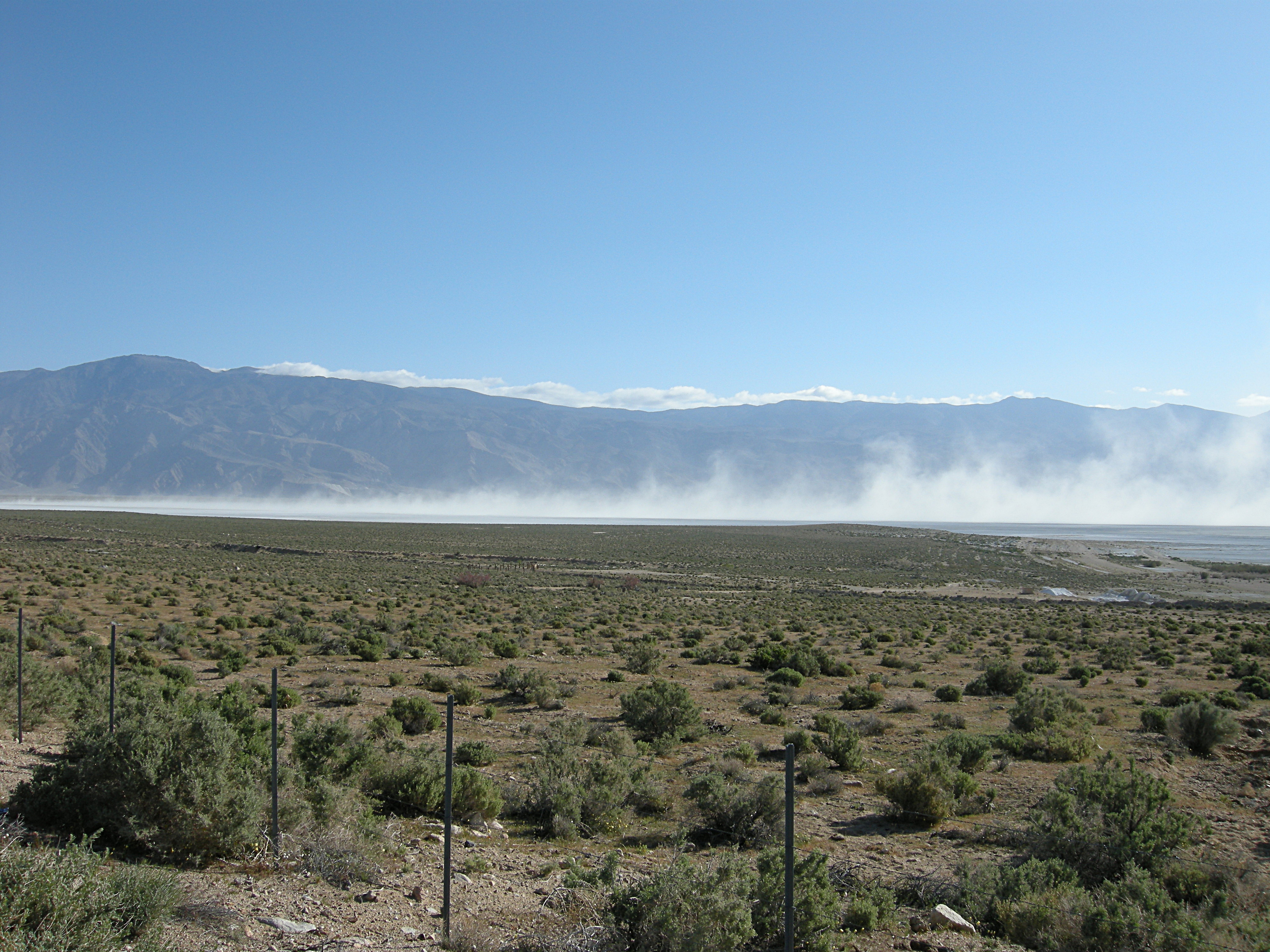
Owens Lake began dying immediately. The Owens River, which had fed the lake for millennia, now flowed through the aqueduct to Los Angeles. Evaporation exceeded inflow; the lake shrank year by year. By 1924, the lake was mostly dry. Where 100 square miles of water had supported waterfowl, fishing, and a steamboat service, there was now a salt flat. The salt was mixed with arsenic (naturally occurring), cadmium, and other toxic elements. The lakebed was 110 square miles of poison waiting for wind. When the wind came - and in the Owens Valley, it always comes - the dust flew.
The Dust
Owens Lake dry lakebed became the largest single source of PM10 pollution in America. Dust storms darkened the sky, reduced visibility to zero, closed highways, and sent particulate matter into lungs throughout the valley. The dust contained arsenic, cadmium, nickel, and other toxins. Respiratory disease rates in the Owens Valley exceeded national averages. Los Angeles, 200 miles south, drank clean water while the valley where that water originated couldn't breathe. Environmental lawsuits and federal Clean Air Act enforcement finally forced Los Angeles to act - not out of conscience, but legal compulsion.
The Mitigation
Los Angeles has spent over $2 billion trying to control the dust it created. Shallow flooding, gravel cover, vegetation, and managed wetlands now cover most of the lakebed, suppressing dust but not restoring the lake. Some water returns - enough to create seasonal habitat for migrating birds, not enough to fill the basin. The dust is mostly controlled now; air quality has improved. But Owens Lake remains dead, a managed corpse rather than a living system. Los Angeles keeps growing; the aqueduct keeps flowing; the valley keeps remembering what was taken.
Visiting Owens Lake
Owens Lake is located in Inyo County, California, east of the Sierra Nevada along Highway 395. The dry lakebed is visible from the highway as a vast white flat with managed wetland areas. The Owens Lake Dust Mitigation Program operates visitor facilities seasonally - check with the Los Angeles Department of Water and Power for access. The town of Keeler on the lake's east shore is a near-ghost town; Lone Pine to the north has full services. The Eastern Sierra Visitor Center interprets regional history including the water wars. Photography is excellent at sunrise and sunset when the Sierra casts shadows across the lakebed. The story is best understood by driving Highway 395 through the valley and imagining it with water.
From the Air
Located at 36.43°N, 117.95°W in the Owens Valley, California. From altitude, Owens Lake appears as a vast pale expanse east of the Sierra Nevada - whites, tans, and the dark lines of dust control infrastructure. Managed wetland areas show as dark patches where shallow flooding suppresses dust. The Sierra Nevada rises dramatically to the west, Mount Whitney visible as the highest peak. The Owens River channel and Los Angeles Aqueduct are visible as lines through the valley. Lone Pine is visible to the north; the highway runs along the valley floor. The scale of the dead lake is only apparent from above - 110 square miles of what was once water.