Ozark Riverways: America's First Protected Wild Rivers
In 1964, America decided to save a river from itself. The Current and Jacks Fork Rivers in the Missouri Ozarks were threatened by proposed dams; conservationists argued these spring-fed waterways were too beautiful to flood. They won. Ozark National Scenic Riverways became America's first unit of the National Park System designed specifically to protect a river's free-flowing character. The concept was revolutionary: not a canyon, not a battlefield, not a natural wonder - just rivers, allowed to remain rivers. The Current flows 134 miles through Ozark forest, fed by massive springs that pour 90 million gallons daily from limestone aquifers. It's the same river that would have been drowned behind concrete. Saving it changed how America thinks about water.
The Springs
The Ozark rivers are spring-fed, which makes them different from any other waterway. Big Spring discharges an average of 276 million gallons daily - one of the largest in the Western Hemisphere. Alley Spring, Round Spring, Blue Spring, and dozens of smaller springs pour cold, clear water into the rivers constantly. The flow is remarkably stable; the springs are fed by aquifers that store decades of rainfall. The result is water cold enough to support trout, clear enough to see bottom at 20 feet, and consistent enough to paddle year-round. The springs aren't scenic features; they're the rivers' life support.
The Threat
The Army Corps of Engineers proposed damming the Current River at multiple sites through the 1960s - flood control, hydropower, recreation, the standard justifications. The reservoirs would have drowned the springs, eliminated the cold-water fishery, and transformed unique rivers into generic lakes. Conservation groups, led by the Ozark National Scenic Riverways Council, argued that some rivers were worth more undammed than flooded. It was a new argument in 1964; the National Park Service hadn't previously preserved rivers qua rivers. The legislation that passed created a model now applied to rivers nationwide.
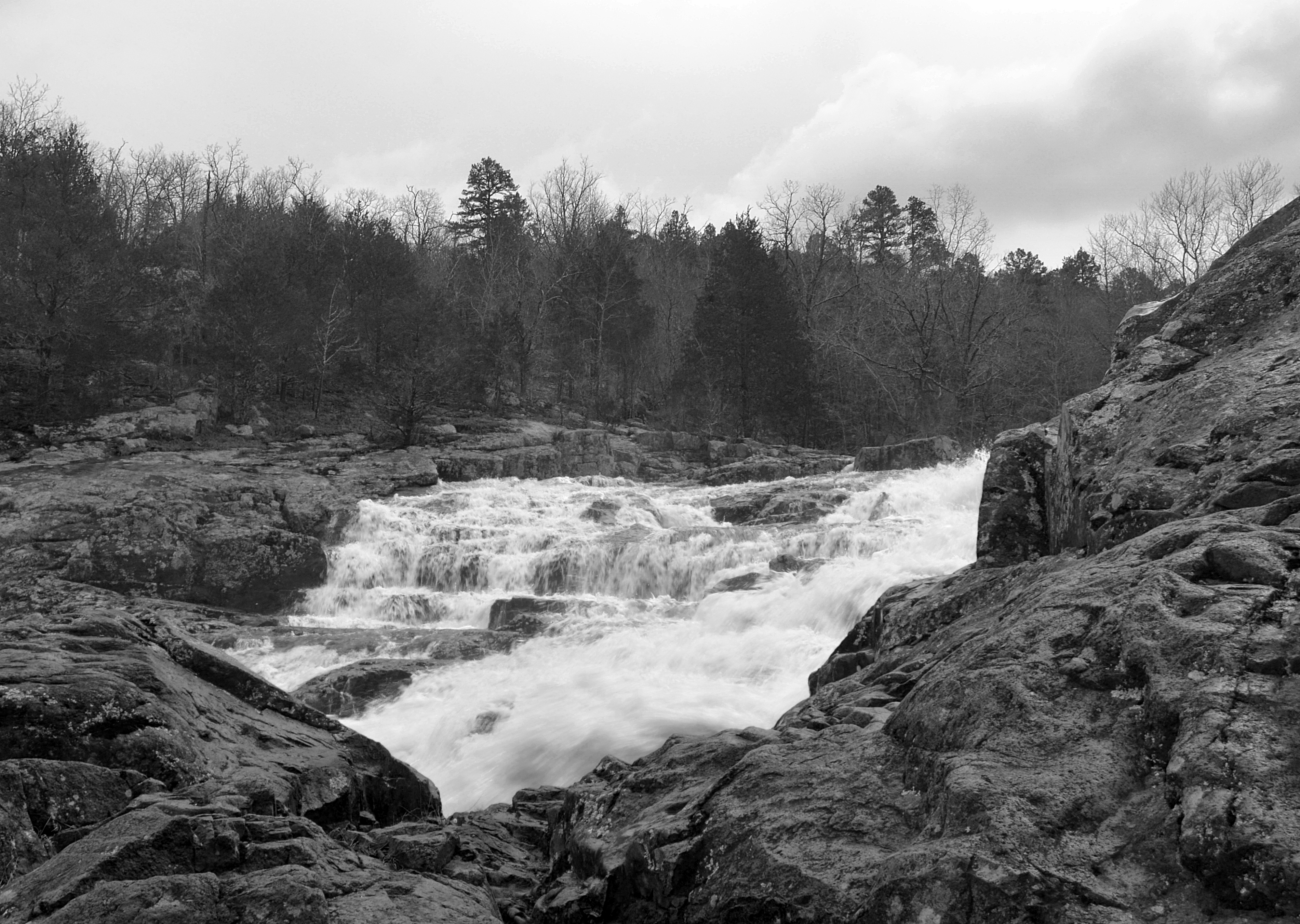
The Rivers
The Current River flows 134 miles from Montauk State Park to its confluence with the Black River, dropping through limestone bluffs, gravel bars, and forested bottomlands. The Jacks Fork, a tributary, adds 44 miles of protected waterway. The rivers are everything Ozark waterways should be: clear, cold, lined with sycamores and cedars, supporting populations of smallmouth bass and rainbow trout. Paddling is the primary activity - canoes and kayaks on easy float trips through scenery that barely changes in 60 years of protection. The rivers remain wild because someone decided they should.
The Caves
The same limestone that creates the springs creates caves - over 400 documented within the riverway boundaries. Round Spring Cavern offers guided tours through formations that took millions of years to develop. Other caves are accessible only to permitted researchers or serious cavers. The cave systems connect to the springs; water flowing through caverns emerges at spring heads. The relationship illustrates why surface protection isn't sufficient - the rivers depend on underground systems extending miles beyond park boundaries. Groundwater quality in the surrounding region determines spring quality in the park.
Visiting Ozark Riverways
Ozark National Scenic Riverways is located in Shannon and Dent Counties, Missouri, about 150 miles south of St. Louis. Multiple access points allow day trips or multi-day floats. Canoe and kayak rental operations are available at most access points; reservations recommended for summer weekends. Big Spring, Alley Spring, and Round Spring have visitor facilities including campgrounds. Cave tours are available at Round Spring (seasonal). The rivers are floatable year-round, but spring and fall offer the best conditions - summer can be crowded and low water may require dragging. Van Buren and Eminence have basic services. Float trip planning tools are available through the park website.
From the Air
Located at 37.15°N, 91.40°W in the Missouri Ozarks. From altitude, the Current and Jacks Fork Rivers appear as winding ribbons through heavily forested hills - the green corrugated landscape of the Ozark Highlands. The spring basins are visible as blue pools where tributaries emerge. The terrain shows typical karst topography: sinkholes, losing streams, and irregular drainage patterns. The towns are tiny; development is minimal. The rivers are protected from dams, but the landscape's emptiness comes from century-old logging and population decline rather than preservation. The rivers wind through what was once more settled country.