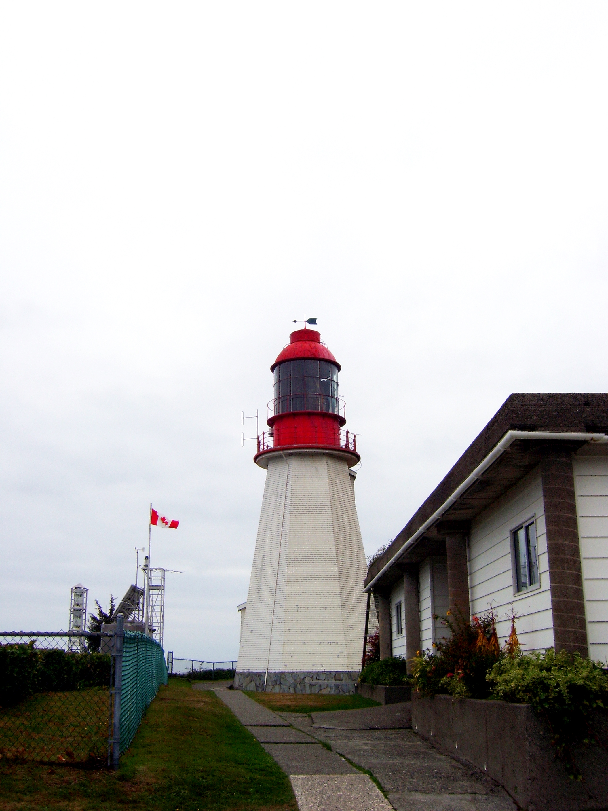
Pachena Point Light
Calvin Martin had been the lightkeeper at Pachena Point since 2005. Before him, Peter Redhead served two stints spanning a dozen years. Before Redhead, Ian Crocker kept the light through most of the late 1980s and 1990s. The chain stretches back unbroken to 1907, when John S. Richardson became the first keeper of the octagonal wooden tower perched on a headland 13 kilometers south of Bamfield, watching over some of the most treacherous waters on the Pacific coast. On October 26, 2024, that chain was broken. The lightkeepers departed, and the station went dark in a way the light itself never had.
A Light for the Graveyard
Pachena Point Lighthouse was built in the aftermath of disaster. The wreck of the SS Valencia in January 1906, which killed 136 people along this stretch of coast, galvanized the Canadian government into action. Among the improvements was a new lighthouse at Pachena Point, completed in 1907 within Pacific Rim National Park. The octagonal wooden tower became a fixed point of reference for vessels navigating the entrance to the Strait of Juan de Fuca, where the Pacific funnels into the narrows between Vancouver Island and the Olympic Peninsula. The Canadian Coast Guard maintained the station and employed keepers who did far more than tend the light -- they watched the weather, monitored the sea, and served as an informal lifeline for hikers on the West Coast Trail below.
The Keepers' Succession
The list of keepers reads like a genealogy of solitude. Richardson gave way to William Robinson Pillar in 1908, who gave way to Richard Clark in 1913. Some served decades -- John Alfred Hunting first arrived in 1924, returned in 1931, and did not leave until 1958. Others lasted a year or two before the isolation proved too much. The rhythm of the work remained constant across the century: maintain the light, record the weather, watch the sea. When fog rolled in -- which was often -- the foghorn joined the rotation. When hikers stumbled out of the forest injured or hypothermic, keepers offered shelter and called for help. The station sat at the intersection of two kinds of remoteness: the ocean's and the trail's.
Seismic Concerns, Human Cost
In July 2024, Fisheries and Oceans Canada and the Canadian Coast Guard announced that Pachena Point and nearby Carmanah Point light stations were seismically unstable. The ground beneath the keepers' feet, they determined, could not be trusted in the event of a significant earthquake -- a real concern on a coast that sits atop the Cascadia subduction zone. By October 26, both stations were destaffed. The decision drew immediate and heavy criticism. Local governments, Indigenous leaders, and industry figures all pushed back, pointing to more than a century of continuous human presence at the stations and the safety role keepers played for the thousands of hikers who pass through each summer. The lightkeeper union raised concerns about inadequate consultation with First Nations and stakeholders. A petition was formed to delay the destaffing until a firm plan for the lighthouses' future could be established.
The Light Without a Keeper
The light itself still operates -- automated systems have handled the basic function of illumination for years. But a lighthouse without a keeper is a different thing than a lighthouse with one. The keeper was the judgment, the eyes that could distinguish a vessel in distress from a vessel merely passing, the voice on the radio that could relay conditions no sensor captures. At Pachena Point, where the Graveyard of the Pacific earned its name through decades of wrecks that piled bodies on these beaches, the human presence carried a weight beyond its job description. The heritage buildings remain under the care of Fisheries and Oceans Canada. The octagonal tower stands. Whether it will ever again have someone standing in it, watching the fog roll in, is uncertain.
From the Air
Pachena Point Lighthouse is at 48.72°N, 125.10°W on a headland 13 km south of Bamfield on Vancouver Island's southwest coast, within Pacific Rim National Park. The octagonal tower is visible from 1,500-2,500 feet on the exposed point. The West Coast Trail passes directly below. Nearest airport: Port Alberni (CBS8). The coastline here is particularly rugged with reefs offshore. Frequent fog -- this is the Graveyard of the Pacific.