Pacific Rim National Park Reserve
By the mid-1960s, the beaches between Tofino and Ucluelet were being loved to death. Highway 4, completed in 1959, had flung open the gates to Vancouver Island's wild west coast, and thousands of visitors descended each summer, camping on the sand, building driftwood shacks, digging improvised latrines, and leaving behind garbage and vehicles sunk in the beach. The paradise that had inspired dreams of a national park since 1929 was being consumed by the very popularity that proved its worth. It would take decades of political wrangling, timber disputes, and Indigenous rights negotiations before the 511 square kilometre Pacific Rim National Park Reserve finally received formal protection in 2000.
Three Worlds Under One Name
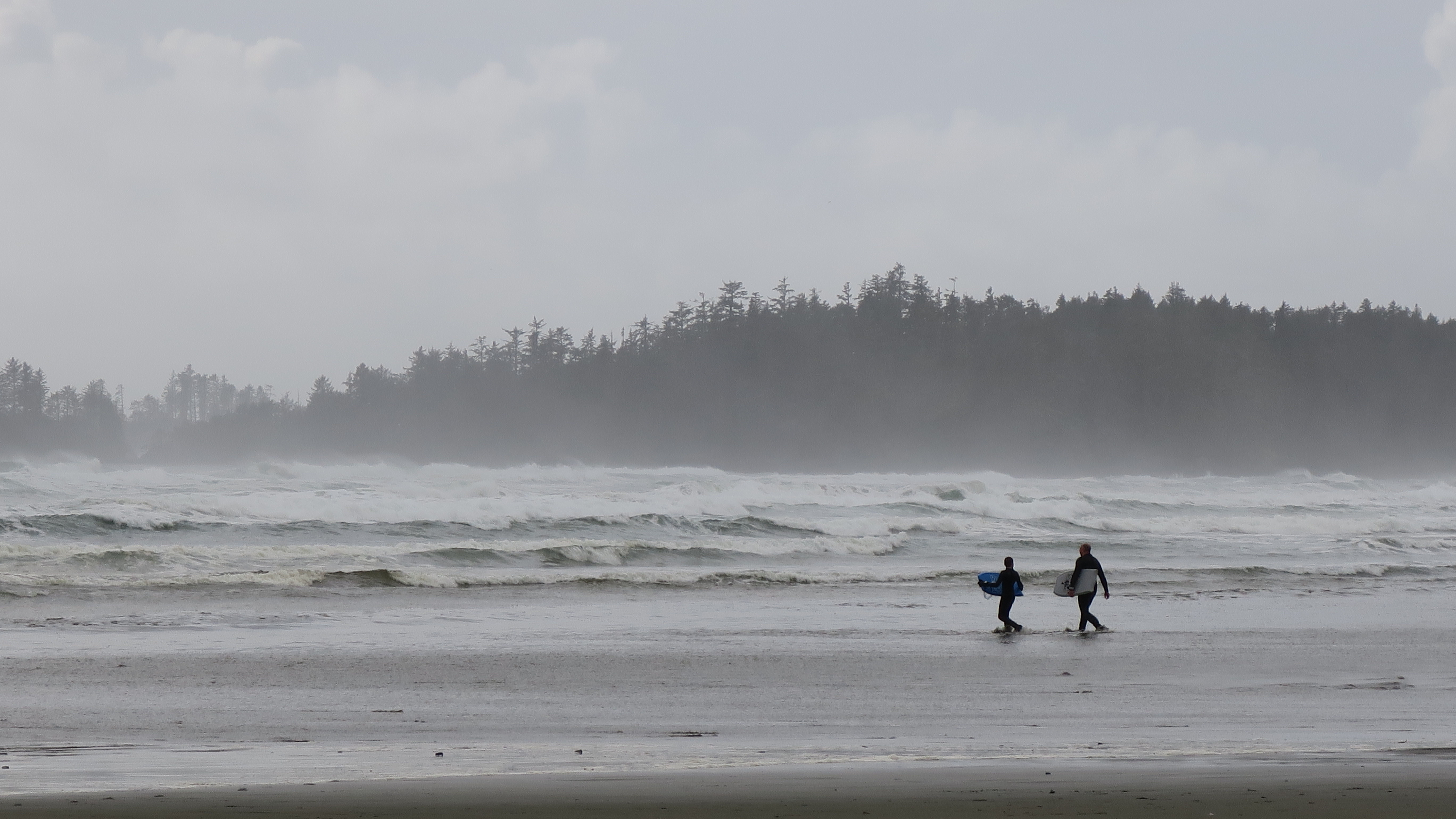
The park is not a single place but three distinct units stitched together along a rugged 130-kilometre stretch of coast. Long Beach, the most accessible, draws surfers and storm-watchers to a sweep of sand and driftwood between Tofino and Ucluelet. The Broken Group Islands scatter more than a hundred rocky islets across Barkley Sound, a sea-kayaker's archipelago where abandoned village sites hint at centuries of Nuu-chah-nulth habitation. And the West Coast Trail traces 75 kilometres of cliff, rainforest, and cable-car river crossings between Port Renfrew and Bamfield, following a corridor originally built as a telegraph line in 1889 and later upgraded as a life-saving trail after the 1906 wreck of the SS Valencia.
The Rainforest Within
Step off the beach and into the forest, and the world transforms. Western hemlock, Sitka spruce, and western red-cedar tower overhead, their trunks wrapped in moss so thick it softens every surface into something sculptural. The understory is a tangle of deer fern, sword fern, and sphagnum, all thriving in over 3,500 millimetres of annual rainfall that makes this one of the wettest places on Earth. Black bears, Roosevelt elk, and Vancouver Island wolves move through the shadows. The park protects Cheewhat Giant, a western red cedar that is the largest known tree in Canada. Marbled murrelets nest in the old-growth canopy, while six species of salmon thread through the park's watercourses below.
Where the Ocean Lives
The coastal ecology is equally rich. Intertidal zones harbor ochre sea stars, aggregating anemones, and northern abalone clinging to rocks pounded by surf. Kelp forests sway in the subtidal waters, providing habitat for Steller sea lions and harbour seals. Grey whales migrate past each spring on their journey from Baja California to Alaska, and humpback whales and orca patrol the deeper channels. The Kuroshio Current moderates water temperatures, keeping the sea between 8 and 14 degrees Celsius year-round, warm enough to sustain the remarkable biodiversity that has drawn researchers and divers to these waters for generations.
Unceded Ground
The word 'reserve' in the park's name carries legal weight. Seven First Nations, including the Huu-ay-aht, Tla-o-qui-aht, and Ditidaht, claim territory within the park's boundaries as part of lands that were never ceded by treaty. The Nuu-chah-nulth Tribal Council submitted a formal claim in 1980, and the government accepted it for negotiation in 1983. Early in the park's formation, little consultation had occurred with the Indigenous peoples whose ancestral territory was being redrawn as federal parkland. Since 1995, collaborative management programs have brought Nuu-chah-nulth perspectives into park operations, from interpretive trails to shared stewardship responsibilities. The Tla-o-qui-aht have declared the Kennedy Lake watershed and nearby Meares Island a tribal park, asserting their own vision of land protection alongside the federal designation.
The Long Negotiation
Creating the park took three decades of grinding political work. The idea first surfaced in 1929, but reconnaissance trips deemed the area too remote and foggy for a health-resort-style park. It was not until Jean Chretien replaced Arthur Laing as the federal minister responsible for parks in 1968 that real progress began. British Columbia adopted the West Coast National Park Act in 1969, and the two governments signed an agreement in 1970, but disagreements over timber rights with forestry giants MacMillan Bloedel and B.C. Forest Products delayed the final land transfers until 1988. The park was formally added to the National Parks Act in 2000, more than seventy years after it was first proposed. Every kilometre of trail and beach had been fought for.
From the Air
Located at approximately 48.98N, 125.67W along the west coast of Vancouver Island. The Long Beach unit is visible from altitude as a broad crescent of sand between Tofino and Ucluelet. The Broken Group Islands are scattered across Barkley Sound to the south. Nearest airport is Tofino/Long Beach Airport (CYAZ), which is actually an enclave within the park. Ucluelet Water Aerodrome (CAP4) also serves the area. Expect low cloud and fog, particularly in summer mornings. The park spans approximately 130 km of coastline.