Pallas-Yllastunturi National Park
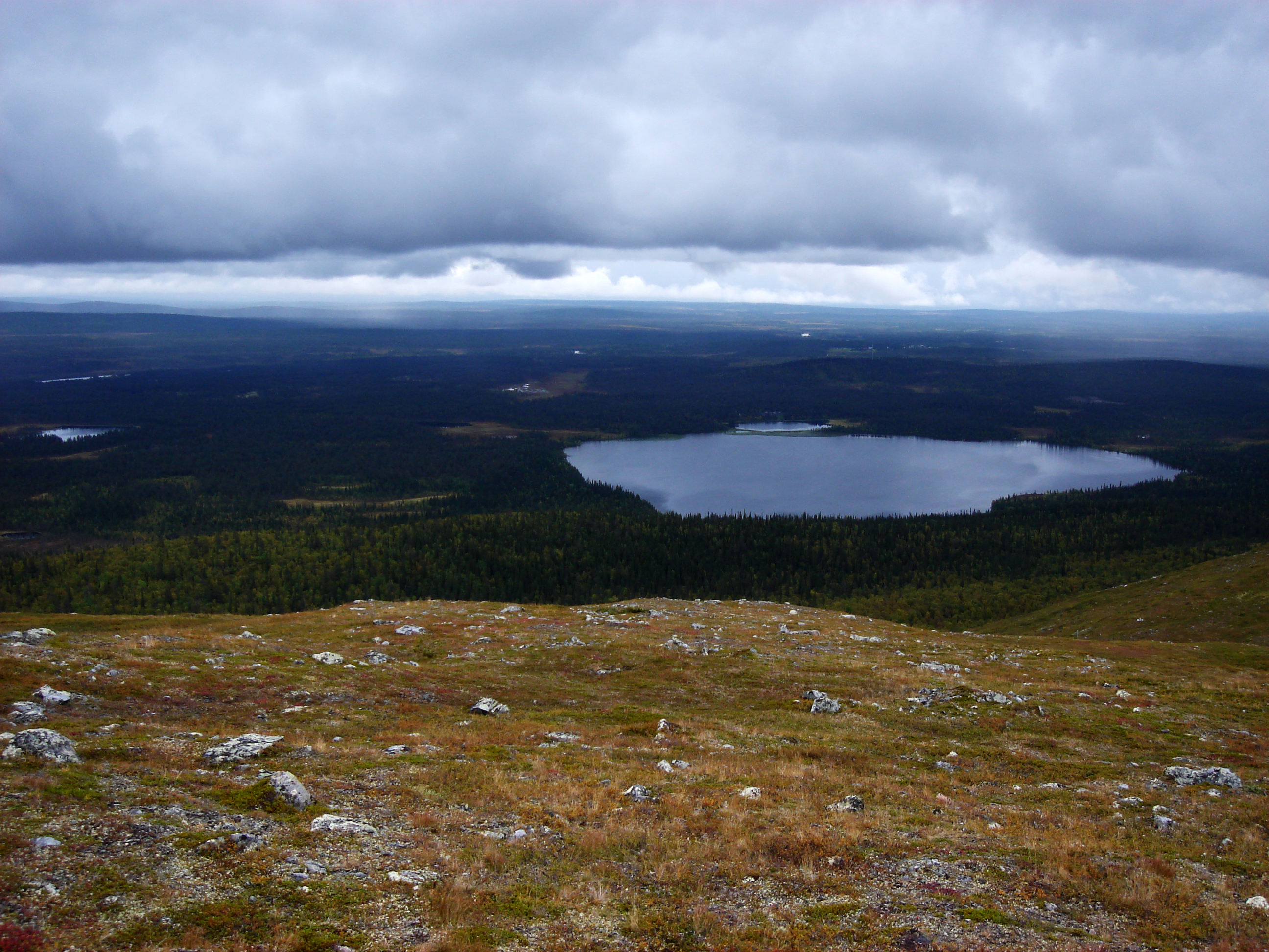
The treeline here is not a metaphor. You can walk across it in a single morning -- stepping from dense spruce forest where elk browse the understory into the open, wind-scoured world of the fells, where the ground is lichen and low scrub and the horizon extends to the curve of the earth. Pallas-Yllastunturi National Park straddles this ecological frontier in Finnish Lapland, covering a chain of rounded fells where Forest-Lapland yields to Fell-Lapland. With over 500,000 visitors per year, it is Finland's most popular national park, yet its 1,020 square kilometers absorb the crowds into a landscape vast enough to feel genuinely wild.
Where the Forest Ends
The park lies across four municipalities -- Enontekio, Kittila, Kolari, and Muonio -- in a region where the northern limit of the spruce forest passes directly through the protected area. Height differences exceed 500 meters, which is unusual for a country known for flatness. The result is a layered landscape: mires and boreal forests on the lowlands give way to birch scrub, then bare fell tops where only the hardiest plants survive. This is also a cultural boundary. Enontekio, with its center at Hetta on the park's northern edge, is part of the Sami native region, where the Sami people hold special rights and their language carries official status. Reindeer husbandry replaces farming as the dominant livelihood, and the Vuovjjus exhibition at one of the park's visitor centers tells the story of nomadic Sami culture and northern nature.
Finland's Oldest Trail
The Hetta-Pallas hiking trail, running 55 kilometers through the heart of the park, is the oldest marked trail in Finland. It dates from the establishment of Pallas-Ounastunturi National Park in 1938, one of the first national parks in the country. In 2005, the original park was merged with the Yllas-Aakenustunturi protected area to form the current Pallas-Yllastunturi National Park. Today the trail network extends across 350 kilometers of marked summer hiking routes and over 500 kilometers of cross-country skiing tracks. Four major long-distance trails -- Hetta-Pallas, Pallas-Yllas, Yllas-Levi, and Yllas-Olos -- connect the park's fells, forests, and visitor centers. In peak season, which runs from February through April when the snow is thick and the days are long and sunny, the skiing trails draw thousands to this corner of Lapland.
Extremes of Light and Cold
Pallas-Yllastunturi operates on a seasonal rhythm dictated by light and temperature. In midwinter, daylight is scarce, temperatures routinely drop below minus 20 Celsius, and minus 40 is possible -- conditions that demand serious preparation and equipment. The fell tops can experience hurricane-force winds when valleys below are calm. Spring arrives in May with snowmelt turning trails to mud, and summer brings the midnight sun along with swarms of mosquitoes that make long sleeves and repellent essential gear. Ruska, the Finnish term for the brief autumn explosion of red and yellow leaves, arrives in mid-September and lasts only a few weeks before snowfall reclaims the landscape. Each season has its own character, and each demands respect from those who enter the park.
Wilderness Huts and Campfire Rights
The park's infrastructure reflects a distinctly Finnish approach to outdoor life. Eighteen open wilderness huts scattered across the trail network provide free shelter on a first-come basis -- arriving last gives you an absolute right to space, which in peak season means the wise hiker carries a tent regardless. Three reservation huts near Pallastunturi offer beds for a small fee, and campfire sites provide firewood for cooking and warmth. In the wilderness zone, camping is permitted anywhere, and campfires may be lit by water. Berries and edible mushrooms can be freely gathered except in restricted areas. There are cafes operating within the park during peak season, and local businesses offer full service packages: meals prepared, saunas heated, luggage transported along the trail ahead of you. It is wilderness with a safety net, but the safety net has limits.
Gateway to the Fells
Night trains from Helsinki reach Kolari in peak season, and flights connect to Kittila year-round. From the ski resorts of Yllas, Akaslompolo, and Levi, the park's trails are within easy reach -- a proximity that makes Pallas-Yllastunturi far more accessible than most Arctic wilderness areas. Yet the accessibility is deceptive. Weather changes without warning on the open fells. Fog can reduce visibility to meters, blizzards arrive suddenly, and phone coverage is spotty at best. The park authorities recommend telling someone your planned route and setting a deadline for when rescue services should be called. From the air, the fell chain is unmistakable: a line of rounded summits rising above the forest, their treeless tops pale against the dark green of the boreal forest below, stretching northwest toward Enontekio and the Norwegian border beyond.
From the Air
Located at 68.09N, 24.02E in Finnish Lapland, spanning four municipalities. The fell chain is clearly visible from altitude as a line of treeless rounded summits above the surrounding boreal forest. Nearest airports: Kittila (EFKT) to the east, Enontekio/Hetta (EFET) to the north. The ski resorts of Yllas and Levi are adjacent landmarks. Recommended viewing altitude 5,000-15,000 ft to appreciate the fell-forest boundary.