Palo Alto Airport
Palo Alto Airport sits at the edge of San Francisco Bay, its single runway pointing into the prevailing winds that blow across the salt ponds and marshlands of the South Bay. It is a general aviation airport -- no scheduled airlines, no jetways, no terminals in the commercial sense -- serving the private pilots, flight schools, and small aircraft operators of a region where the per-capita income is among the highest in the nation. Flying in or out of Palo Alto, you pass over some of the most valuable real estate on Earth at an altitude where the tech campuses look like circuit boards.
A Bayshore Runway
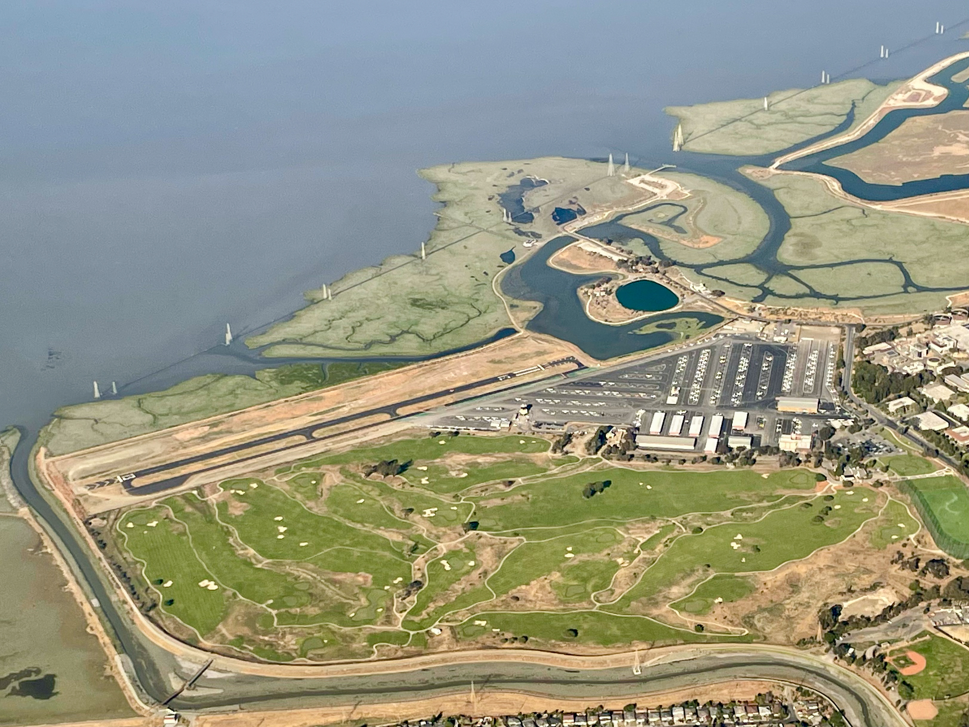
The airport occupies a strip of reclaimed bayshore land in Santa Clara County, near the south end of San Francisco Bay. The western shore location gives pilots departing to the east a view across the bay to the East Bay hills, while westbound departures climb toward the Santa Cruz Mountains and the Stanford campus. The salt ponds that surround the airport -- geometric basins of evaporating brine in shades of green, red, and brown -- are one of the most distinctive aerial features of the South Bay, visible on approach from miles away.
Silicon Valley's Airstrip
Palo Alto Airport serves a clientele that reflects its geography. Tech executives, venture capitalists, and Stanford-affiliated researchers use the field alongside student pilots and weekend aviators. The airport operates without a control tower during certain hours, relying on pilot self-coordination -- a system that works precisely because the traffic volume remains modest. In a region defined by scale and growth, KPAO has stayed small, constrained by the baylands on three sides and residential neighborhoods on the fourth.
Approaching Palo Alto
For pilots, KPAO is both convenient and demanding. The proximity to SFO's Class B airspace requires careful altitude management. The bay's marine layer can roll in quickly, reducing visibility. But on a clear day, the approach offers one of the best aerial tours in California: Stanford's campus with Hoover Tower, the Dish antenna in the foothills, the grid of Palo Alto's tree-lined streets, and the Bay itself stretching north toward San Francisco. The airport is a gateway to Silicon Valley in the most literal sense -- the place where the ground and the air meet.
From the Air
Palo Alto Airport (KPAO) is at 37.461°N, 122.115°W on the western shore of the South Bay. Single runway. No control tower during some hours; check CTAF. SFO Class B airspace directly overhead requires clearance for operations above certain altitudes. Salt ponds and marshlands surround the field.