Pamban Bridge
For over a hundred years, a single railway bridge was the only way to reach the holy island of Rameswaram without a boat. When it opened on 24 February 1914, the Pamban Bridge was India's first sea bridge, and it held the record as the country's longest sea bridge until the Bandra-Worli Sea Link opened in Mumbai nearly a century later. Built on 143 concrete piers above the corrosive waters of the Palk Strait, in a zone battered by cyclones and relentless salt air, it was an engineering act of stubborn ambition. The bridge did not merely connect an island to the mainland. It connected millions of Hindu pilgrims to one of their holiest destinations.
Built for Empire, Used for Faith
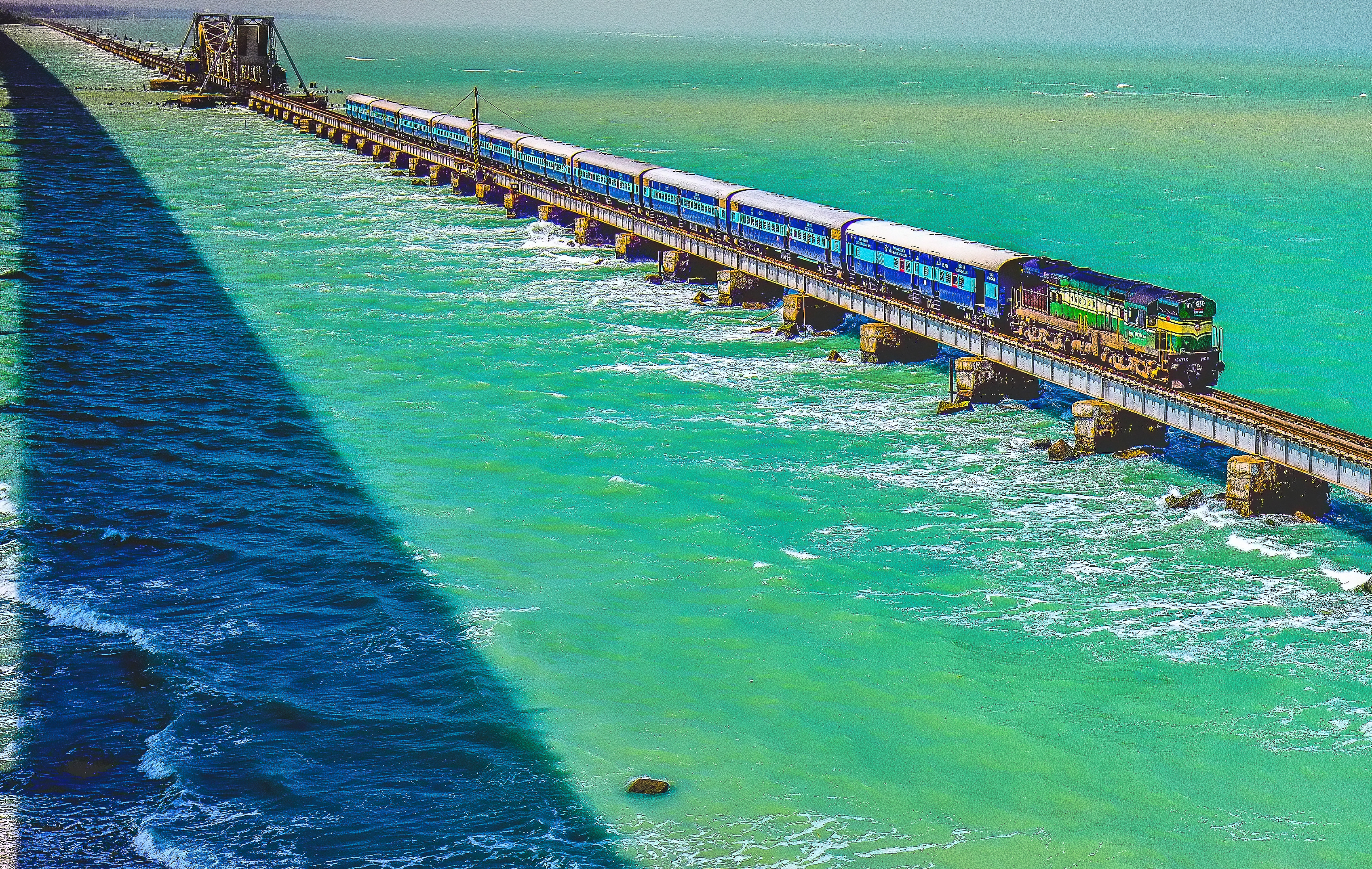
The idea of bridging the Pamban channel dates to 1870, when the British colonial administration saw commercial potential in a surface link that would ease trade with Ceylon. Construction began in August 1911, and the bridge opened for traffic on 24 February 1914, connecting the town of Rameswaram on Pamban Island to Mandapam on the mainland. What the British built for commerce, pilgrims adopted for devotion. The railway terminus at Rameswaram became the endpoint of lines from Chennai and Madurai, carrying millions of devotees to the Ramanathaswamy Temple and the sacred bathing tanks of one of Hinduism's holiest sites. The bridge was a conventional structure resting on concrete piers, with a double-leaf bascule section at its midpoint, a Scherzer rolling lift span that could be raised to let ships and barges pass through. Each half of the lifting span weighed 415 tonnes, and the two leaves were opened manually using levers, a process that took 45 minutes per side.
The Night the Cyclone Came
On the night of 22-23 December 1964, a cyclone made landfall at nearby Dhanushkodi with winds estimated at 280 kilometers per hour and tidal waves seven meters high. The storm destroyed the town of Dhanushkodi entirely, killing an estimated 1,800 people, including 115 passengers aboard the Pamban-Dhanushkodi passenger train, which was swept off the tracks by the storm surge. The railway line from Pamban to Dhanushkodi was obliterated and never rebuilt. The Pamban Bridge itself sustained severe damage and required extensive repairs. The Government of Madras declared Dhanushkodi a ghost town, unfit for habitation. The bridge survived, but the branch line it once fed into the island's southeastern tip was gone forever.
Corrosion, Cracks, and Stubbornness
Salt water is patient and relentless, and for a steel-and-concrete bridge sitting directly above the sea in a cyclone-prone zone, corrosion was never a matter of if but when. A parallel road bridge opened in 1988, relieving some of the structural burden, and in 2009 the renowned engineer E. Sreedharan supervised strengthening work to handle heavier freight trains. But the repairs kept coming. In 2013, a naval barge struck the piers. In 2018, a fissure in one of the spans halted train movement for months. By December 2022, the bascule section had weakened so severely from corrosion that rail traffic was permanently suspended. The old bridge had carried trains for 108 years, holding the island's lifeline across the strait through storm, collision, and the slow chemistry of salt on steel.
A New Bridge Rises
In 2020, the Government of India announced that a new railway bridge would be constructed near the old Pamban Bridge. The New Pamban Bridge was designed as a vertical-lift sea bridge, a modern successor to the manually operated bascule span that had defined its predecessor. Construction was completed in 2024, and the bridge was opened for traffic in April 2025, inaugurated by Prime Minister Narendra Modi. Trains to Rameswaram now cross the strait on the new structure, while the original Pamban Bridge stands nearby, its rusting bascule span frozen in place, a monument to the century of pilgrims, freight cars, and saltwater it endured. The channel beneath still carries small vessels, the Gulf of Mannar still pushes its tides through the gap, and the island on the far side still draws the faithful by the millions.
From the Air
Pamban Bridge is located at approximately 9.28N, 79.20E, spanning the Pamban channel between the Indian mainland (Mandapam) and Pamban Island (Rameswaram). The old and new bridges run roughly parallel and are visible as thin lines across the strait. Best viewed at 2,000-8,000 feet. The bascule/lift section at the midpoint is a distinguishing feature. Nearest airport is Madurai (VOMD), approximately 160 km northwest. The parallel road bridge is visible alongside. Look for the contrast between the Gulf of Mannar to the south and the Palk Strait to the north.