Pamir Mountains
The lapis lazuli buried with Egyptian pharaohs traveled thousands of miles to reach their tombs, and its likely origin was a place most Egyptians could never have imagined: the high, windswept plateaus of the Pamir Mountains, in what is now the Badakhshan province of Afghanistan. Straddling the borders of Tajikistan, China, Afghanistan, Pakistan, and Kyrgyzstan, the Pamirs form a massive knot where the Himalayas, Karakoram, Hindu Kush, and Tian Shan ranges converge. The name itself carries weight. Some researchers connect it to Mount Meru, the sacred five-peaked mountain of Hindu, Buddhist, and Jain cosmology, believed to be the center of all physical and spiritual universes. Whether or not the Pamirs inspired that myth, the landscape earns the comparison: vast, silent, and elemental, a place where the Earth seems to push its bones through the skin.
A Highway Across the Sky
The Pamir Highway, the world's second-highest international road, threads through this terrain from Dushanbe in Tajikistan to Osh in Kyrgyzstan, crossing the Gorno-Badakhshan Autonomous Province. It is the isolated region's main supply route, and driving it is an exercise in altitude and endurance. But long before Soviet engineers laid asphalt, the Pamirs served as a corridor for far older travelers. The Great Silk Road crossed multiple Pamir ranges, and about 138 BCE the Chinese envoy Zhang Qian reached the Fergana Valley to the northwest. From about 600 CE, Buddhist pilgrims traversed both sides of the mountains on their way from China to India. Marco Polo may have traveled along the Panj River. In 1602, the Portuguese Jesuit Bento de Goes made the crossing from Kabul to Yarkand. Each of them passed through the same stark geography that still confronts anyone who ventures here: thin air, immense distances, and a silence so deep it presses against the eardrums.
The Great Game's Highest Board
In the nineteenth century, the Pamirs became a chessboard for the British and Russian empires. In 1838, Lieutenant John Wood became one of the first Europeans to reach the headwaters of the Pamir River. From 1868 to 1880, Indians secretly working for the British surveyed the Panj area, mapping territory that no European had documented. In 1873, Britain and Russia agreed to an Afghan frontier along the Panj River, drawing a border through land neither fully controlled. Russian military-scientific expeditions followed, led by naturalists and soldiers like Alexei Fedchenko and Nikolai Severtzov. In 1891, a Russian patrol informed the British officer Francis Younghusband that he was standing on their territory, an encounter that became known as the Pamir Incident. By 1893 the Russians had built a fort near present-day Murghab, and by 1895 they had shifted their base to Khorog, staring across the river at Afghanistan. The mountains did not care about borders, but the empires that drew them here certainly did.
Secrets in the Stone
The Pamirs have yielded discoveries that reshape timelines. In the early 1980s, geologists found a deposit of gemstone-quality clinohumite here, the only such deposit known in the world until a second was discovered in Siberia's Taymyr region in 2000. More recently, excavations at the Jirzankal Cemetery, high on the Pamir Plateau, uncovered the earliest known evidence of human cannabis use, with chemical residues dating to the first millennium BCE found inside burial braziers. The finding suggests that the high-altitude funeral rituals of the people who lived here involved deliberately burning cannabis plants to produce psychoactive smoke. In 1928, the last unmapped areas around the Fedchenko Glacier, one of the longest non-polar glaciers in the world, were finally charted by the German-Soviet Alay-Pamir Expedition. Even into the twentieth century, the Pamirs held blank spaces on the map.
Life on the Roof
For all its extremes, the Pamir region sustains life. Coal is mined in the western areas, but sheep herding in the upper meadowlands remains the primary livelihood for many inhabitants. The Pamiri peoples who call these mountains home speak a cluster of Eastern Iranian languages distinct from the Tajik spoken in the lowlands. Their communities cling to valley floors where rivers carve corridors of green through otherwise barren rock. The twentieth century brought upheaval to this landscape: the Tajikistan Civil War of the 1990s turned the mountains into a battleground, and border disputes between China and the Soviet Union kept the region militarized for decades. Tourism has slowly begun to reach the Pamirs, with the New York Times featuring articles on the area's potential as early as 2009. But the Pamirs remain, above all, a place defined by remoteness, where the distances between settlements are measured not in kilometers but in hours of difficult travel.
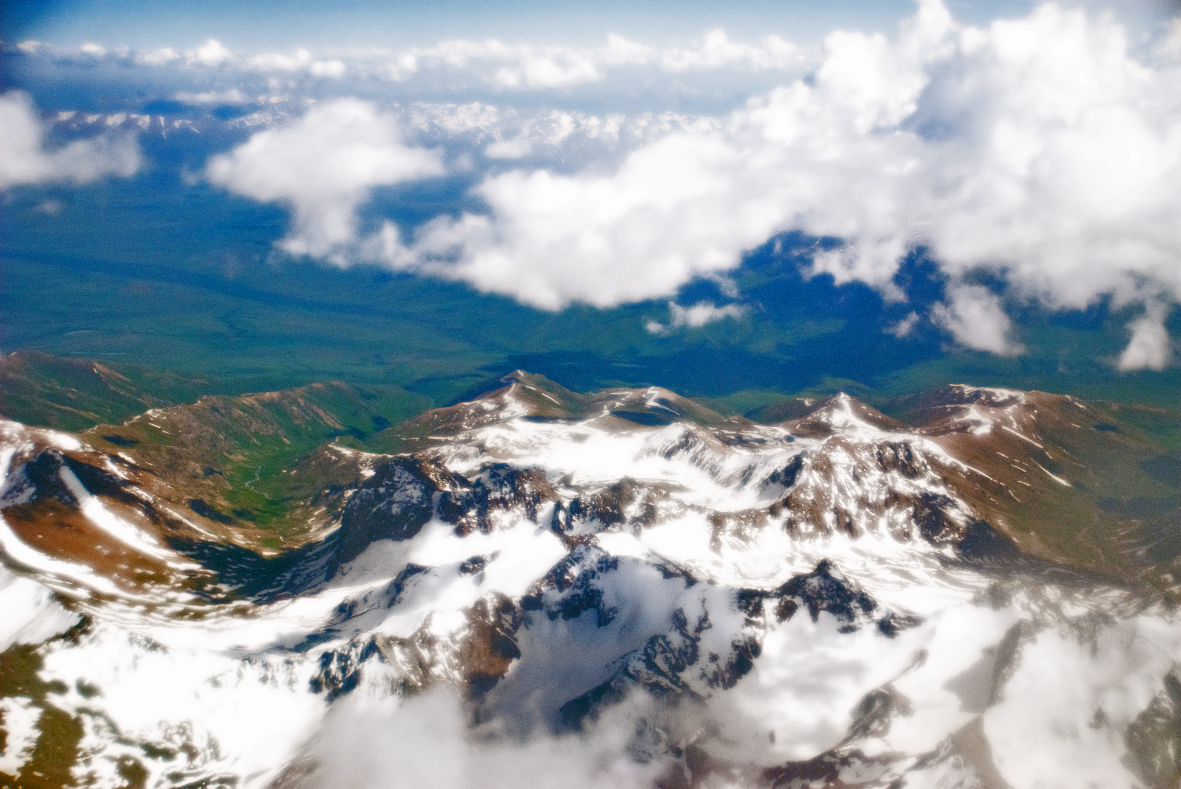
From the Air
Located at 39.00N, 72.00E in Central Asia, where Tajikistan, China, Afghanistan, Pakistan, and Kyrgyzstan converge. The Pamir plateau averages 3,500-4,500 m (11,500-14,800 ft), with peaks exceeding 7,000 m. The Fedchenko Glacier is visible from altitude as a massive river of ice. Dushanbe Airport (UTDD) lies to the west; Osh Airport (UAFO) to the north in Kyrgyzstan. The Pamir Highway is visible as a thin thread crossing the high plateau. Extreme mountain weather conditions with severe turbulence possible. Recommended viewing altitude: FL250+ to clear terrain safely.