Panajachel
Everyone calls it Pana. The full name -- Panajachel -- takes too long for a town where everything happens on foot within twenty minutes. Perched on the north shore of Lake Atitlan in Guatemala's western highlands, this small settlement on a river delta became a magnet for hippies in the 1960s, emptied out during the civil war, and reinvented itself as the lake's primary tourist gateway once peace returned in 1996. Along with Antigua and Flores, Panajachel ranks among Guatemala's most visited destinations. But unlike those colonial showpieces, Pana earns its reputation not through grand architecture but through what it faces: three volcanoes rising from the far shore of what Aldous Huxley called the most beautiful lake in the world.
The Delta and the Dock
Panajachel occupies a small alluvial delta where a river meets the lake, creating the relatively flat ground that makes it one of the few easily walkable towns on Atitlan's steep shores. The town's geography is simple: Calle Principal runs through the center, intersecting Calle Santander -- the main commercial strip -- which leads down toward the water. At the intersection, chicken buses, tuk-tuks, and shuttle vans congregate in a loose approximation of a bus station. Three-wheeled tuk-tuks circle the handful of streets continuously, charging five quetzales for any ride in town or ten if the trip requires climbing uphill off the delta. The lakefront docks connect Pana to the dozen-odd communities ringing the water. Public speedboats -- lanchas -- depart regularly for San Pedro La Laguna, Santiago Atitlan, and the smaller villages between. For many visitors, Panajachel is less a destination than a starting point, the place where you step off a bus and onto a boat.
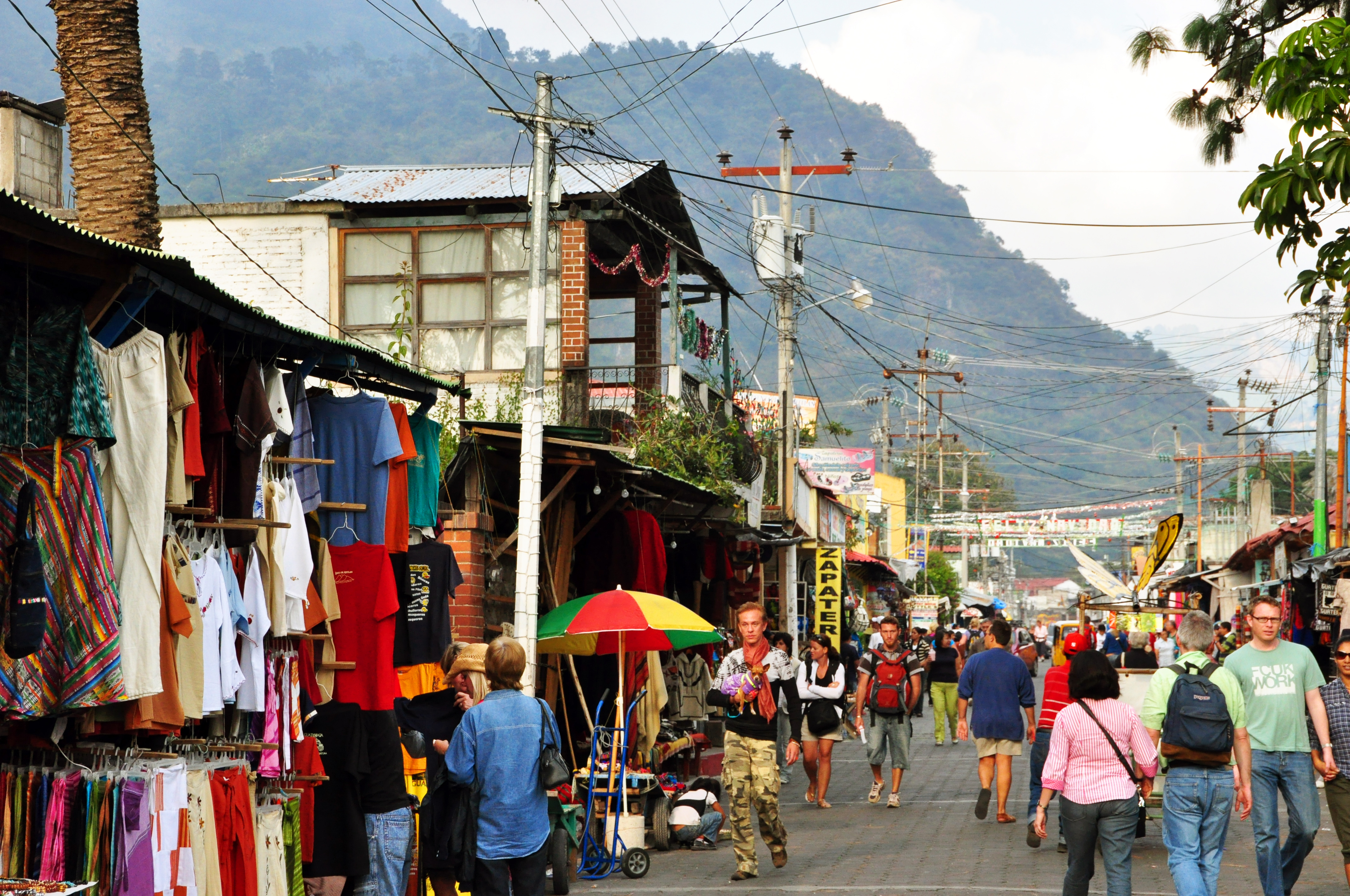
Calle Santander and the Art of the Sale
From morning until well past dark, Mayan vendors walk Calle Santander selling handwoven textiles, paintings, jade jewelry, clothing, and roasted nuts. They will approach diners inside restaurants, sometimes a dozen times in a single meal. The selling is persistent, and bargaining is expected -- experienced buyers aim for half to two-thirds of the opening price. The quality of textiles around Lake Atitlan surpasses what you find in most of Guatemala, though the finest weavings come from Santiago Atitlan on the lake's south side. Beyond the street vendors, Pana offers a cosmopolitan dining scene that reflects its international visitor base. Uruguayan steakhouses sit alongside chocolate shops selling handmade bonbons with chile lime -- a welcome departure from mass-market candy bars. Street vendors near the Calle Principal bus stop sell tacos, sweet corn, and sugared nuts at all hours. The town's drinking tradition is distinctly Guatemalan: walking up and down Calle Santander with a litro -- a one-liter bottle of Gallo beer -- in hand.
Villages by Lancha
Panajachel's greatest asset is access. From the docks, a single day's circuit by lancha and tuk-tuk can take you through half a dozen lakeside villages, each with its own character. A common route starts with a boat to San Pedro La Laguna, continues on foot to San Juan La Laguna, climbs to the Mirador Kaqasiiwan viewpoint, then catches a tuk-tuk to San Marcos La Laguna -- known for its cliff diving and spiritual retreat centers. From San Marcos, another lancha reaches Jaibalito, a village accessible only by water, and from there a footpath winds east along the shore to Santa Cruz La Laguna before a final boat ride back to Pana. The whole loop can fill a long day or a relaxed two. Kayak rentals along the Pana waterfront offer another perspective -- paddling along the shoreline under the volcanoes, with warm water for swimming and cliff-side stops for diving. Full-moon and sunrise paddles have become a specialty of local outfitters.
Between Two Worlds
Pana exists in a tension common to tourist towns built atop indigenous communities. The economy now depends almost entirely on visitors, yet the surrounding culture remains deeply Maya. Pickup trucks -- fletes -- carry indigenous families to and from the market, and they remain the cheapest way to reach nearby towns with direct roads. Organizations like the Robert Muller LIFE School, the only English-speaking nonprofit school in Guatemala, work to provide multicultural education to both expat and indigenous children, with nearly half its students receiving financial assistance. Mayan Families, another local organization, runs education scholarships, emergency food programs, an elderly feeding initiative, and stove installation projects in indigenous and Ladino communities. Volunteers can teach, translate, cook, or sort donations at no fee. The pollution problem, however, tells a harder story -- Pana generates waste at a rate its infrastructure cannot handle, and local environmentalists maintain a recycling collective that tracks which businesses participate and which do not.
From the Air
Panajachel is located at 14.74N, 91.16W on the north shore of Lake Atitlan at approximately 1,570 meters (5,150 feet) elevation. From the air, the town is visible as a small developed area on an alluvial delta where the river meets the lake's north shore. Volcan San Pedro (3,020m), Volcan Toliman (3,158m), and Volcan Atitlan (3,537m) dominate the view across the water. Nearest major airport is La Aurora International (MGGT) in Guatemala City, roughly 80 km to the east. Afternoon winds (the Xocomil) can produce turbulence over the lake. The town's dock area and Calle Santander are identifiable from low altitude.