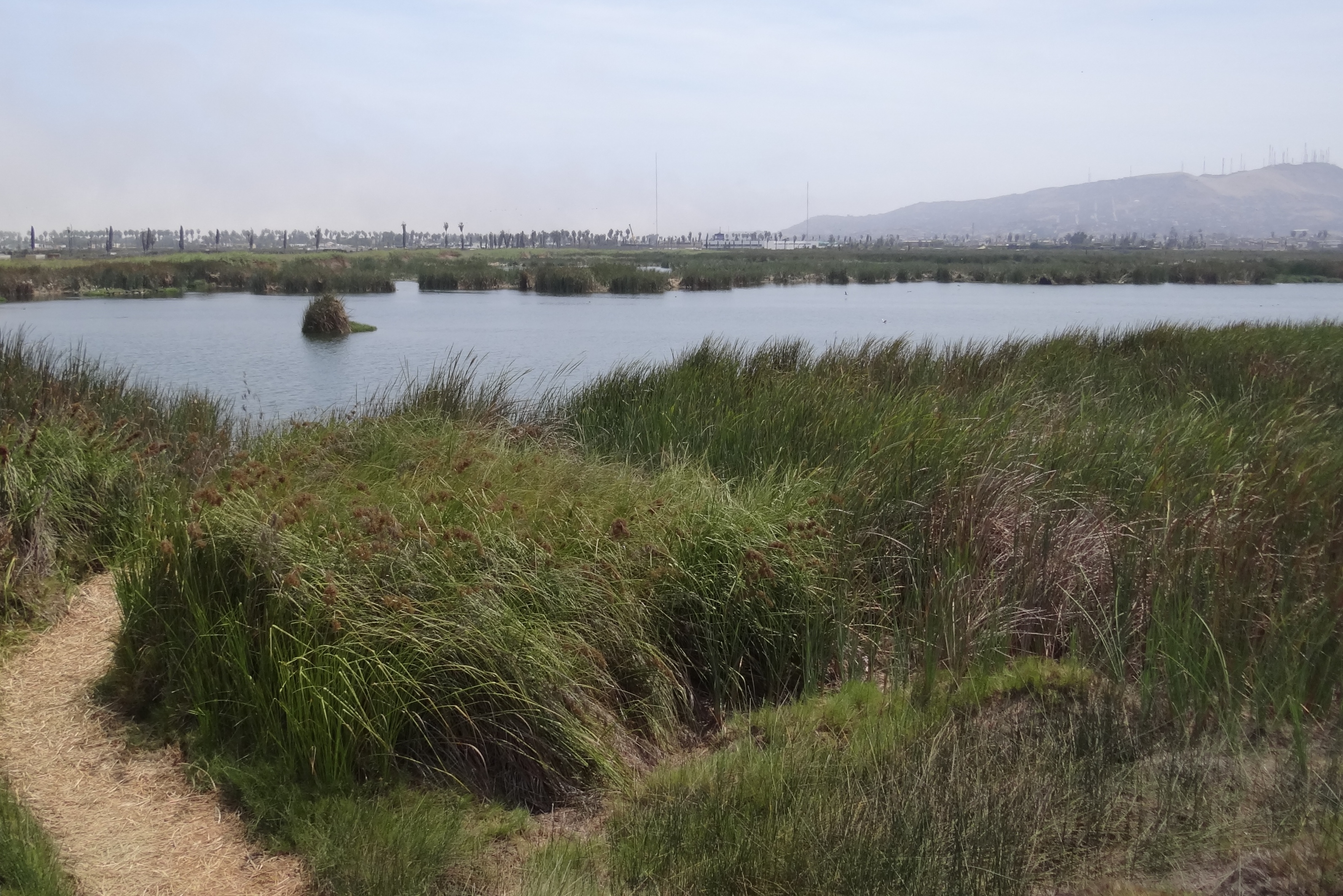
Pantanos de Villa Wildlife Refuge
Lima is one of the driest capital cities in the world, parked on a strip of coastal desert where annual rainfall barely reaches 60 millimeters. So the fact that 263 hectares of marshland survive inside its city limits -- brackish lagoons thick with cattails, teeming with over 200 bird species -- feels like a small act of defiance against geography. Pantanos de Villa Wildlife Refuge sits in the district of Chorrillos, surrounded on all sides by one of South America's largest metropolises. It is fed not by rain but by seepage: water filtering through underground canals and branching off from the Rimac River via the Ate-Surco-Chorrillos irrigation canal. The marsh exists because the city's old agricultural infrastructure, built to water farms that are now neighborhoods, keeps leaking. In a place where nature has almost no room left, the refuge persists on borrowed water.
Salvaged from the Sprawl
The protection of Pantanos de Villa has been a slow, bureaucratic campaign waged over decades. The Municipality of Lima began managing the area through its parks service in 1977. The Ministry of Agriculture declared it a wildlife reserve in 1989. In 1993, the municipality established the Natural Metropolitan Park of Villa, and the following year created a special oversight office that included military, agriculture ministry, and municipal representatives. The Ramsar Convention recognized the wetlands in 1997, placing them on the international register of important wetland sites. A governing body called PROHVILLA was established in 1998 to coordinate management. The area was declared a reserved zone in 2001, and it finally achieved its current designation as a wildlife refuge in 2006. Each step was a response to the same relentless pressure: a city of ten million people pressing in from every direction.
Wings Over the Desert
A total of 210 bird species have been recorded within the refuge's boundaries, a number that seems almost extravagant for a patch of wetland nearly at sea level -- the entire protected area sits between zero and five meters above it. A study conducted between 2004 and 2007 documented 58 resident or migrant species, with the possibility of 56 more awaiting identification. Birdwatching is the primary draw, especially during Lima's summer months from December to March, when migratory species arrive and the marshes come alive with movement. PROHVILLA offers three tourist routes: two lasting an hour, the third a brisk 45 minutes. The experience is surreal. Behind you, Lima's apartment blocks and traffic noise; ahead, great grebes diving in still water, oystercatchers probing the mudflats. The refuge also harbors native fish species including Bryconamericus peruanus and the flathead grey mullet, though visitors are far more likely to hear the birds than see the fish.
Garua Season
The refuge's climate is subtropical but defined by its coastal desert setting. Austral winters bring a persistent drizzle the locals call garua -- a fine mist that never quite becomes rain but pushes humidity to between 85 and 99 percent. Winter temperatures hover between 14 and 19 degrees Celsius. Summers are warmer, ranging from 15 to 26 degrees, and drier. The annual precipitation total of 60 millimeters means that nearly everything growing here depends on the underground water that feeds the lagoons. The native plant community includes cattails, bulrushes, wild tomato relatives, and the glasswort Sarcocornia, species adapted to the brackish conditions where freshwater seepage meets the salty influence of the nearby Pacific. It is a landscape that looks lush but is fundamentally fragile, sustained by hydrology rather than climate.
Borrowed Time
The threats facing Pantanos de Villa read like a catalog of urban pressure. Squatters encroach on the protected area itself. Chaotic development pushes right up to the boundaries. Wastewater discharges pollute nearby zones. Industrial plants operate within the buffer area that is supposed to insulate the marshes from the city. Most critically, the agricultural canals that feed the wetlands -- especially the Surco canal -- are disappearing or becoming contaminated as the farmland they once irrigated gives way to concrete. The refuge exists because of water that was never meant for it, surplus from an irrigation system designed for a Lima that no longer exists. As that system decays, the water supply that sustains one of South America's most unlikely urban wetlands decays with it. Researchers continue to study the area, but the fundamental question is whether a city of ten million will leave room for 263 hectares of marsh. So far, decade by decade, the answer has been a grudging yes.
From the Air
Pantanos de Villa sits at 12.21S, 76.99W in the Chorrillos district of Lima, near the Pacific coast. From the air, the marshes appear as a green irregularity amid dense urban development, easily spotted on approach to Jorge Chavez International Airport (SPJC), which lies roughly 10 km to the north-northwest. The refuge is nearly at sea level (0-5 meters). Best viewed at 2,000-4,000 feet AGL on a clear day -- garua season (June-September) may obscure visibility with persistent mist.