Paparoa Track
Twenty-nine men went into the Pike River Mine on 19 November 2010. Two walked out. The rest never came home. In the years that followed, as families grieved and a nation reckoned with what had gone wrong, an idea took shape among the people who had lost the most: build something. Not a plaque on a wall or a wreath laid once a year, but a trail across the mountains - a path that would carry visitors through the landscape where their husbands, sons, and brothers had worked, and that would bring life back to a region hollowed out by loss. The Paparoa Track, New Zealand's newest Great Walk, is that path. It crosses the Paparoa Range from the site of the Pike River Mine on the east to the coastal village of Punakaiki on the west, and every step of it carries weight.
A Memorial You Walk Through
The idea of a memorial track emerged from the families themselves. They wanted something that honored the dead without freezing grief in place - something active, forward-looking, useful. Working with the Department of Conservation and the government, they proposed a trail built to Great Walk standard, linking the Pike River Mine site with the West Coast. Construction tenders were sought in 2016, and work began in 2017. The track was officially opened on December 1, 2019, becoming the tenth trail in New Zealand's Great Walks network and the first added since the Kepler Track in 1988. A major landslip had forced a delay and then a partial closure shortly after opening; full length was open from March 2020. In February 2024, the Pike29 Memorial Walk and Cycle Trail section opened, completing the full memorial vision. The track is not just a walk. It is an act of remembrance in motion.
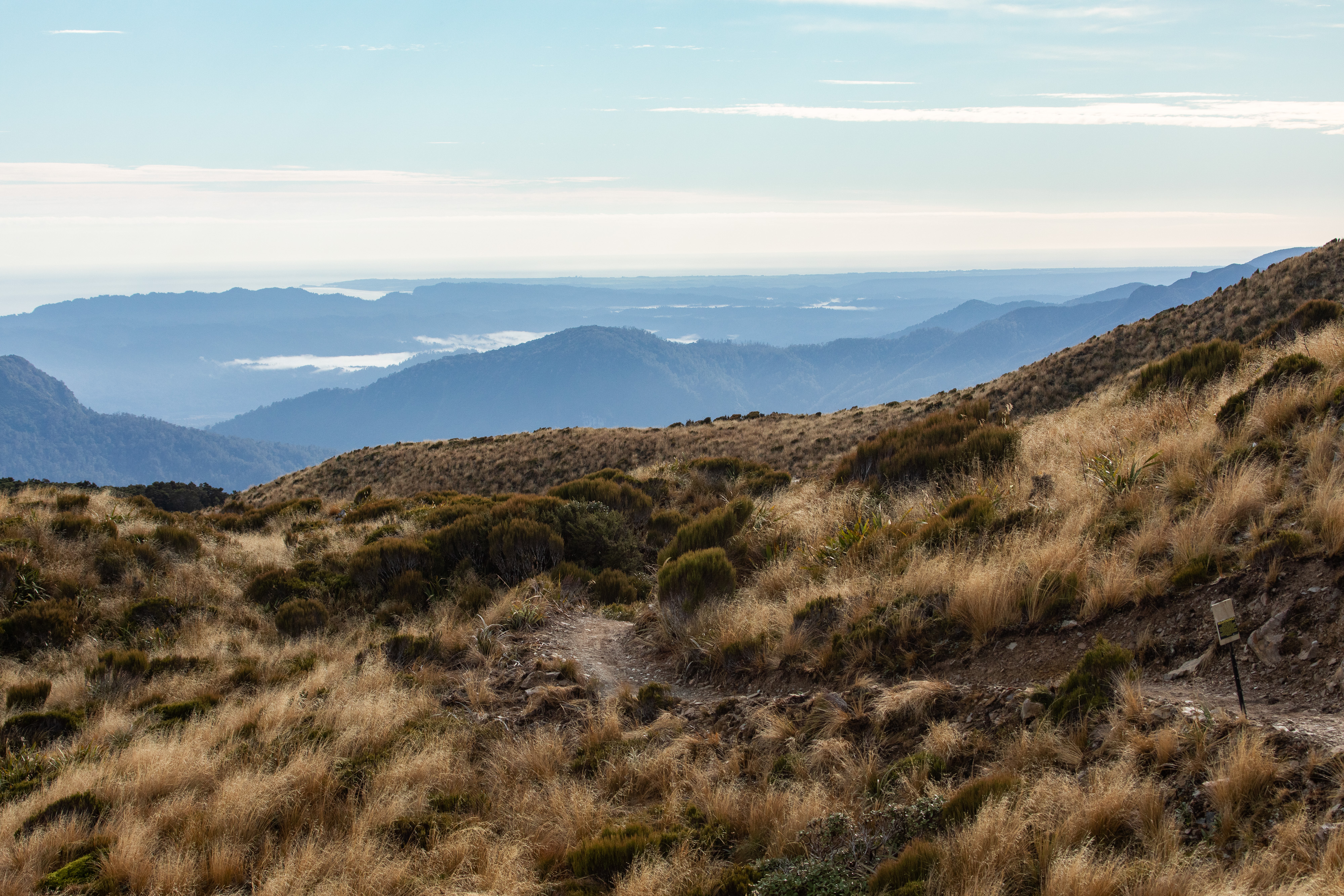
Across the Spine of the Range
The Paparoa Range rises between the Grey River valley and the Tasman Sea, a wall of limestone, granite, and dense podocarp forest draped in cloud more often than not. The track crosses this spine over roughly 55 kilometers, climbing through beech forest into subalpine scrub before descending through nikau palms to the coast. On clear days, the views stretch from the Southern Alps to the sea. On overcast days - and there are many - the forest closes in, dripping and intimate, the trail winding through a green tunnel of moss and fern. The terrain is serious enough to demand respect but accessible enough for fit trampers with moderate experience. Huts along the route provide shelter, and the track is also open to mountain bikers, making it one of the few Great Walks to accommodate both walkers and riders.
The Weight of the West Coast
The West Coast of New Zealand's South Island has always lived by extraction - gold, timber, coal. When Pike River Coal established its mine in the Paparoa Range, it promised jobs and economic stability to a region that badly needed both. The mine's catastrophic failure did not just kill 29 people; it gutted a community's livelihood. The Paparoa Track was designed, in part, to replace what the mine had taken away. Tourism would bring income where coal no longer could. Punakaiki, already drawing visitors to its famous Pancake Rocks, gained a world-class multiday trail on its doorstep. The government committed $14.9 million in tourism funding that included the track's construction. For the West Coast, the trail represents something rare: a future that does not depend on pulling things out of the ground.
Walking with the Dead
Not everyone welcomed the track. Some Pike River families felt that a tourist attraction trivialized their loss. One widow called it an insult to the dead miners. The tension was real and unresolved - grief does not speak with one voice. But for many families, the track offered something they could not get from inquiries, apologies, or compensation: a place where the landscape itself remembers. The eastern trailhead sits near the mine, in country the 29 men knew. Hikers beginning the walk there start their journey in the shadow of what happened, and the first hours of the track carry a quiet gravity that no signage needs to explain. By the time you reach the coast, the mood shifts. The forest opens, the sea appears, and something lifts. It is not resolution - the bodies of the 29 men remain entombed in the mine to this day. But it is forward movement, which may be the closest thing to resolution that grief allows.
From the Air
Located at 42.21°S, 171.44°E on the Paparoa Range, West Coast of New Zealand's South Island. The track runs roughly east-west across the range, visible as a corridor through dense bush. Punakaiki and the Pancake Rocks are on the coast to the west. Nearest airports: Greymouth (no ICAO, small aerodrome) and Hokitika (NZHK) to the south. Best viewed at 3,000-5,000 ft in clear conditions to see the full range crossing.