Paracel Islands
Somewhere between Hainan and Vietnam, in the pale jade waters of the South China Sea, a scattering of coral islands and atolls barely breaks the surface. The Paracel Islands are small enough to miss from altitude and strategically important enough to have sparked a naval battle, strained relations between nuclear powers, and generated centuries of competing historical claims. Chinese fishermen from Hainan have worked these waters for generations. Vietnamese navigators mapped them as Hoang Sa, the Golden Sandbank, in documents dating to the fifteenth century. European sailors marked them as dangerous grounds and gave the reefs names borrowed from East India Company officials. Today, China controls every rock and reef in the archipelago, but the argument over who owns them has never stopped.
Names Written in Sand and Stone
The Paracels carry more names than most nations. Song dynasty texts from the eleventh century refer to Qianli Changsha, the Thousand-Mile Long Sands. Vietnamese records call them Hoang Sa, and the Nguyen lords of the eighteenth century dispatched the Hoang Sa Company, seventy men recruited from Quang Ngai province, to patrol and salvage in the archipelago each year. Portuguese cartographers in the sixteenth century labeled them Ilhas do Pracel, a name derived from their word for shallow sandy shoals. The British named individual islands after East India Company officials: Drummond, Pattle, Money, Duncan. When Emperor Minh Mang ordered steles erected on the islands in the 1830s, he was marking territory that the Vietnamese considered theirs. When the Song navy patrolled the same waters centuries earlier, China considered them its own. The names accumulate like coral, each layer reflecting a different era's claim.
Two Groups, One Archipelago
The archipelago divides into two clusters. The Amphitrite group, named after a French frigate that observed the islands while carrying Jesuits to Canton in 1698, sits in the northeast and includes Woody Island, the only feature with a substantial population. Over a thousand residents live there now, including fishermen, military personnel, and administrators. It has an upgraded airport, a seaport, a hospital, a school, and a post office. The Crescent group lies about seventy kilometers to the southwest, its islands and reefs forming a curved chain that encloses a deep central lagoon. Money Island anchors the southwest end. Near the center of the eastern reef sits Dragon Hole, the second deepest known ocean sinkhole in the world. Fresh water remains scarce across the archipelago; a solar-powered desalination plant began operating on Woody Island in 2016, reducing dependence on barrels of water shipped in by boat.
The Battle That Settled Nothing
On January 19, 1974, Chinese and South Vietnamese naval forces fought for control of the Crescent group. South Vietnam had garrisoned the western half of the Paracels since France withdrew in the 1950s, while China held the eastern Amphitrite group. When South Vietnamese officers reported Chinese military activity on Drummond and Duncan islands, Saigon dispatched frigates. The engagement was brief and decisive. China's fleet prevailed, and with South Vietnam already consumed by its civil war and the United States unwilling to intervene, no attempt was made to reclaim the islands. China has controlled the entire archipelago ever since. The battle did not resolve the underlying dispute. North Vietnam's prime minister Pham Van Dong had recognized Chinese sovereignty over the Paracels in 1958, but after reunification, Hanoi retracted that recognition, claiming it had been a concession made to secure Chinese aid against the Americans.
Concrete Over Coral
By 2017, satellite imagery and the Asia Maritime Transparency Initiative documented twenty Chinese outposts across the Paracels, built on reclaimed land. Duncan and Drummond islands acquired small helipads. Three outposts could berth naval and merchant vessels. Wind turbines and solar panels supplement diesel generators, though the Chinese government has considered floating nuclear power plants to meet growing energy demands. An experimental wave power generator was installed off Woody Island in 2020. Cellphone reception works, the postal code is 572000, and the telephone area code connects to Hainan province. Tourism has operated since 1997, with Chinese visitors paying up to two thousand dollars for five-day cruises, though the ecological cost is real. The reefs support endangered green sea turtles, hawksbill turtles, whale sharks, and historically, blue whales and Chinese white dolphins. Direct damage from military construction and tourism has been documented, and government efforts to curb illegal tourism remain ongoing.
A Sea of Claims
Vietnam's National Assembly passed a law in 2012 demarcating its sea borders to include the Paracels. The Philippines lodged protests when China established Sansha City to administer the area that same year. Taiwan maintains that all of the South China Sea islands belong to the Republic of China, rejecting both Vietnamese and mainland Chinese claims as illegitimate. In 2016, an international arbitration tribunal ruled that China had no legal basis for historic rights claims within its nine-dash line, but the ruling addressed the Spratlys, not the Paracels directly. China and Taiwan both rejected the decision. The archipelago remains what it has been for centuries: a collection of reefs too small to sustain large populations but positioned at the crossroads of some of the world's busiest shipping lanes, where roughly a third of global maritime trade passes each year. The competing claims show no sign of resolution.
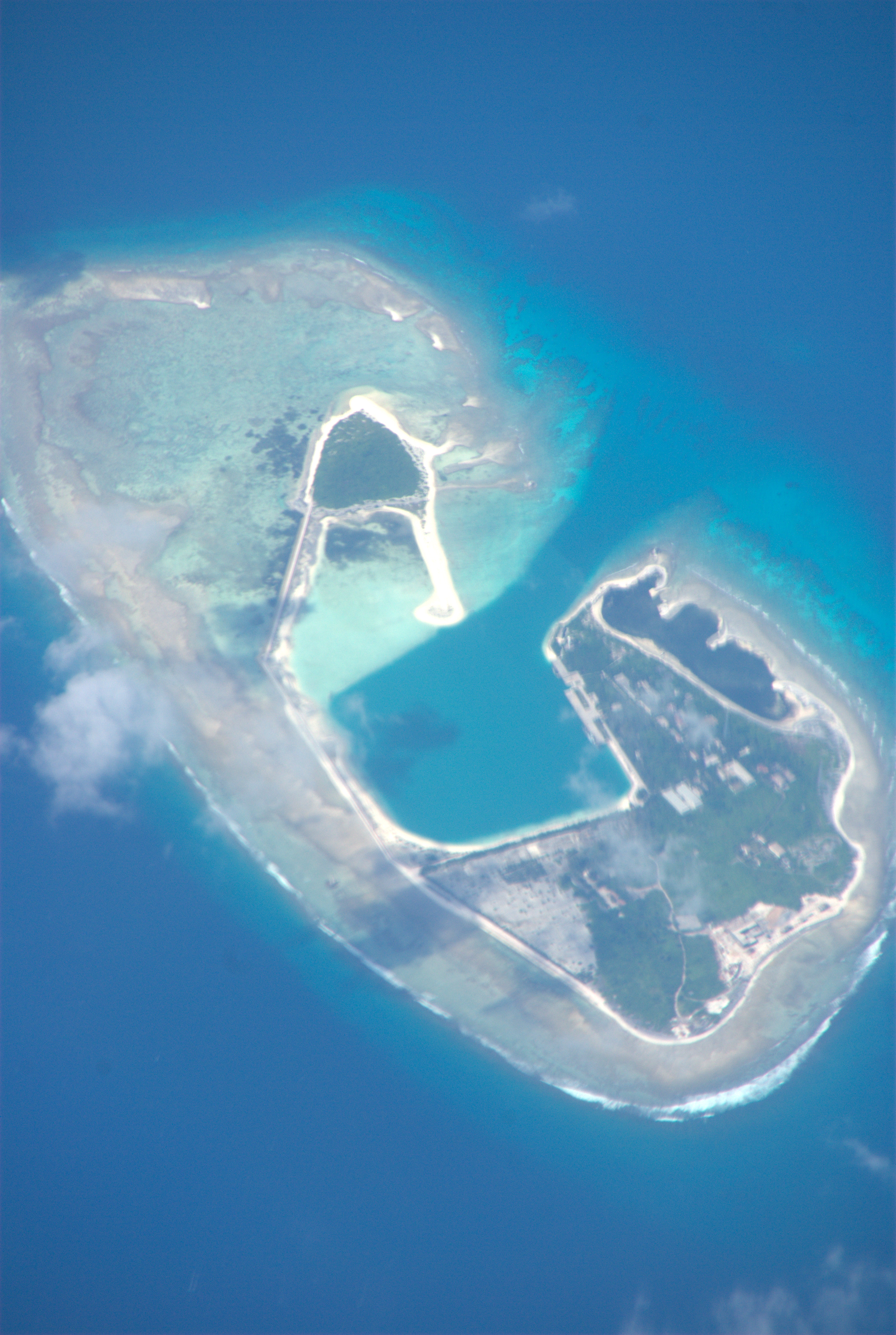
From the Air
The Paracel Islands are centered at approximately 16.65N, 112.75E in the South China Sea, roughly equidistant between Hainan Island (China) and the coast of central Vietnam. Woody Island (Yongxing Island) has an upgraded runway capable of handling military aircraft. The nearest major airports are Haikou Meilan International (ZJHK) on Hainan, about 350 km to the north, and Da Nang International (VVDN) in Vietnam, about 380 km to the west. From altitude, the archipelago appears as scattered pale patches against the deep blue sea. The Amphitrite group is more visible due to Woody Island's built infrastructure, while the Crescent group's lagoon structure is distinctive from above. Expect restricted airspace; China maintains military control of the area.