Parque El Ejido
On the morning of 28 January 1912, an angry crowd broke into the García Moreno prison in Quito, seized the bodies of former President Eloy Alfaro and three of his followers, and dragged them through the city streets. At the edge of the city they reached a public grazing ground called the North Ejido - common land where horses and cattle had fed for nearly four centuries. There the mob burned what remained. The event became known as La Hoguera Bárbara, the Barbarous Bonfire. Ten years later, Quito inaugurated that same ground as Parque de Mayo - named for the May 1822 battle that had won the country its independence. Today it is called Parque El Ejido, the third-largest park in the city, and most of the people walking its paths have no idea what happened there.
Ejidos of the King
On 25 January 1535, only weeks after the Spanish founding of Quito, the city's Cabildo mapped out the Ejidos del Rey - the common lands that every Spanish colonial town needed for grazing livestock. Three were established: the North Ejido (which would become this park), the Turubamba or South Ejido, and the Conocoto or East Ejido. The North Ejido ran along the royal road between La Alameda and Cotocollao. For four hundred years it served as pasture. It also served as execution ground. From the sixteenth century until the early twentieth, the Ejido held a firing squad post and a pillory where criminals were hanged and publicly shamed. A pillory still stood here until the 1920s. Under President Gabriel García Moreno in the 1860s and 70s, the land became something else again - a burial ground for dissidents, excommunicated people, and Protestants who could not be laid in consecrated Catholic soil. Layers of public use, each reflecting the city's hierarchies and fears.
The Burning of Eloy Alfaro
Eloy Alfaro had been the architect of the Ecuadorian Liberal Revolution. Twice president, responsible for separating church from state, building railroads, expanding public education - he was an extraordinary figure by any measure, and an extremely polarizing one. In January 1912, after attempting to settle a factional dispute in Guayaquil, he was imprisoned in the García Moreno prison in Quito along with several allies. On the 28th, a mob loyal to conservative factions broke into the prison. Alfaro and his followers were killed in their cells, then dragged behind horses through the streets to the North Ejido, where their bodies were burned in a public bonfire. La Hoguera Bárbara became one of the defining traumas of Ecuadorian political history - the country's liberal movement murdering its own founder in full public view. A century later, the event is still taught in Ecuadorian schools as a cautionary tale about political violence.
Becoming a Park
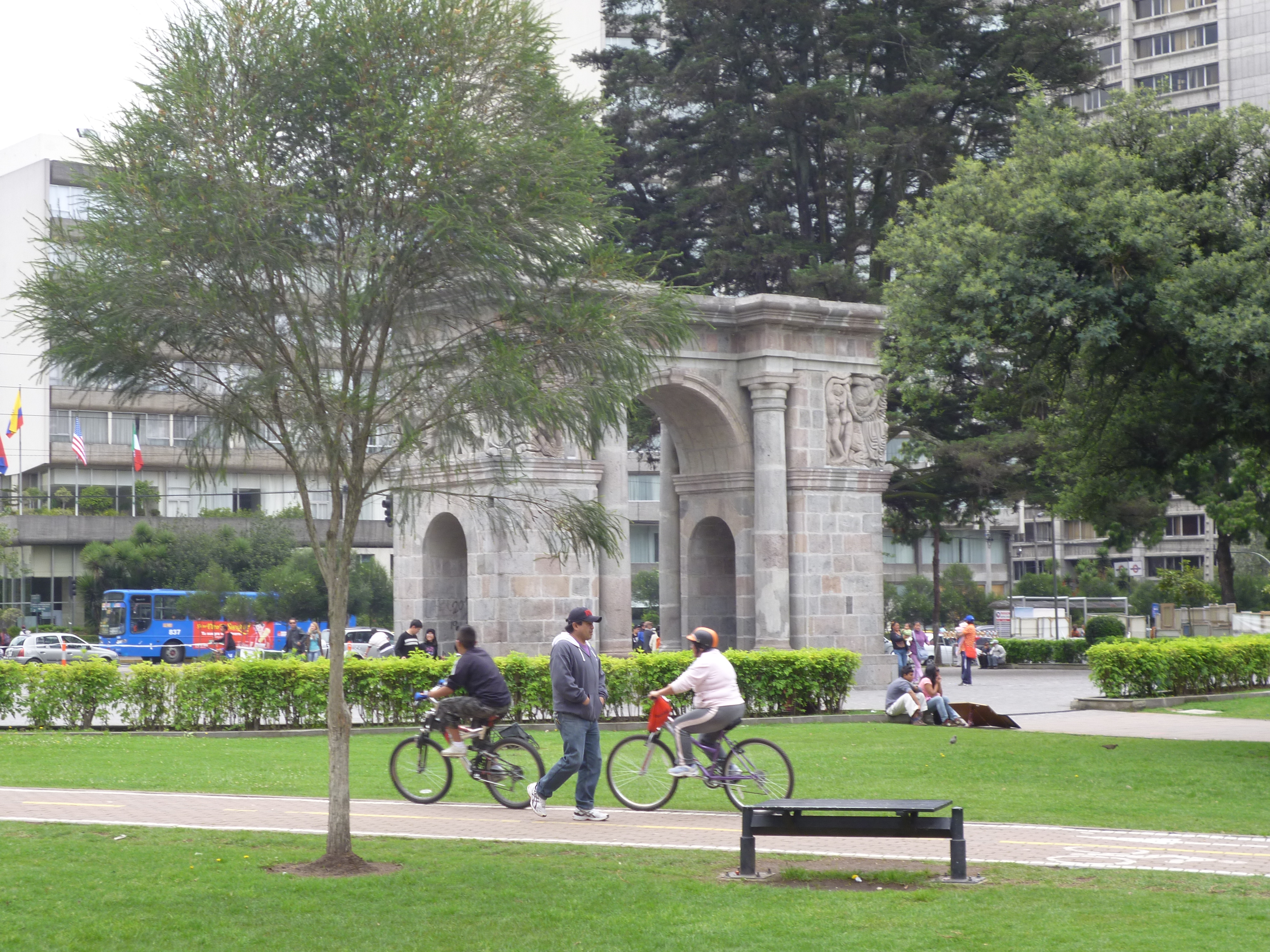
In 1922, the city made the transition formal. For the centennial of the Battle of Pichincha - the May 1822 engagement that sealed Ecuador's independence - the North Ejido was planted with trees, laid out in the asymmetrical curved pathways fashionable in European urban parks of the era, and reopened as Parque de Mayo. The design was typical of late-19th and early-20th century urbanism, with walks converging on an eccentric circle at the park's trapezoidal center. By 1914, the wealthy Ciudadela Larrea neighborhood had consolidated on the western side, its mansions built in the historicist styles then in vogue. By the 1920s, the aristocratic La Mariscal neighborhood was taking shape to the north. The old pasture had become surrounded by the city. Today, Parque El Ejido contains the highest concentration of heritage trees in the Metropolitan District of Quito - at least two dozen over a hundred years old, planted as the park opened.
What Happens Here Now
Street artists perform in the park's internal plazas. In the northwest corner, men gather on weekends to play ecuavoley - a distinctively Ecuadorian three-player variant of volleyball - and cocos, a traditional Quito game where players use large metal balls to pull small coconuts out of a traced circle in the dirt. Both involve bets of 10 to 50 dollars. Monuments and busts line the boulevards: a memorial to former President José María Velasco Ibarra, a bust of Fyodor Dostoevsky, a statue of Hungarian poet Sándor Petőfi, memorials to Ecuadorian writers César Dávila Andrade and Jorge Carrera Andrade. In late 2016 the park's perimeter was rehabilitated for the Habitat III Conference, the UN's once-per-twenty-years summit on urban development, which Quito hosted that October. Accessibility routes were added. Sculptures restored. The old grazing ground, execution site, and burning place now doubles as one of Quito's most civilized public spaces.
From the Air
Located at 0.21°S, 78.50°W in the Itchimbía neighborhood, just north of Quito's Old Town at 2,820m elevation. The park's trapezoidal footprint sits between Avenues Patria, Tarqui, and 6 de Diciembre - visible from altitude as a rectangular green space separating the colonial historic core from the modern commercial district of La Mariscal. Viewing altitude 4,500m reveals the transition from UNESCO-listed Old Quito into the 20th-century city. Nearest airport: Mariscal Sucre International (SEQM) at Tababela, 18nm east. The park is a key waypoint for locating the boundary between old and new Quito along the long north-south valley between the Pichincha volcano (4,784m) and the Guangüiltagua range.