Patalkot
The name means "very deep" in Sanskrit, and for most of its history, that depth was Patalkot's defining feature. This horseshoe-shaped valley in the Tamia tehsil of Chhindwara district, Madhya Pradesh, drops roughly 400 meters below the surrounding plateau, ringed by hills on nearly every side. Until recent decades, no proper road reached its floor. The Bharia and Gond communities who lived in its twelve villages and thirteen hamlets -- a population of about 2,000 people -- existed in near-complete separation from the world above the rim.
Geology of Isolation
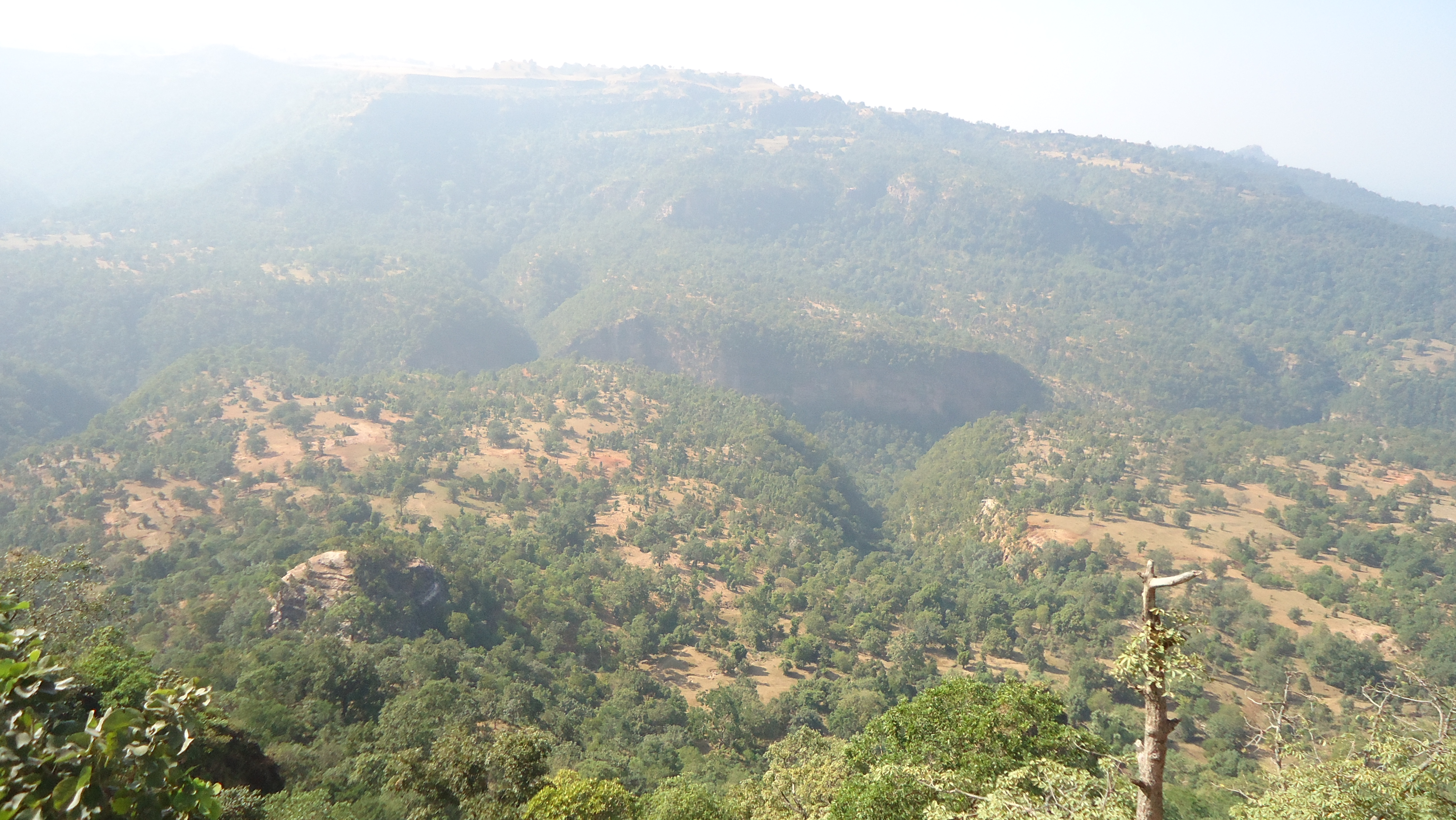
Patalkot covers 79 square kilometers at an average elevation of 2,750 to 3,250 feet above sea level. The Doodhi River threads through its floor. The valley's rocks belong to the Archaean era -- granite gneiss, green schists, and quartz formations roughly 2,500 million years old, overlaid with Gondwana sediments of sandstone and carbonaceous shale. In some upper patches, Shilajit -- a tarry mineral pitch prized in traditional Indian medicine -- seeps from the rock faces. Several pathways wind down from the rim to the villages below, but the terrain is steep enough that for centuries, these trails were the only connection between Patalkot and the outside world. The valley's geographic isolation is not metaphorical. It is a physical fact written in billion-year-old stone.
The People Below
The Bharia people have lived in Patalkot for more than 500 years, alongside the Gond community. Together they maintained a way of life shaped entirely by what the valley provided. Their herbal healers, known as Bhumkas, developed treatments from the roughly 220 plant species growing in the valley -- remedies for ailments ranging from snake bites and cholera to diabetes and hypertension. Some of these plants, including species of Sundew, are now highly endangered. During festivals, community members wear traditional ornaments -- Chulki, Mundri, Hasli, Paijan -- and play instruments like the Bansuri, Dhol, Shehnai, and Tambura. Their prayer sites, called Devghars, honor deities including Mahadev, Badadev, Surjadev, and Madmi Mai. This was not a culture preserved in amber by choice; it was a culture that geography simply never forced to change.
Legends of the Underworld
Local mythology places Patalkot at the border between the human world and Patal-lok, the underworld of Hindu cosmology. According to one tradition, Prince Meghnad -- son of the demon king Ravana in the Ramayana -- descended to the underworld through this very valley after worshipping Lord Shiva. Another story holds that the Bhonsle kings of Nagpur, defeated by the British Army in the early 19th century, retreated into Patalkot's forests to hide, using a tunnel said to connect the valley to Pachmarhi in neighboring Hoshangabad district. The area where they sheltered is still called Rajakho. Whether the tunnel ever existed remains unproven, but the idea captures something true about Patalkot: it was a place you could disappear into.
A Valley Opening Up
In 2009, a coalition of the Centre for Forestry Research, the district administration, and the District Olympic Association launched an ecotourism program that trained 3,000 tribal youth in adventure activities -- parasailing, paragliding, rock climbing, trekking, and bird watching. Every October, the Satpuda Adventure Sports Festival draws visitors to the valley. Roads have improved. The monsoon season, when the valley's greenery is at its most dramatic, has become a popular time for tourists. But exposure brings pressure. The herbal knowledge of the Bhumkas, once passed down in isolation, now faces the paradox of outside interest: the more the world learns about Patalkot's medicinal plants, the greater the risk of over-harvesting. The valley that sustained itself for centuries is learning what it means to be found.
From the Air
Located at 22.25°N, 78.46°E in the Satpura Range, Chhindwara district, Madhya Pradesh. The valley drops approximately 400 meters below the surrounding plateau and is visible from the air as a dramatic horseshoe-shaped depression in the forested hills. It is 78 km from Chhindwara and 20 km from Tamia. Nearest airports: Nagpur (VANP, approximately 200 km east) and Bhopal (VABP, approximately 250 km west). The Doodhi River on the valley floor is a useful visual reference. Best viewed at 3,000-5,000 feet AGL for the dramatic depth contrast between rim and valley floor.