Paulista Avenue
Every Sunday, the city closes Paulista Avenue to cars. Two and a half million people pour onto the pavement -- cyclists, skateboarders, families with strollers, couples walking dogs, street musicians setting up beside food carts. For a few hours, the financial heart of South America's largest city belongs entirely to pedestrians. It is a ritual that captures what Avenida Paulista has always been: not just a road, but a stage.
Coffee Money and Grand Ambitions
Uruguayan engineer Joaquim Eugenio de Lima opened Paulista Avenue in 1891, carving a 2.8-kilometer boulevard along the ridgeline that divides the Pinheiros and Tiete river basins. The location was strategic -- at roughly 800 meters above sea level, the ridge offered cooler air and panoramic views in an era before skyscrapers blocked the horizon. Sao Paulo's coffee barons claimed the avenue immediately, lining it with European-style mansions and gardens that announced their wealth to anyone passing below. For decades, Paulista was a residential showcase, a place where fortunes built on coffee beans took architectural form in Art Nouveau facades and imported marble.
The Glass Transformation
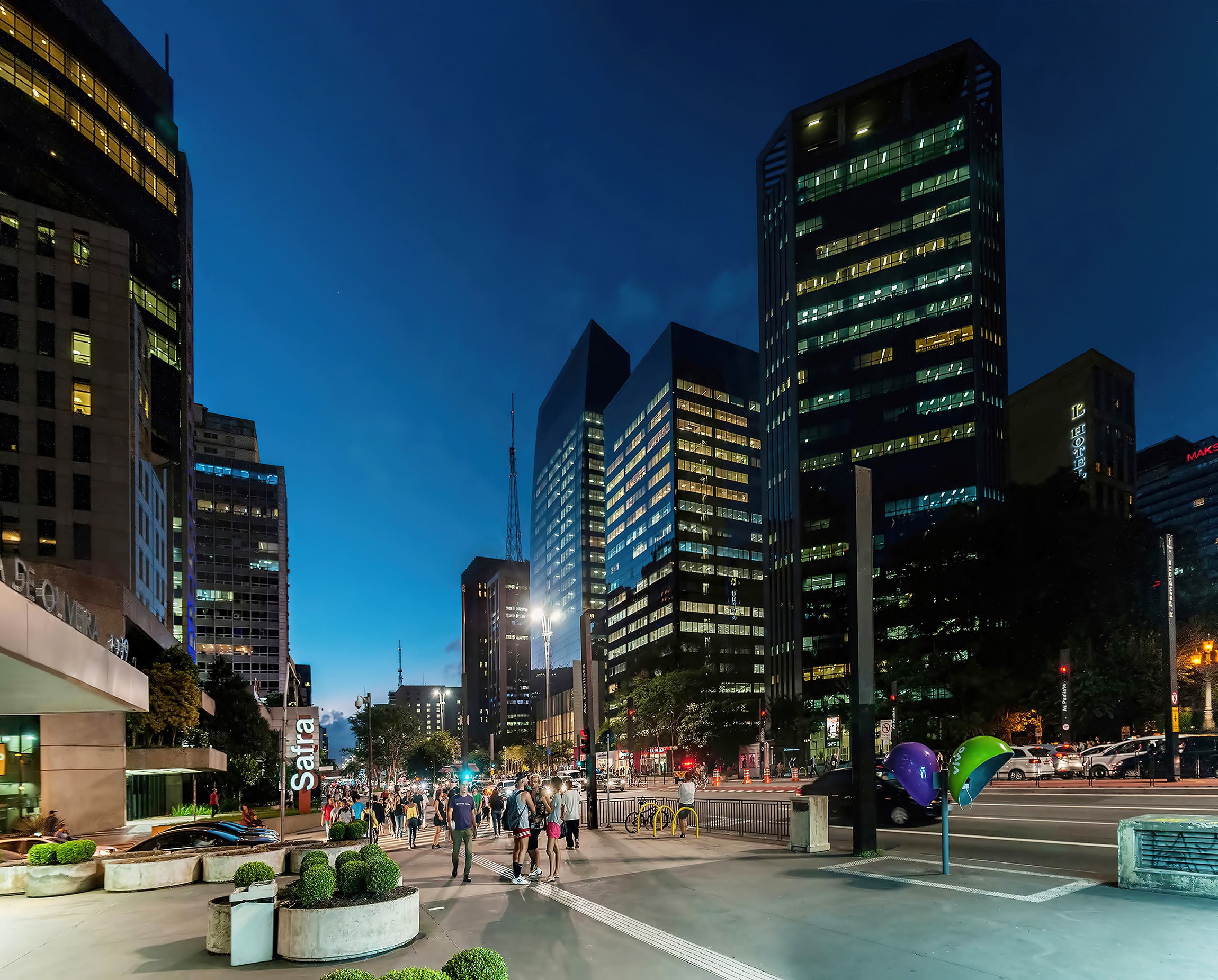
The mansions did not last. Beginning in the 1950s and accelerating through the 1970s, Sao Paulo's explosive growth turned Paulista into a commercial corridor. The coffee barons' estates fell one by one to corporate towers, bank headquarters, and shopping complexes. Today the Safra Group, Banco Central do Brasil, Petrobras, and Citibank all occupy buildings along the avenue. Large-scale malls -- Conjunto Nacional, Shopping Patio Paulista, Center Tres -- anchor the blocks between them. A few survivors from the earlier era remain, most notably Casa das Rosas, a 1935 French-style mansion now operating as a cultural center. Its rose garden sits in improbable contrast to the glass and concrete pressing in from every side.
Culture Between the Towers
Paulista concentrates cultural institutions the way other avenues concentrate banks. The Sao Paulo Museum of Art -- MASP -- stands as the avenue's most recognizable landmark, its bold concrete frame hovering above an open civic plaza. Nearby, the Instituto Itau Cultural and the Centro Cultural FIESP host rotating exhibitions and free theatrical performances at the Teatro Brasileiro de Comedia. Private schools with deep roots line the side streets: the Anglican Saint Paul's, Dante Alighieri, the Casa di Cultura Italiana. The Rodrigues Alves public school sits in a yellow neoclassical building directly across from Hospital Santa Catarina, one of several major hospitals clustered along the avenue. Education, art, healthcare, and commerce coexist here with a density that feels almost compressed, as if the city decided to stack its civic life along a single axis.
Where the City Raises Its Voice
When Sao Paulo has something to say, it says it on Paulista. The avenue has hosted the city's largest political demonstrations for decades, from protests against military dictatorship to the millions-strong marches of 2015 and 2016. The Sao Paulo Pride Parade, one of the world's largest, fills the avenue each June with an estimated three to four million participants. When a local football club wins a championship, the celebration gravitates here. When the national team advances in the World Cup, the crowd forms on Paulista before anywhere else. The avenue functions as a public commons in a metropolis of twelve million people, a shared space large and symbolic enough to absorb the collective emotion of an entire city.
Sunday on the Ridge
The Sunday closure began as a pilot program and became permanent because Paulistanos refused to let it end. Families spread blankets on the median. Buskers claim their preferred spots early. Food vendors sell acaraje and pastel de feira from wheeled carts. At Christmas, the remaining historic mansions and bank lobbies mount elaborate decorations, drawing crowds who photograph the displays against backlit towers. The avenue runs roughly northeast to southwest along its ridge, and on clear late afternoons the sun catches the glass facades and throws reflected light across the pavement. Walking the full 2.8 kilometers, you pass from Paraiso to Consolacao and through a cross-section of everything Sao Paulo contains -- wealth and hustle, art and commerce, protest and celebration, all compressed into a single boulevard.
From the Air
Paulista Avenue runs along a prominent ridgeline at approximately 23.561S, 46.656W, oriented roughly NE-SW through central Sao Paulo. At 800 meters elevation, the ridge is visible as a line of tall commercial towers rising above the surrounding urban fabric. The MASP building's distinctive elevated concrete frame is a useful visual reference. Nearest major airport: Sao Paulo-Guarulhos International (SBGR) approximately 25nm northeast. Congonhas Airport (SBSP) is much closer at roughly 5nm south. Best viewed from 2,000-4,000 feet AGL; the avenue's linear corridor of towers contrasts with lower surrounding neighborhoods.