Pedro Mountain Road
"DANGEROUS FOR AUTOMOBILES -- TAKE ROAD VIA SAN MATEO." The sign was not subtle, but motorists ignored it anyway. Pedro Mountain Road, the only coastal route between Pacifica and Montara for decades, featured grades as steep as 25 percent, hairpin turns that demanded "the coolest heads, firmest hands, and strongest brakes that a car can have," and wrecked vehicles in the ravines below to prove the warnings were not exaggeration. Motoring magazine put it plainly in 1913: "Anyone going this way is simply inviting disaster." Some of those wrecked cars are still down there.
The Portola Crossing
The first recorded crossing of Pedro Mountain was by the Portola expedition in October 1769. The Spanish explorers described it as "a very bad road up over a high mountain" that, while manageable on the ascent, had "a very hard abrupt descent on the opposite side." Their route, now called the Indian Trail, ran from Martini Creek over Saddle Pass and down into what is today the Linda Mar district of Pacifica. For the next eight decades, this basic routing served as the only way over the mountain. After the Mexican-American War, the path was known as Road Trail, running east-west along the ridge from Saddle Pass and descending above Adobe Drive toward the Sanchez Adobe. Even on horseback, it was considered barely passable.
Potholes on Top of Potholes
From 1879 to 1914, the Half Moon Bay-Colma Road attempted to solve the problem by routing closer to the ocean on steep switchbacks. The solution was marginally better. Charlie Nye Jr., a longtime coastside resident, recalled the experience decades later: "The road coming over Pedro Mountain was terrible, just awful. Words can't describe it. It went around turns and more turns, hairpin turns, short turns, backward turns. There were potholes on top of potholes." The Ocean Shore Railroad, operating from 1907 to 1920, provided an alternative, but after the railroad's bankruptcy, travelers were stuck with the mountain again. In 1915, a new paved route called Coastside Boulevard offered genuine improvement, climbing from Higgins Road in Pacifica back toward Saddle Pass. This routing survived until 1937, when Highway 1 was finally rerouted along Devil's Slide. Cyclists now unofficially call the remnants of the old road "Planet of the Apes."
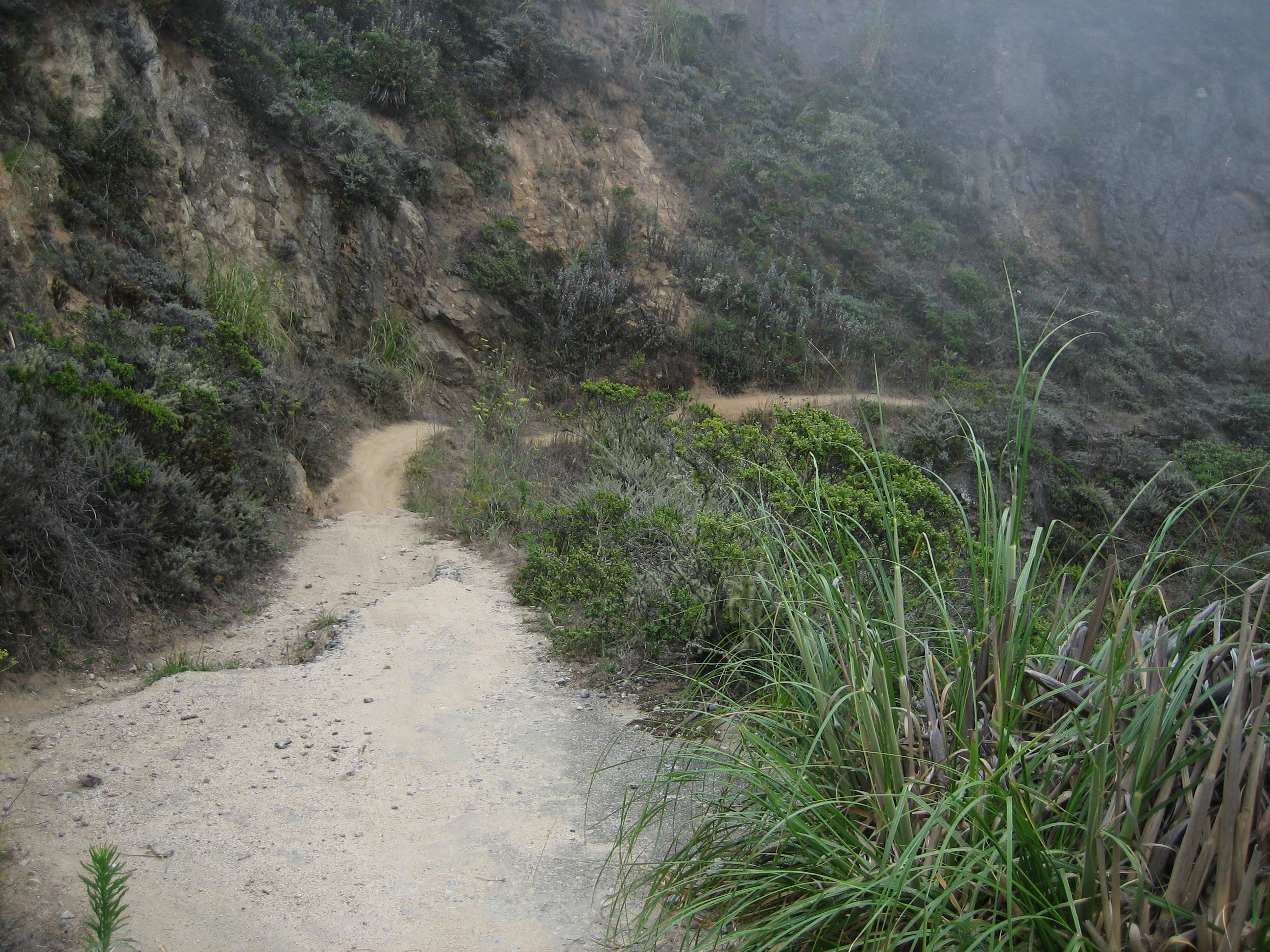
Walking Where Cars Once Crawled
Pedro Mountain Road's crumbling pavement can still be found between Montara and Pacifica. In some places the roadbed has washed out; in others, landslides have partially buried it. A short stub of the original highway remains in use in Montara near a local nursery. But the old routes are accessible to hikers, mountain bikers, and horseback riders, and walking them offers a visceral understanding of why the road was so feared. The route begins at a chain-link fence in Montara and climbs to an elevation of 930 feet before descending into Pacifica as Higgins Way. Near the top, it intersects with the North Peak Access Road leading to Montara Mountain's summit. Where drivers once white-knuckled their way around blind curves, hikers now pause to admire views that no one traveling the old road at eight miles per hour ever had the composure to enjoy.
From the Air
Located at 37.58°N, 122.49°W on the ridge between Pacifica and Montara. The old road's route is visible as a narrow scar on the mountainside within McNee Ranch State Park. The modern Tom Lantos Tunnels and Highway 1 are visible nearby. Half Moon Bay Airport (KHAF) is 5 nm south. San Francisco International (KSFO) is 8 nm northeast. Terrain rises to 930 ft along the old road route.