Pemberton
Thirty-three kilometers past Whistler, where the tourist crowds thin and the highway number stays the same but the character changes, the village of Pemberton occupies a valley floor surrounded by peaks. The Lil'wat First Nation has called this place home since time immemorial, their territory extending through the mountains that rise on every side. European settlers arrived for the Fraser Gold Rush, staying for the rich soil that still produces seed potatoes and organic vegetables. Today Pemberton serves as an adventure base for those who find Whistler too crowded, too developed, too tame - a gateway to backcountry that remains genuinely wild.
Lil'wat Territory
The Pemberton area is part of the traditional territory of the Lil'wat First Nation, whose presence here long predates European maps. Mount Currie, the neighboring community, is the center of Lil'wat population today, and the nation's cultural influence shapes the valley. The trails that adventurers now follow often trace routes that Lil'wat people established for hunting and trading, paths through mountain passes that connect this interior valley to the coast and to neighboring territories.
The Gold Rush of 1858 brought the first Europeans through in numbers, but permanent settlement remained sparse until the railway connected Pemberton to Vancouver in 1915. The valley's isolation protected it from rapid development; even today the road connections are limited, the alternatives to Highway 99 requiring 4x4 vehicles and dry weather. This remoteness is part of the appeal, the distance from Vancouver creating a buffer that keeps the valley quiet even as Whistler absorbs millions of visitors.
Beyond Whistler
Whistler attracts the crowds; Pemberton attracts those who seek what the crowds don't find. The skiing here accesses terrain that Whistler's boundaries don't reach - backcountry operations offering helicopter and cat-skiing into powder stashes that remain fresh long after resort runs are tracked out. In 2012, Pemberton and nearby Rossland were jointly voted best ski locales in North America by Powder Magazine readers, recognition earned not by lift-served terrain but by what lies beyond the lifts.
Summer brings different adventures: hiking into the Coast Mountains, mountain biking on over 200 kilometers of trails, rock climbing on crags that Squamish-bound climbers pass by without knowing. Paragliding and hang gliding launch from ridges above the valley - Pemberton hosted the Canadian Paragliding Nationals in 2012, the thermals and landing zones attracting pilots from across the country. The airport accommodates private planes and helicopters, enabling access for those who fly themselves.
Hot Springs Country
The geology that builds these mountains also heats the water beneath them, and hot springs dot the territory surrounding Pemberton. Some are developed with facilities; others remain wild soaks requiring hikes or rough-road drives to reach. The mineral-rich water emerges at temperatures that demand respect - a phenomenon called supernatant liquid can create a cooler layer floating atop scalding depths, and unwary bathers have been burned.
The hot springs draw a particular type of visitor, those willing to trade convenience for authenticity. Skookumchuck Hot Springs lies along the In-shuck-ch Forest Service Road, a rough route that eventually connects to Harrison Lake and the Fraser Valley. The drive alone filters out casual tourists, leaving the pools to those who've made the effort. It's emblematic of Pemberton's appeal - rewards proportional to commitment, experiences earned rather than purchased.
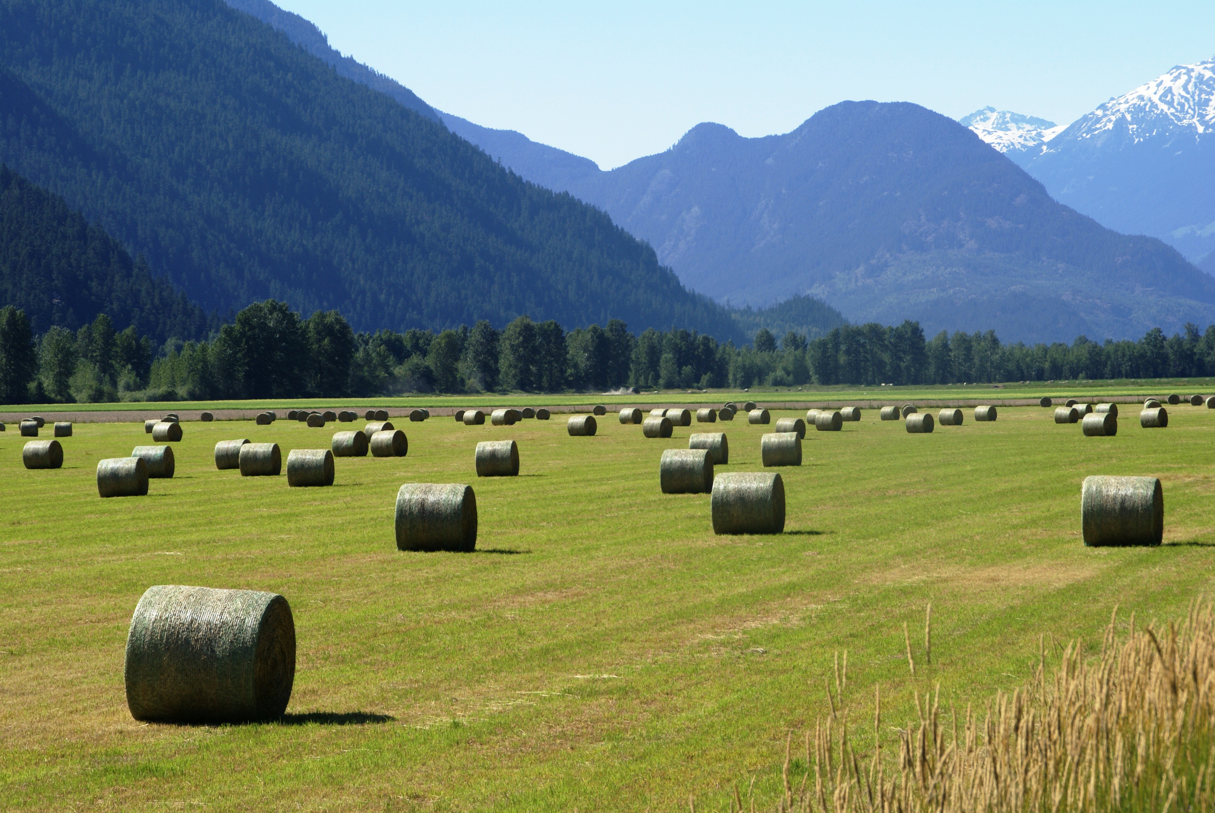
The Agricultural Valley
The valley floor tells a different story than the surrounding peaks. Rich soil deposited by glacial floods supports farms that have operated since the 1870s, their fields producing seed potatoes, organic vegetables, and the hay that feeds horses and cattle through mountain winters. The agricultural character persists alongside the adventure tourism, farmers and guides sharing the same small-town services.
The Slow Food movement has found adherents here, the local food culture emphasizing connection between producer and consumer. Farm stands sell direct to visitors; restaurants source ingredients from fields visible from their windows. It's a working agricultural valley that happens to sit amid world-class mountain terrain, the combination creating a place that feels complete rather than specialized. Pemberton serves as Whistler's bedroom community for workers priced out of the resort, but it maintains an identity that doesn't depend on its famous neighbor.
From the Air
Located at 50.32N, 122.81W in British Columbia, approximately 33 km north of Whistler along Highway 99. The Pemberton Valley is visible as a flat agricultural area surrounded by Coast Mountains peaks. Mount Currie is visible to the east; the Lillooet River flows through the valley. Pemberton Airport is visible near the village. Highway 99 continues north as the Duffey Lake Road toward Lillooet. The Whistler ski area is visible to the south; the Coast Mountains extend in all directions. Vancouver is 158 km south.