Penzhina Bay
Twice each day, the Sea of Okhotsk inhales and exhales through Penzhina Bay, and the effect is startling. The water rises as much as 13.4 meters — nearly 44 feet — between low tide and high. Coastal cliffs that stand exposed and barnacle-covered in the morning are submerged by afternoon. The bay has the highest tides of any bay in the Pacific Ocean, a distinction that has drawn the attention of engineers, scientists, and dreamers for decades. They look at Penzhina and see potential energy measured in gigawatts, a force of nature that has never been seriously harnessed and remains, for now, entirely untouched.
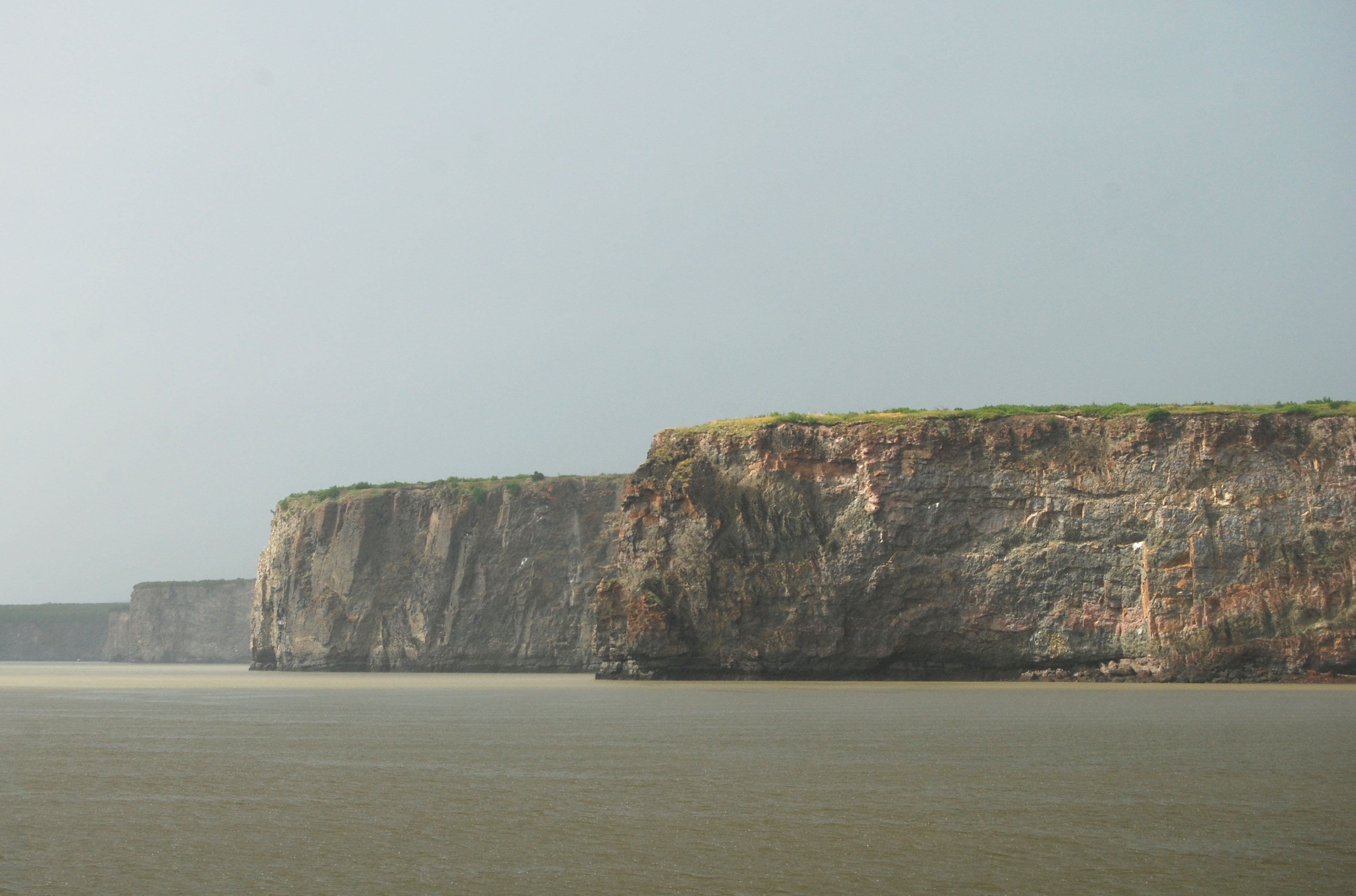
Geography of a Remote Corner
Penzhina Bay reaches into the northeastern corner of the Sea of Okhotsk, forming the upper right arm of the larger Shelikhov Bay. It is bounded to the east by the Kamchatka Peninsula and to the west by the Taygonos Peninsula, which separates it from the adjacent Gizhigin Bay. The bay runs approximately 300 kilometers in length and 65 kilometers in width at its broadest, though near its middle two peninsulas squeeze the water into a narrow throat just 30 kilometers across — a passage the local geography names, with straightforward Russian directness, The Gorlo: the throat. From October to May, ice covers much of the bay. The Penzhina River, 713 kilometers long, winds east, then south, then southwest before emptying into the bay's head. The basin supports almost no permanent human settlement.
A Fortress Against the Koryaks
The first Russians to reach this coast came not for scenery but for control. In 1669, they built an ostrog — a fortified stockade — called Aklansk on the Penzhina River, using it as a base to subdue the indigenous Koryak people and as a staging point on the overland route south toward the Kamchatka Peninsula. The Koryaks attacked the fort multiple times before it was eventually abandoned, the sea route from Okhotsk having made the difficult overland passage obsolete. Two centuries later, in 1866, the American explorer and telegraph surveyor George Kennan passed through the town of Penzhina on the middle river, one of the very few outsiders to document life in this forgotten corner of the Russian empire. His accounts remain among the few detailed observations of the region from that era.
The Whalers' Bay
Between 1849 and 1900, American whaleships out of New Bedford and other New England ports worked these waters regularly, hunting the bowhead whale that populated the Sea of Okhotsk in considerable numbers. On August 11, 1867, the barque Stella — a 270-ton vessel commanded by Captain Ebenezer F. Nye and registered out of New Bedford — wrecked on the western shore of the bay at a point called Krayny. Two men died as the ship broke apart. The rest of the crew was rescued by vessels from the surrounding fleet. The whalers were not alone in working the bay's resources. In late September 1968, the Soviet factory ship Vladivostok and its accompanying catcher boats spent five days in the bay illegally taking sixty-six bowhead whales — a poaching operation documented only because Soviet archives eventually surfaced the records decades later.
Power Waiting to Be Tapped
Engineers have long looked at Penzhina Bay's tides and seen electricity. The calculations are straightforward and the numbers are staggering. The bay's basin covers approximately 20,530 square kilometers. With an average tide of 10 meters rising and falling over that area daily, the theoretical energy potential approaches 120 gigawatts of average capacity — yielding roughly 1,012 terawatt-hours of electricity per year at 96% conversion efficiency. For comparison, that figure approaches the annual electricity output of France. Multiple proposals for tidal power stations have been studied over the decades, from Soviet-era concepts to more recent feasibility analyses. None has advanced beyond paper. The remoteness of the bay, the severity of its winters, the absence of roads, and the sheer engineering challenge of constructing anything in this environment have kept the bay's power theoretical rather than practical. For now, the tides rise and fall precisely as they always have, watched by no one in particular.
From the Air
Centered at approximately 61.25°N, 163.00°E on the northwestern coast of the Kamchatka Peninsula, at the upper reach of the Sea of Okhotsk. The bay is clearly visible from cruising altitude as a long, narrow inlet extending northeast from Shelikhov Bay. The narrowing at The Gorlo — where the bay constricts to 30 km — is visible on clear days. The region is largely roadless and uninhabited; no commercial airports serve the bay directly. The nearest regional centers are Palana (UHPL) to the southeast and Magadan (UHMM) across the sea to the northwest. Low cloud and sea ice (October to May) can obscure the bay from the air.