Percé Rock
Samuel de Champlain saw the holes first. Sailing past the tip of the Gaspé Peninsula in 1607, he noted a massive block of limestone with openings cut clean through it by the ocean, and he named it what it was: Percé, the pierced rock. Four centuries later, the name still fits. At 433 meters long, 90 meters wide, and 88 meters high, Percé Rock rises from the Gulf of Saint Lawrence like the hull of a stone ship, its single remaining arch framing a 15-meter window onto open water. From certain angles, the formation resembles a beached supertanker. From others, it looks like something the sea has been arguing with for 400 million years -- and losing, slowly, but losing all the same.
Written in Stone
The limestone that forms Percé Rock dates to the Devonian period, roughly 375 to 400 million years ago, when the waters here teemed with life forms now found only as fossils. The rock contains approximately 150 species of them: brachiopods, trilobites, dalmanites, corals, and marine worms, all compressed into reddish-gold layers of siliceous limestone threaded with sandstone and siltstone veins. Sir William Edmond Logan, known as the father of Canadian geology, first mapped the Devonian formations of the Gaspé interior in 1844, but Percé Rock was already famous by then. It had been a landmark for navigators, a subject for painters, and a source of local legend for generations. One tale describes the rock as "the monstrous giant, pierced through by an immense eye, now green, now gray, now blue or violet, according to the moods of the sea." During storms, locals say, the vaporous clouds that engulf it give the rock the shape of a phantom -- Le Génie de l'Isle Percée.
The Arch and the Vanished Arch
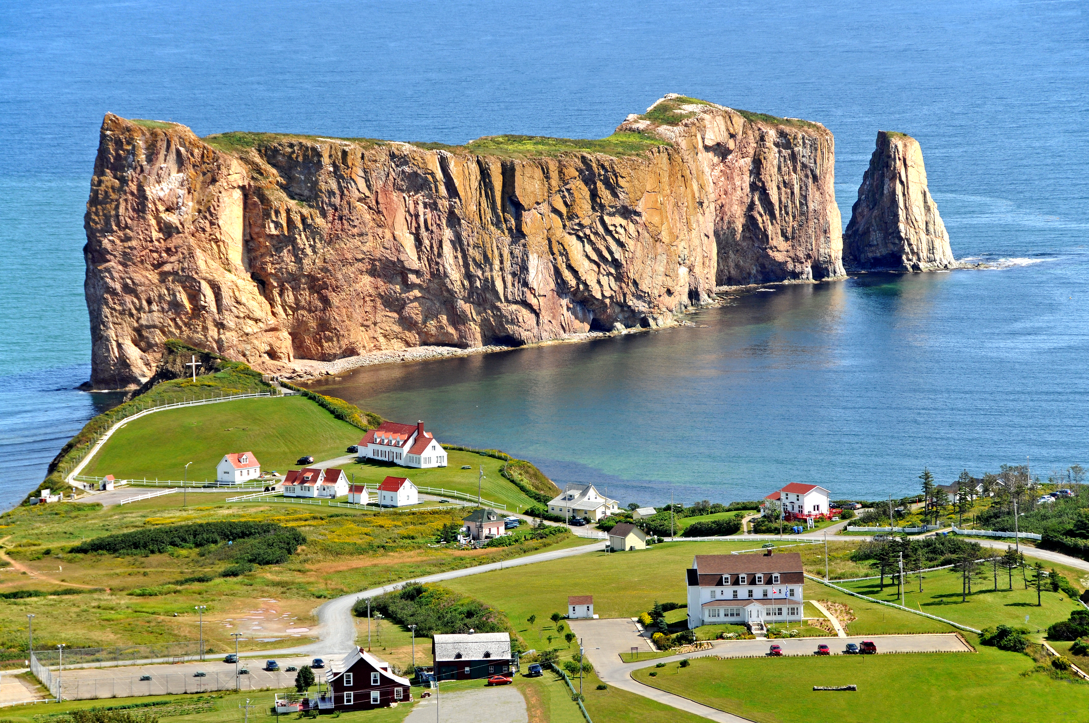
Historical engravings tell a story the rock itself can no longer confirm. A 1760 print by Captain Hervey Smyth, engraved by Pierre Charles Canot in 1768, clearly shows two arches, not one. The second arch collapsed on June 17, 1845, leaving the single southern piercing that gives Percé Rock its name. Even the surviving arch is temporary on a geological timescale -- the sea carved it, and the sea will eventually close it. For now, though, the 15-meter opening remains, framing sky and water in a window that shifts color with the light. At low tide, the ocean retreats from a wide sandbar connecting the rock to the mainland at Rue du Mont Joli, and for about four hours visitors can walk out to the base of the formation and stand beneath cliffs that dwarf everything human in the vicinity.
A Kingdom of Wings
Percé Rock shares its waters with neighboring Bonaventure Island, and together they form the Parc national de l'Île-Bonaventure-et-du-Rocher-Percé, established in 1985 across 5.8 square kilometers of coastline and sea. The park's main claim to fame is staggering in scale: over 110,000 northern gannets nest here, making it one of the largest gannet colonies on Earth -- rivaling and possibly exceeding the famed colony at St Kilda in Scotland. The birds arrive in spring and stay through fall, covering the cliffs in a shifting blanket of white. They are not alone. The park hosts a wide variety of other seabirds, and from May through December, the waters offshore draw blue whales, humpback whales, minke whales, and fin whales along the coast near Percé, Bonaventure Island, and Forillon National Park to the north.
Gateway to Gaspésie
The town of Percé sits on the shores of the bay that bears its name, with fishing as its traditional livelihood and the rock as its perpetual backdrop. Travellers began arriving in earnest in the early 1900s, drawn by the dramatic scenery of the Gaspé Peninsula's tip -- a landscape of cliffs, bays, and hills formed from reddish-gold limestone and shale. A reef lies about half a mile southwest of the rock, and beyond it stretches the open Gulf of Saint Lawrence. The rock formation occupies one of five geological zones at the tip of the peninsula, and it is the only one that falls within the national park boundaries. The park extends over two kilometers of coastline, but it is Percé Rock that commands the view -- an immovable fact of geography that has outlasted every human story told about it, and will outlast many more.
From the Air
Percé Rock sits at 48.52°N, 64.20°W at the extreme tip of the Gaspé Peninsula. The massive limestone stack is unmistakable from the air, a narrow bluff jutting from the shoreline into the Gulf of Saint Lawrence. Nearby Bonaventure Island is visible just offshore. Best viewed at 2,000-3,000 feet AGL for the full effect of the arch and gannet colonies. Nearest airport: Gaspé (Michel-Pouliot) Airport (CYGP), approximately 70 km northwest. Coastal fog is common, especially in spring and early summer.