Peter Roose Homestead
To reach the land he intended to farm, Peter Roose had to take a train to Seattle, a ship to the Makah village of Neah Bay on the Strait of Juan de Fuca, and then hire Makah canoeists to paddle him to the mouth of the Ozette River. From the beach, he carried his belongings inland on foot, bushwhacking through some of the densest forest on the continent. There were no roads. There would not be roads until the 1920s. Roose, an immigrant from Bollnas, Sweden, claimed 160 acres under the Homestead Act in 1907, settling on one of the open bog prairies near Ozette Lake that the Makah had been burning for centuries to keep productive. He built his life on land that Indigenous people had already shaped for their own purposes -- a fact that the Homestead Act did not acknowledge and Roose may not have fully understood.
Prairies That Aren't Prairies
The open areas near Ozette Lake that settlers called 'prairies' -- Ahlstrom's Prairie and Roose's Prairie among them -- are not prairies in any conventional sense. They are herbaceous bogs with peaty soil saturated for most of the growing season, dominated by mosses, sedges, and low-growing heath shrubs rather than the grasses that define true prairie. The Makah and the residents of Ozette Village, which sat on a bench above the beach at Cape Alava about three miles to the west, had maintained these open areas through deliberate burning for centuries. The fires kept forest and dense brush from reclaiming the bogs, preserving habitat for bog cranberry -- Vaccinium oxycoccus -- which served as both a dietary staple and a valuable trade item. Berries, Labrador-tea, and basketry materials were gathered here, and the open ground provided hunting areas for elk, deer, and black bear.
Scandinavians at the End of the Road
Peter Roose was not alone in his ambition. Starting around 1890, a wave of Scandinavian homesteaders -- primarily from Sweden, Norway, and the upper Midwestern states of Minnesota and the Dakotas -- began settling around Ozette Lake. They were drawn by the mild maritime climate, the absence of the brutal Midwestern winters, and the apparent fertility of land that could grow such enormous trees and dense vegetation. What the advertisements and rumors did not adequately convey was the difficulty of clearing that vegetation. The forest was immense, the terrain steep, and the near-constant dampness made every task harder. An overland route from Clallam Bay approached the east side of the lake on a 25-mile foot trail -- now the Hoko-Ozette Road -- but for most early settlers, the only practical access was by canoe from Neah Bay. These were people willing to travel thousands of miles from Scandinavia only to discover that the last 25 miles were the hardest.
Five Buildings in a Bog
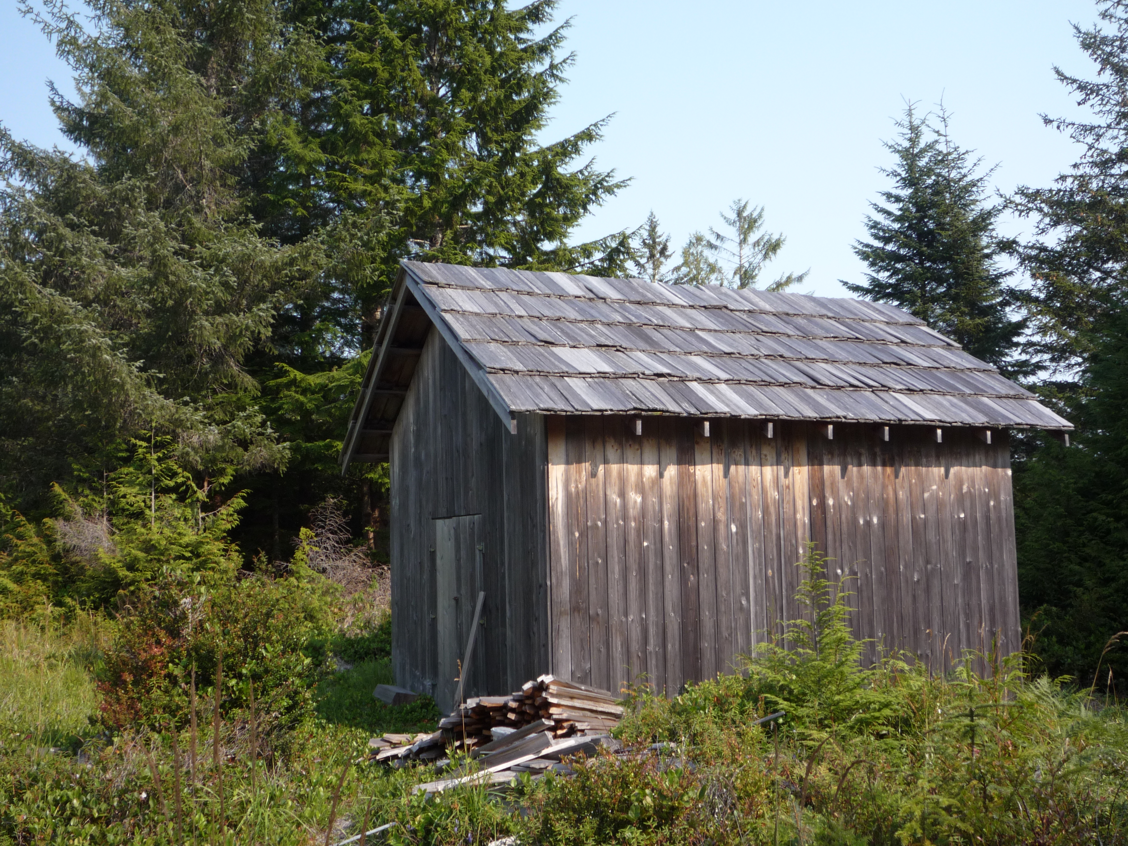
The Peter Roose Homestead, added to the National Register of Historic Places in 2007, comprises a 34-acre historic district containing five contributing buildings and structures. These modest structures -- a house, a well, a sheep barn among them -- represent the physical evidence of one family's attempt to establish a working farm in conditions that defied most expectations of agriculture. The soil was peaty and waterlogged, suited to cranberries and sedges but hostile to the crops a Swedish farmer would have known. The climate was mild but relentlessly damp. The nearest neighbors were other Scandinavian homesteaders scattered around the lake, and beyond them, the Makah families whose ancestral relationship to this landscape stretched back millennia. The homestead sits today within Olympic National Park, its buildings preserved as artifacts of a brief, intense period when the Homestead Act sent settlers to the farthest edges of the continent.
Two Histories on the Same Ground
Ozette Village, at Cape Alava, was first occupied around the year 0 CE and remained inhabited into the 1930s. A foot trail -- now called the Cape Alava Trail -- connected the village to the lake and the prairies where Roose and other homesteaders eventually settled. The Makah used these same paths, these same prairies, these same resources. Oral histories from both Makah tribal members and descendants of early settlers confirm that the Makah regularly burned the bogs, a land management practice that created the very openings the homesteaders later claimed as farmland. The Roose homestead, in this light, is not just the story of a Swedish immigrant and the Homestead Act. It is a story about two cultures using the same landscape for different purposes, one with 2,000 years of tenure and one with a 160-acre claim. Both left marks. The Makah marks just go deeper.
From the Air
The Peter Roose Homestead is located at 48.16°N, 124.71°W near Ozette Lake within Olympic National Park on Washington's Olympic Peninsula. The homestead is not visible from altitude, but Ozette Lake and the surrounding bog prairies (Ahlstrom's and Roose's Prairies) appear as lighter clearings in otherwise unbroken forest. Cape Alava and the Pacific coast are approximately 3 miles west. Nearest airport is Quillayute (KUIL) about 18 nm south. No paved roads serve the immediate area. Frequent rain and low cloud. Best viewed at 3,000-5,000 ft.