Petroglyph National Monument
The images reveal themselves slowly. From a distance, the basalt boulders along Albuquerque's West Mesa look uniformly dark, their surfaces coated in a glossy, almost-black patina that geologists call desert varnish. Step closer, and figures emerge from the stone: spirals, handprints, animals, masked faces, crosses, livestock brands. An estimated 24,000 petroglyphs line this volcanic escarpment on the city's western edge, carved over roughly 3,000 years by Ancestral Pueblo peoples and, later, Spanish settlers. Each image was made by chipping through the dark oxidized surface to reveal the lighter gray rock beneath - a technique that turned the entire ridgeline into an open-air gallery of sacred and secular art.
Fire Before Art
The canvas came first, shaped by volcanic fire. Approximately 200,000 years ago, six eruptions sent rivers of molten basalt flowing downhill through old arroyos, forming triangular, peninsula-shaped channels around existing hills. Over millennia, the softer hills eroded away while the harder basalt remained - a geological phenomenon called reverse topography, where lava fills valleys and then becomes the ridgeline after everything around it wears down. The eruptions also built a chain of five volcanic cones along the monument's western boundary: Butte, Bond, Vulcan, Black, and JA volcanoes, all now dormant. The basalt itself made the petroglyphs possible. Rich in iron, manganese, and calcium, the rock developed its dark desert varnish through thousands of years of oxidation - the manganese and iron rusting when exposed to oxygen and rainwater. That dark, glossy coating became the medium. Chip through it, and the contrast between dark surface and light interior creates an image visible for centuries.
Voices in Stone
The oldest carvings in Boca Negra Canyon date back roughly 3,000 years. Archaeologists determine relative age by examining the darkness of the carved surface - older petroglyphs have begun to re-varnish, their exposed rock slowly darkening again toward the color of the surrounding stone. The images hold deep cultural significance to Pueblo peoples and neighboring Native communities, their meanings complex and varied. Many carvings are recognizable: bighorn sheep, birds, human figures, geometric patterns. Others are abstract, their significance understood perhaps only by the carver. Spanish settlers added their own marks centuries later - livestock brands and Christian crosses layered alongside the older Pueblo imagery. The monument protects hundreds of archaeological sites across four major areas open to visitors: Boca Negra Canyon, Piedras Marcadas Canyon, Rinconada Canyon, and the Volcano Day Use trails. Together, they form one of the largest petroglyph sites in North America.
A Monument Under Siege
Authorized on June 27, 1990, Petroglyph National Monument is cooperatively managed by the National Park Service and the City of Albuquerque - an arrangement that has generated persistent tension. The city succeeded in building a four-lane highway directly through the monument site, relocating nine petroglyphs in the process despite opposition from the SAGE Council (a Native-founded citizens' group), the Sierra Club, and the National Trust for Historic Preservation. In 2012, Public Employees for Environmental Responsibility alleged that the petroglyphs were in danger because the city refused to allow NPS rangers to patrol or enforce Park Service rules on city-controlled land, which constitutes the bulk of the monument. Due to city service cutbacks, most of the monument was left unpatrolled. NPS Intermountain Regional Director John Wessels acknowledged the challenges in a 2011 letter, and advocates called Petroglyph a national treasure deserving the same protections as other national parks.
Ancient Art on the City's Edge
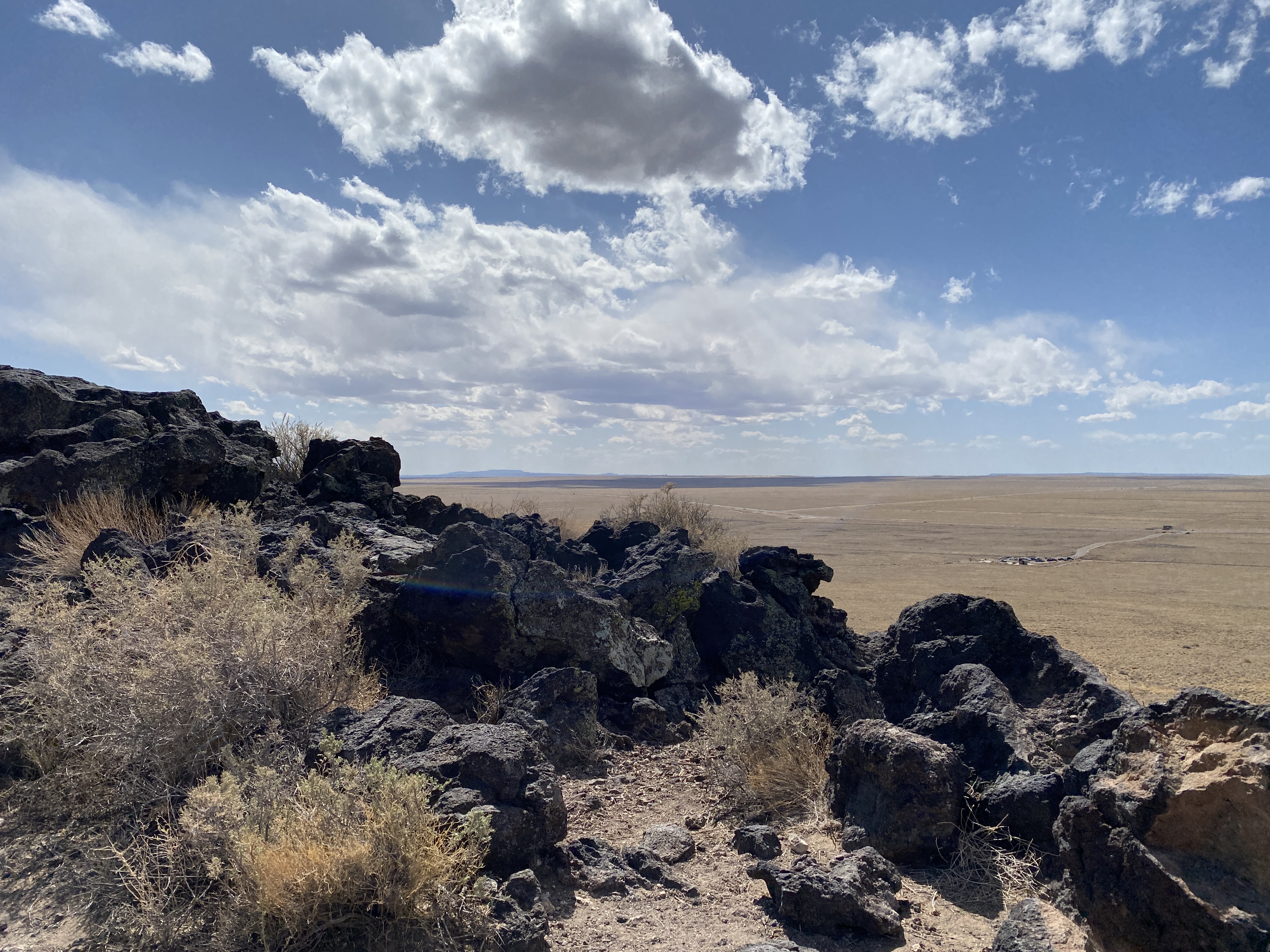
What makes Petroglyph National Monument remarkable is its location. This is not a remote archaeological site accessible only by dirt road and determination. It sits at the western edge of New Mexico's largest city, a place where suburban development presses directly against 3,000-year-old rock art. From the top of Black Volcano, you can see downtown Albuquerque's skyline to the east and the vast emptiness of the West Mesa stretching toward the horizon to the west. The five volcanic cones stand along the monument's western boundary like sentinels. Vulcan, Black, and JA volcanoes are connected by hiking trails that offer views across the entire Rio Grande valley. The juxtaposition is striking: one of North America's great concentrations of ancient rock art exists not in wilderness but at the boundary between city and desert, modern life and deep time, where the suburbs end and the basalt begins.
From the Air
Located at 35.14N, 106.76W along the western edge of Albuquerque, New Mexico. The monument stretches approximately 17 miles along the West Mesa escarpment - from the air, it appears as a dark volcanic ridgeline running north-south, separating Albuquerque's suburban development to the east from open mesa to the west. The chain of five volcanic cones (Butte, Bond, Vulcan, Black, JA) is clearly visible from altitude as a line of small peaks along the western boundary. The contrast between the dark basalt escarpment and the surrounding tan desert is particularly striking. Nearest airport is Albuquerque International Sunport (KABQ), approximately 10 miles southeast. Double Eagle II Airport (KAEG) sits just north of the monument. Recommended viewing altitude: 2,000-4,000 feet AGL to see the full extent of the escarpment and volcanic chain.