Pico Bonito National Park
The mountain announces itself long before you reach the park. Pico Bonito -- the Beautiful Peak -- rises 2,435 meters above the Caribbean lowlands south of La Ceiba, its upper slopes vanishing into clouds that rarely lift for long. At 564 square kilometers, Pico Bonito National Park is the largest in Honduras, and the altitude gain from its lowest point at 60 meters to its summit compresses an astonishing range of ecosystems into a single protected area: coastal wetlands, lowland tropical forest, deep river canyons, and cloud forest where moisture drips from every surface. Established on January 1, 1987, the park protects the heart of the Cordillera Nombre de Dios, a mountain range that forms a dramatic green wall behind one of Central America's most vibrant port cities.
Where the Caribbean Meets the Clouds
The proximity of sea and summit creates Pico Bonito's extraordinary biodiversity. Warm, moisture-laden air sweeps in from the Caribbean and collides with the mountain range, producing torrential rainfall that feeds rivers, waterfalls, and a density of plant life that rivals anywhere in the Americas. More than 400 bird species have been recorded here, making the park one of the best birdwatching destinations in the Western Hemisphere. Toucans are common in the lower elevations, their oversized bills a flash of color against the green canopy. The lovely cotinga -- an electric-blue bird so vivid it looks artificial -- draws birders from around the world. Higher up, the cloud forest shelters resplendent quetzals, emerald toucanets, and dozens of hummingbird species that thrive in the perpetual mist.
Big Cats and Hidden Canyons
Below the canopy, the park's wildlife reads like a field guide to Neotropical megafauna. Jaguars patrol the remote interior, sharing territory with mountain lions and the smaller, spotted ocelot. Howler monkeys fill the dawn with a sound that carries for miles -- a deep, resonant roar that seems far too large for the animal producing it. Spider monkeys swing through the upper canopy, and armadillos root through the leaf litter on the forest floor. The terrain that shelters these animals also makes them difficult to see. Deep canyons carved by the Cangrejal River and its tributaries create natural barriers within the park, and much of the interior remains accessible only to the most determined hikers. This inaccessibility is not a failing of park design -- it is the reason the wildlife still thrives.
Waterfalls and Whitewater
Three waterfalls anchor the park's trail system, each offering a different experience. El Bejuco Falls rewards a challenging hike with swimming holes at its base. Unbelievable Falls, reached by a moderate trail, cascades in tiers over mossy rock into a pool deep enough for a plunge. Cascada Zacate is the shortest hike of the three, but swimming is prohibited -- the community downstream depends on its water for drinking. Beyond the falls, the Cangrejal River provides Class III and IV whitewater rafting along the park's eastern boundary, where the river tumbles through boulders and narrow gorges on its way to the Caribbean. The rapids are fed by the same relentless rainfall that sustains the forest, and after a heavy rain, the river transforms from a clear stream to a brown torrent in hours.
La Ceiba's Green Backdrop
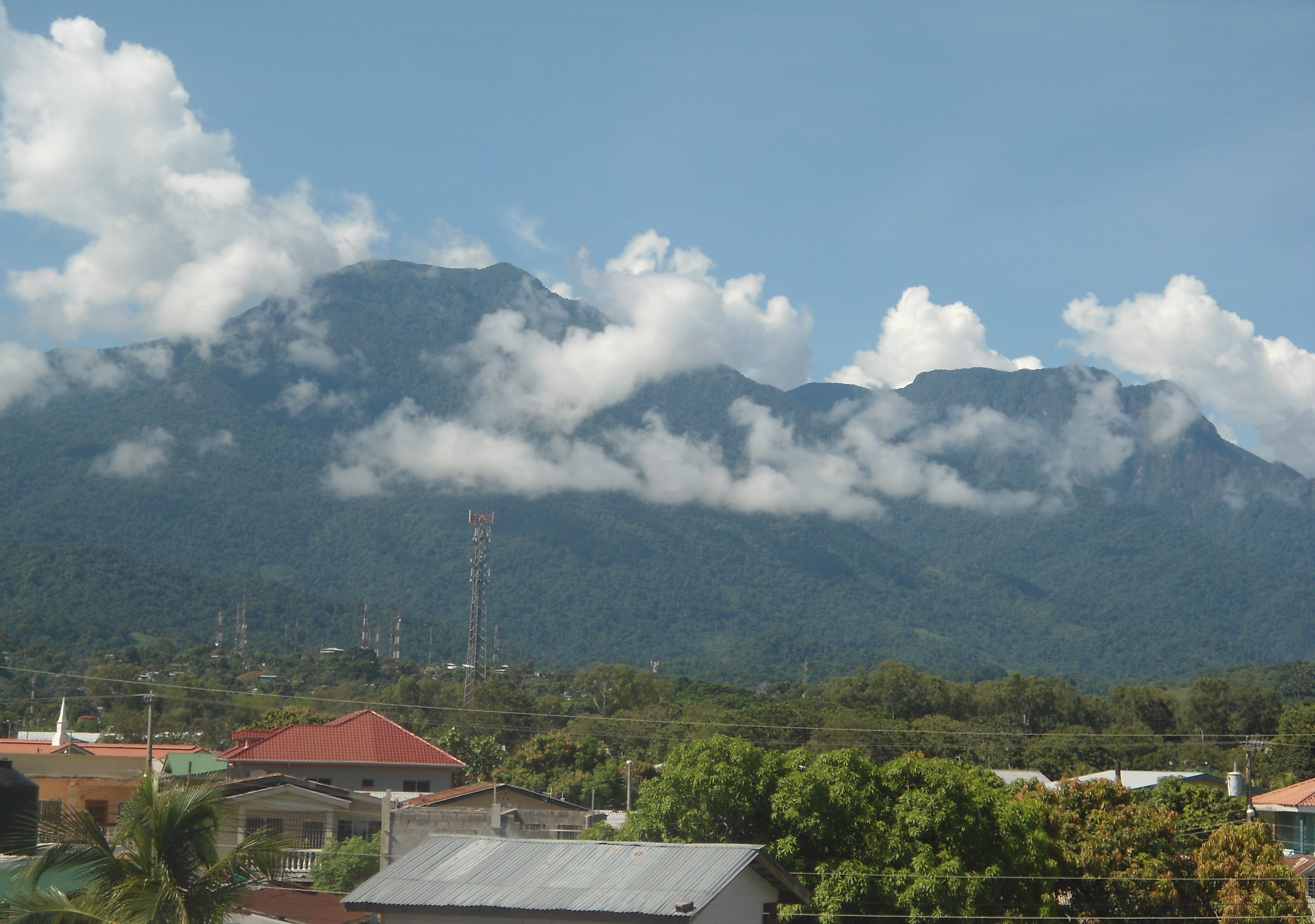
From the streets of La Ceiba, Pico Bonito dominates the southern skyline -- a wall of green rising abruptly from the coastal plain. The park entrance is a short bus or taxi ride from the city center, making it one of the most accessible wilderness areas in Central America despite its vast interior. Lodges surrounding the park offer guided birdwatching tours that begin before dawn, when the forest is most vocal. The relationship between city and park is symbiotic: La Ceiba's identity as the eco-tourism capital of Honduras depends on Pico Bonito's health, and the revenue from visitors provides economic justification for continued protection. In a country where deforestation pressures are relentless, that economic argument may be the park's most important defense.
From the Air
Located at 15.61N, 86.87W in the Cordillera Nombre de Dios of northern Honduras. From altitude, Pico Bonito appears as a massive green peak rising abruptly from the Caribbean coastal plain south of La Ceiba. The summit at 2,435 meters (7,989 feet) is typically shrouded in clouds. Best viewed from 5,000-8,000 feet AGL approaching from the north, where the contrast between coastal city and mountain wilderness is most striking. The Cangrejal River canyon is visible as a deep cut in the eastern flanks. Nearest airport: Goloson International Airport (MHLC) at La Ceiba, approximately 8 nm north of the park boundary.