Picos de Europa National Park
On January 7, 2021, a weather station in the Vega de Liordes recorded minus 35.8 degrees Celsius -- the lowest temperature ever measured in Spain by an unofficial monitoring network, though not recognized as the official record by Spain's state meteorological agency AEMET. That such a reading was set here, in the Picos de Europa, would not have surprised the roughly 1,300 people who live within the park's boundaries. They know what visitors from the coast discover quickly: these mountains, barely 20 kilometers from the Bay of Biscay, generate their own weather, their own rules, and their own sense of scale.
The First Park
Picos de Europa holds the distinction of being the first national park in Spain. On July 22, 1918, with the advocacy of Pedro Pidal, 1st Marquess of Villaviciosa de Asturias -- a mountaineer and conservationist -- the government protected the western massif centered on the Lakes of Covadonga. That original park, the Parque Nacional de la Montana de Covadonga, covered just 169 square kilometers. It has grown since. Extensions in 1995 and 2014 brought the total area to 671 square kilometers, and in 2003 UNESCO designated the park a Biosphere Reserve. It is now one of several biosphere reserves in the Cantabrian Mountains being integrated into a single super-reserve called Gran Cantabrica.
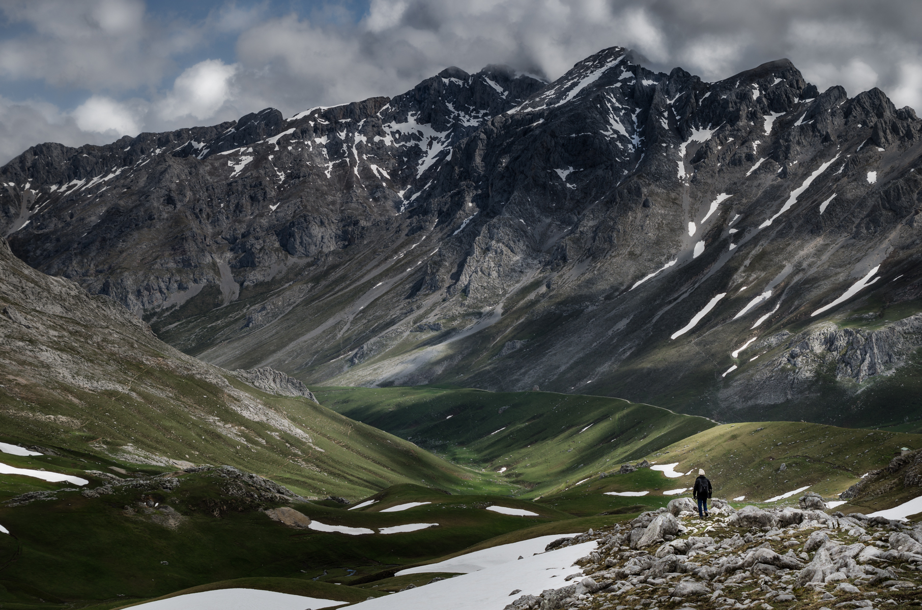
A Vertical Landscape
The park sits at the intersection of three autonomous communities -- Asturias, Cantabria, and Castile and Leon -- and its geography is as dramatic as any in Europe. Torre de Cerredo, the highest peak, rises to 2,648 meters above sea level. The Deva River, at the park's lowest point, runs at just 75 meters. That vertical drop of 2,573 meters creates stacked ecosystems: beech forests and Cantabrian holm oaks in the valleys give way to alpine meadows and bare limestone at altitude. Glacial erosion has carved the limestone massifs into jagged ridges, deep gorges, and the kind of terrain that rewards the careful hiker and punishes the reckless one.
Wild Neighbors
The park shelters species that have vanished from much of Europe. Cantabrian brown bears roam the forests, though encounters are rare. Iberian wolves hunt in packs across the higher ground. Bearded vultures, among Europe's largest raptors, soar above the ridgelines, their wingspan stretching nearly three meters. The Cantabrian capercaillie, a critically endangered grouse, survives in the park's older woodlands. But the animal most identified with the Picos is the Cantabrian chamois, or rebeco -- an agile mountain goat whose likeness appears in sculptures throughout the park. Watching one navigate a near-vertical rock face at speed is a lesson in what evolution produces when the terrain demands it.
Stone and Sky
From the air, the Picos de Europa appear as a sudden wall of white limestone rising from the green lowlands of northern Spain. The proximity to the coast is startling -- the Bay of Biscay shimmers to the north while glacial lakes catch the light in the high valleys. The Lakes of Covadonga, the heart of the original park, glow emerald in their limestone basins. Below the peaks, the Cares Gorge cuts a narrow slot through the rock, its walking trail carved into the cliff face hundreds of meters above the river. This is a landscape that compresses extremes into a small space: salt air and alpine cold, lush forest and bare karst, all within a day's walk of each other.
From the Air
Located at 43.21°N, 4.84°W in the Cantabrian Mountains of northern Spain. Torre de Cerredo reaches 2,648 m (8,688 ft) AMSL -- maintain safe altitude over mountainous terrain. The park is approximately 20 km inland from the Bay of Biscay coast. Nearest airports: Asturias (LEAS) to the west, Santander (LEXJ) to the east. Mountain weather can change rapidly; expect turbulence and reduced visibility near the peaks.