Pillar Point Air Force Station
From the bluffs of Pillar Point, the radar dishes look out to sea as they have, in one form or another, since 1940. What began as a World War II coastal defense post -- artillery, machine guns, searchlights, concrete bunkers -- has evolved into a United States Space Force tracking station that monitors polar-orbiting satellites and intercontinental ballistic missiles launched from Vandenberg. The fishing boats in Pillar Point Harbor below seem unaware that they are anchored in the shadow of the Cold War's living legacy, a 48-acre facility that has reinvented itself with each generation's threats.
Guarding Against Japan
The facility was founded on October 10, 1940, as the Pillar Point Military Reservation, one piece of San Francisco's harbor defense network. The fear was specific: Japan might attack. Large artillery pieces were emplaced, .50-caliber machine guns positioned for anti-aircraft defense, searchlights installed to sweep the ocean at night, and barracks built to house the garrison. In June 1944, the defenses gained technological teeth when a Surface Craft Detection Radar System, the SCR-296 built by Western Electric Company, was installed. It could detect and track ships approaching the coast by UHF radar, a significant upgrade from men staring at the horizon. The threat never materialized -- no Japanese attack on San Francisco ever came -- and on January 17, 1946, the radar was removed. The reservation closed in 1949.
Missiles and the Space Age
The Cold War reopened the base. On September 4, 1959, the Navy established a missile tracking station at Pillar Point to support the Regulus missile program and, later, Minuteman intercontinental ballistic missiles. The station tracked Minuteman II missiles from 1967 to 1972. In the 1960s, the base transferred to the Air Force, and the tracking equipment grew more sophisticated. Today's radars -- the AN/FPQ-6 and AN/MPS-36, both C-band systems from the Western Range at Vandenberg -- monitor launches and track objects in orbit. The base serves the United States Space Force, the Navy, and the Air Force Special Operations Command simultaneously. Just north of the station, what was once Half Moon Bay Flight Strip, a World War II auxiliary airfield for Salinas Army Air Base, has become Eddie Andreini Sr. Airfield.
Rancho, Reef, and Radar
The peninsula that holds the station is barely a third of a mile wide and a quarter mile long, connected to the mainland by a narrow isthmus. Before it became military property, this land was part of Rancho Corral de Tierra, granted to Francisco Guerrero y Palomares by Mexico before California achieved statehood in 1850. The land was used for farming and grazing until the war changed its purpose. A prehistoric artifact site, CA-SMA-151, has been documented at the station and is listed on the National Register of Historic Places, evidence that people have valued this high ground overlooking the harbor for far longer than any military has occupied it. Breakwaters installed in 1961 and 1982 attempt to protect the peninsula from erosion, with mixed results. The ocean, as always, proceeds on its own timeline.
From the Air
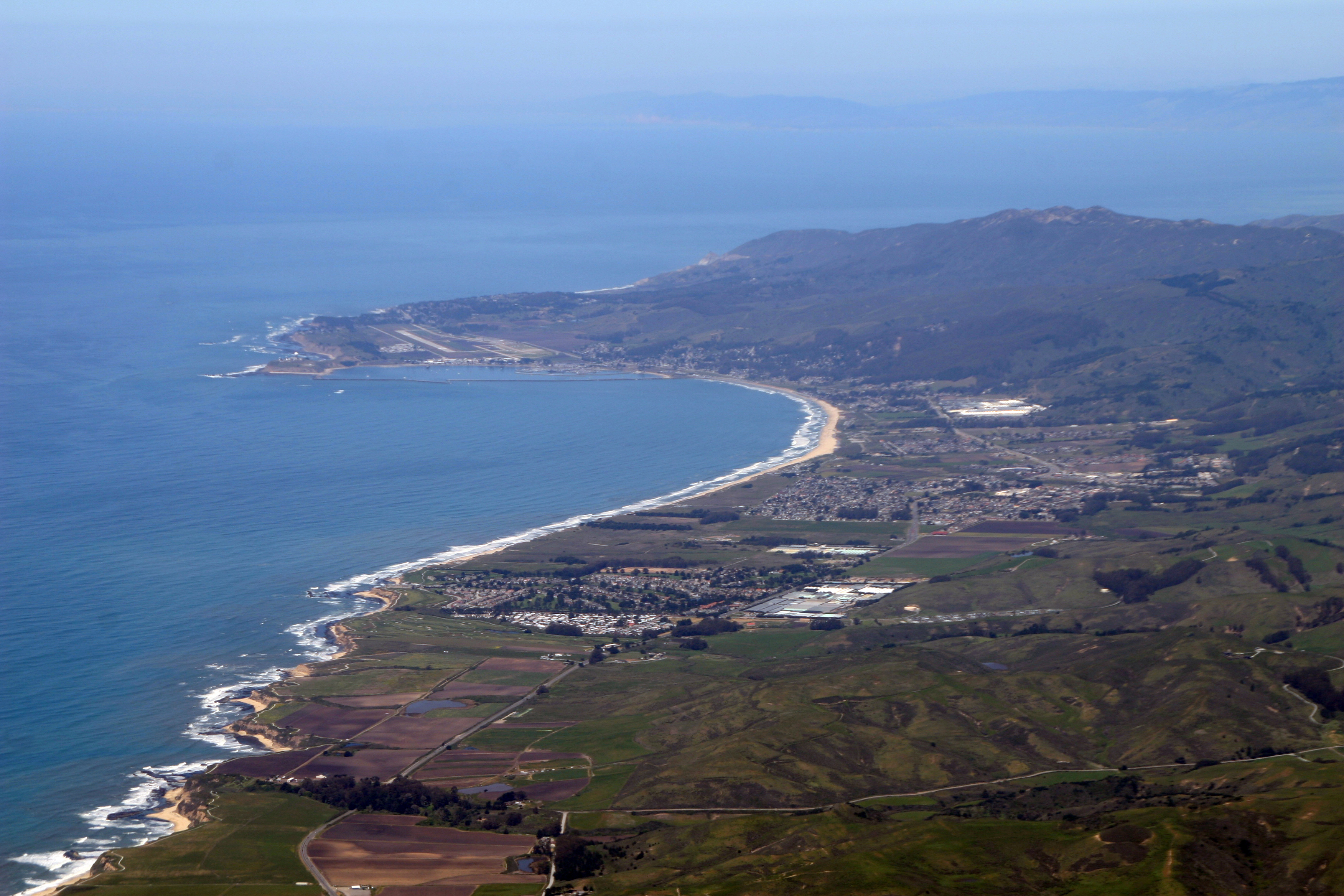
Located at 37.50°N, 122.50°W on the Pillar Point peninsula overlooking Pillar Point Harbor. The radar installations are visible on the bluff. This is an active military facility -- do not overfly at low altitude. Half Moon Bay Airport (KHAF) is approximately 2 nm south. San Francisco International (KSFO) is 15 nm north. The Mavericks surf break is visible offshore to the west.