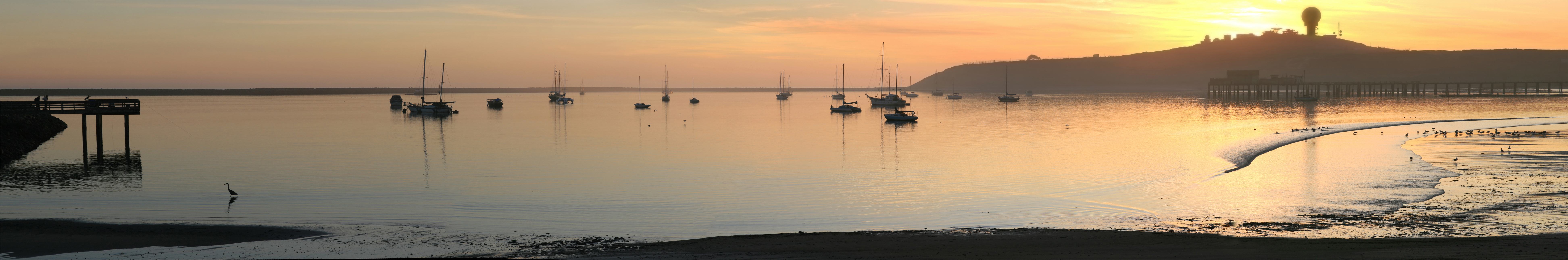
Pillar Point Harbor
The anchor of the ship Rydal Hall sits outside a restaurant near Pillar Point Harbor, recovered in 1971 from the wreck site where the vessel went down in October 1876 while hauling coal to San Francisco. It is one artifact from a long history of nautical trouble at this exposed stretch of coast. The harbor that exists today -- protected by breakwaters built in 1961, extended in 1967, and supplemented by an inner breakwater in 1982 -- represents decades of engineering effort to tame a bay that the Pacific has never stopped testing.
Ohlone Shores and Spanish Diaries
The Ohlone people inhabited the area around Pillar Point through much of the nineteenth century, particularly along the riparian zone of El Granada Creek. An archaeological site, SMA-151, documented at the nearby Air Force Station bluff and listed on the National Register of Historic Places, preserves evidence of their presence. The first European land exploration of Alta California, the Portola expedition, passed through in October 1769, camping just south of the harbor on October 28. Missionary Juan Crespi described Pillar Point in his diary. By the early nineteenth century, Russian fur trappers plied this coast, followed by American settlers.
Denniston's Landing and the Wreck of the Rydal Hall
By 1859, James G. Denniston, a California state assemblyman representing San Mateo County, had built a deep-water landing at Pillar Point. For years it served as a key port for lumber, produce, and other goods bound for San Francisco. But the coast was treacherous. Shipwrecks and nautical accidents were common along this stretch of Pacific coastline. The Rydal Hall disaster of 1876 was the most notable, but it was far from the only vessel lost here. The harbor's vulnerability to storm damage persisted well into the twentieth century, with fierce winter storms sometimes destroying boats even when they were safely moored.
Three Breakwaters and Counting
The modern harbor took shape between 1959 and 1982 in a prolonged battle with the ocean. The Army Corps of Engineers built the first riprap breakwater between 1959 and 1961, adding a pier, the Harbor Master's office, and a foghorn. The breakwater proved inadequate against southwesterly storm waves, which surged through the opening. In 1967, the western arm was extended by 1,050 feet. That fix also fell short, and in 1982 an inner breakwater was finally constructed. Today the harbor serves both pleasure craft and commercial fishing boats, managed by the San Mateo County Harbor District. The world-famous Mavericks surf break lies about half a mile outside the harbor, a reminder that the ocean's power does not diminish simply because humans have built walls against it.
From the Air
Located at 37.50°N, 122.49°W at the north end of Half Moon Bay. The harbor and its breakwater are clearly visible from the air. Half Moon Bay Airport (KHAF) is approximately 2 nm south. San Francisco International (KSFO) is 15 nm north-northeast. The Mavericks surf break is visible offshore to the west of Pillar Point.