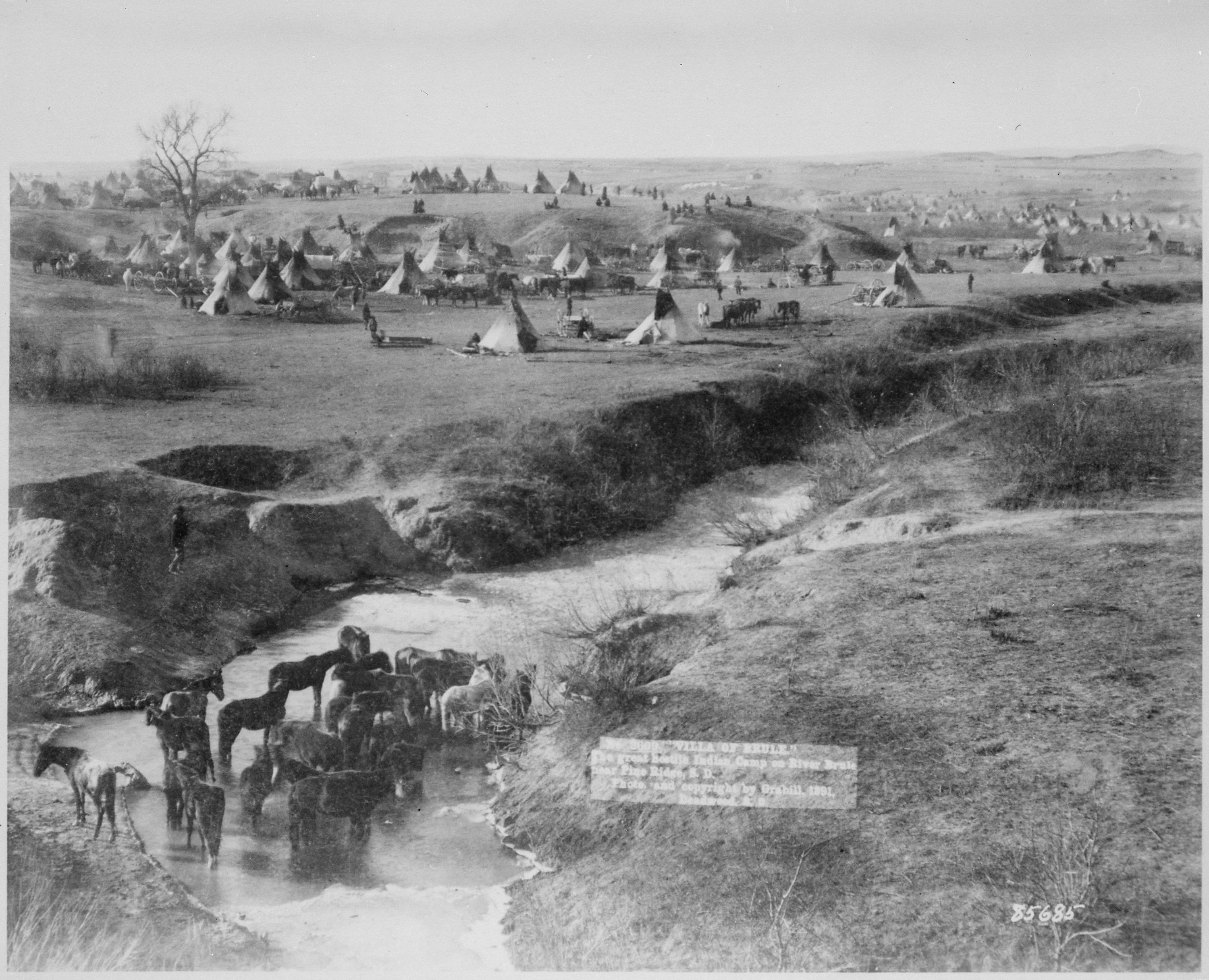
Pine Ridge Indian Reservation
The wind never stops on Pine Ridge. It sweeps across 3,500 square miles of rolling grassland in southwestern South Dakota, carrying with it the weight of history that few places in America can match. This is the homeland of the Oglala Lakota, one of the seven bands of the Lakota Sioux, and it remains one of the largest Indian reservations in the United States. Created by the Act of March 2, 1889, when the Great Sioux Reservation was carved into smaller pieces, Pine Ridge encompasses the entirety of Oglala Lakota County and Bennett County, stretching south to the Nebraska border.
The Wound That Never Healed
On December 29, 1890, near Wounded Knee Creek, the 7th Cavalry surrounded a band of Miniconjou Lakota led by Chief Spotted Elk, known to settlers as Big Foot. What happened next became one of the darkest chapters in American history. Soldiers opened fire on the encampment, killing an estimated 250 to 300 Lakota men, women, and children. The dead were buried in a mass grave on the hillside. The site was designated a National Historic Landmark in 1965, but for the Lakota, Wounded Knee was never just history. It remained an open wound, and in 1973, members of the American Indian Movement occupied the site for 71 days, demanding treaty rights and protesting conditions on the reservation. The standoff drew international attention and two people died before it ended.
Life on the Land
The topography of Pine Ridge tells its own story. To the north, the land breaks into badlands formations, eroded buttes and pinnacles that seem to belong to another world. The southern portion follows Pine Ridge itself, a fault scarp where scattered ponderosa pines and cedar trees find purchase. The prairie between is mixed-grass rangeland, punctuated by sand dunes and the winding paths of White River and its tributaries. Traditional Lakota life followed the buffalo across these plains. Today, with only a small fraction of the land suitable for agriculture, the reservation faces persistent economic challenges. Unemployment hovers between 80 and 85 percent, and nearly half the population lives below the federal poverty level. The 2010 census counted 18,834 residents, the vast majority identifying as American Indian. Communities like Kyle, Manderson, Oglala, and Porcupine dot the landscape, connected by roads that cross miles of open prairie. Winter brings cold that can drop well below zero; summer brings heat and thunderstorms rolling across the endless sky.
Resilience and Sovereignty
The Oglala Sioux Tribe governs itself through an eighteen-member Tribal Council, a system established under the Indian Reorganization Act of 1934. The tribe operates its own police force, courts, and social services. Primary elections are held each October, with general elections in November. Oglala Lakota College, founded in 1971, was one of the first tribal colleges in the nation and continues to educate new generations, with 68 percent of its graduates being women. The Prairie Wind Casino, which opened in 1994 in three doublewide trailers, was upgraded in 2007 to a full resort with a 78-room hotel and full-service restaurant, providing 250 jobs mostly held by tribal residents. Revenues support education and social welfare programs. Despite the challenges, cultural revival is underway. The Lakota language is being taught in schools, traditional ceremonies continue, and the Lakota Country Times gives voice to community concerns. The land remembers, and so do its people.
The View from Above
From the air, Pine Ridge reveals its scale and isolation. The town of Pine Ridge, the reservation's administrative center, sits in the southwestern corner, a small cluster of buildings surrounded by vast emptiness. Rapid City, the nearest urban center, lies roughly 80 miles to the north. The White River traces silver threads through brown and green prairie. To the north, where the reservation borders Badlands National Park, the land fractures into dramatic erosional formations. The communities of Kyle, Manderson, and Porcupine appear as scattered settlements along winding roads. This is a landscape shaped by wind and time, where the horizon seems to stretch forever and the presence of the Lakota people endures against all odds.
From the Air
Located at 43.35N, -102.09W in southwestern South Dakota. The reservation covers approximately 3,500 square miles. Nearest major airport is Rapid City Regional (KRAP), about 80nm north. Pine Ridge village has a small airstrip. The terrain is mixed-grass prairie transitioning to badlands topography in the north, elevation around 3,000-3,500 feet. Look for the White River drainage and the dramatic transition to Badlands National Park along the northern boundary.