Pioneertown Mountains Preserve
Flash floods have reshaped this place twice in recent memory. In 2017, a wall of water roared through Pipes Canyon and buried the upper trail under debris several feet deep. Then in August 2023, Hurricane Hilary struck again, closing routes for months. The desert does not hold still, and neither does the Pioneertown Mountains Preserve — 25,500 acres of terrain that has been battered, burned, and rebuilt, always returning to something startling.
Where Two Deserts Meet
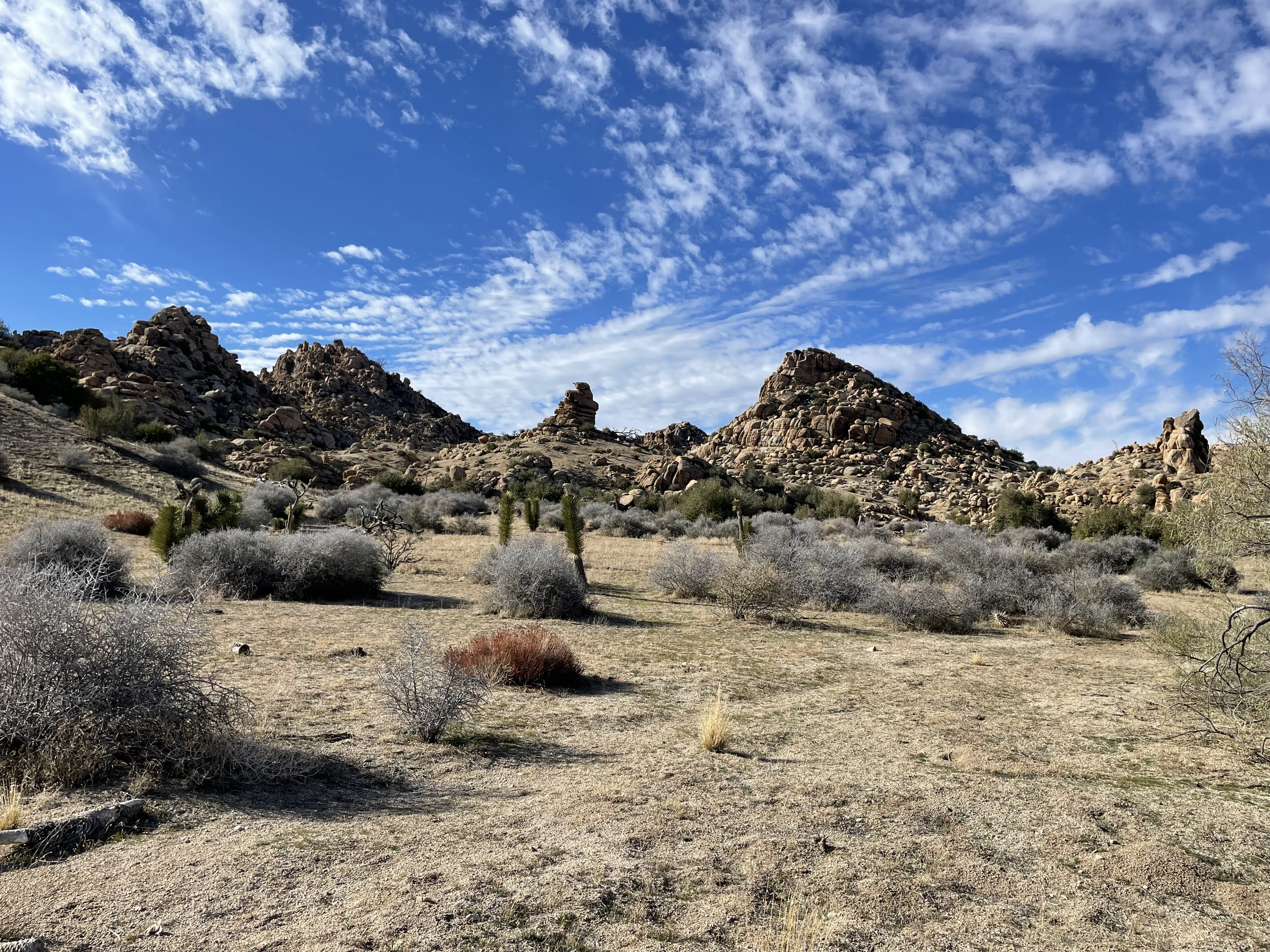
The preserve straddles one of the most ecologically dynamic edges in Southern California, where the Mojave Desert yields, reluctantly, to the lower slopes of the San Bernardino Mountains. Elevation rises nearly 4,000 feet across the property. At the lower end, Joshua trees and desert scrub stretch toward Morongo Valley. Higher up, where the Sawtooth Mountains loom in broken granite profiles, pinyon and juniper take over — communities still recovering from the Sawtooth Complex Fire of 2006. Between them, the terrain is a study in abrupt transitions: sheer red canyon walls in Pipes Canyon give way to rounded boulder domes, volcanic mesas interrupt granitic ridgelines, and unexpected ribbons of green mark perennial streams that survive even the driest years.
A Corridor in the Gaps
Conservation planners had a name for what the preserve protects: a "missing linkage." The South Coast Missing Linkages plan identified this stretch of terrain as a critical connection between lowland desert habitats and the high-elevation refugia of the San Gorgonio Wilderness. Wildlife — mountain lions, mule deer, birds following riparian corridors — depend on continuous habitat to move, breed, and survive a warming climate. The Wildlands Conservancy, which owns and manages the preserve, has assembled its 25,500 acres to fill exactly this gap. The property connects with Bureau of Land Management lands and the Sand to Snow National Monument, making it part of an unbroken block of protected wildlands that stretches from the desert floor toward the 11,000-foot peaks above.
In 2024, a Los Angeles Times investigation into Joshua tree conservation singled out Pioneertown Mountains Preserve as a site included in active climate-refugium restoration efforts, planting trees where models suggest they may survive the century ahead.
The Living Canyon
Pipes Canyon is the preserve's most accessible heart — a slot through red rock walls where, against all expectations, water runs year-round. The stream supports a riparian corridor dense with cottonwood and willow that feels improbable against the surrounding desert. Before the 2017 flood destroyed the upper trail, hikers could follow the canyon deep into the preserve and reach the Olsen Ruins, remnants of an early homestead. That upper route has not been rebuilt; what the flood took, it kept. What remains is still worth the drive: the lower canyon walk offers shade, birdsong, and the unsettling peace that comes from being enclosed by stone in the middle of open desert.
What the Desert Teaches
The Wildlands Conservancy runs occasional educational and volunteer programs here, and the Pipes Canyon Trailhead has parking, a visitor information center, picnic shelter, and restrooms — amenities modest enough that the wildness survives intact. The preserve is not a park engineered for maximum visitors. It is managed as a functioning wildlife corridor first, a place for people second. That priority shows. Chaparosa Peak catches the afternoon light in shades of amber and rust. Granite boulders pile like forgotten arguments. And in spring, when rains cooperate, desert wildflowers spread across the alluvial fans in colors that seem borrowed from somewhere more tropical. The desert, it turns out, is full of surprises — especially after it floods.
From the Air
Located at 34.17°N, 116.55°W in the Little San Bernardino Mountains north of Morongo Valley. The Sawtooth Mountains are the most prominent ridgeline feature. Nearest airports: Twentynine Palms Airport (TNP) ~25 miles east, Desert Resorts Regional (PSP) ~30 miles south. Recommend 7,000–9,000 ft for corridor overview; granite domes and mesa-top volcanic caps are visible in clear desert air.