Piton de la Fournaise
Locals call it simply Le Volcan, the way you might refer to the only mountain that matters. Piton de la Fournaise -- the Peak of the Furnace -- has erupted nearly 300 times since records began in 1650, and the real count is certainly higher. Rising 2,631 meters above the Indian Ocean on the French island of Reunion, this shield volcano produces lava so fluid that eruptions become spectator events rather than evacuation orders. When the Dolomieu crater cracked open in April 2007 and emptied a century's worth of magma down the mountainside and into the sea, people drove toward the eruption, not away from it.
A Furnace with a Long Memory
The volcano sits atop a geological hotspot that has been building Reunion from the ocean floor for two to three million years. The oldest rocks in the Piton de la Fournaise massif date back 530,000 years, and the island itself -- like Hawaii, its geological cousin -- has risen entirely from accumulated eruptions. About 4,700 years ago, a catastrophic explosion collapsed a vast area of the summit, forming the inner caldera known as the Enclos Fouque. Traces of that event, called Bellecombe ashes, can still be found scattered up to 10 kilometers from the crater. Since then, subsequent eruptions have steadily built the central dome back up within the horseshoe-shaped caldera, a 13-kilometer-wide amphitheater of volcanic rock and ash almost completely devoid of vegetation.
The Language of Lava
Piton de la Fournaise produces the same types of lava found in Hawaii, and the names come from Hawaiian languages. Pahoehoe lava, the hottest at 1,100 to 1,200 degrees Celsius, flows like syrup and cools into a glossy, satin-like surface. Aa lava runs cooler, around 1,000 degrees, catching loose rocks as it creeps forward until it resembles a plowed field -- its name mimics the cry of someone walking barefoot across its razor edges. Then there is Pele's hair, volcanic glass spun into fibers fine enough to be carried by the wind for kilometers, and sharp enough to pierce skin. Eruptions typically begin as lava fissures several hundred meters long, from which molten rock pours evenly like waterfalls before concentrating into violent exit points that build up the conical pitons scattered across the caldera floor.
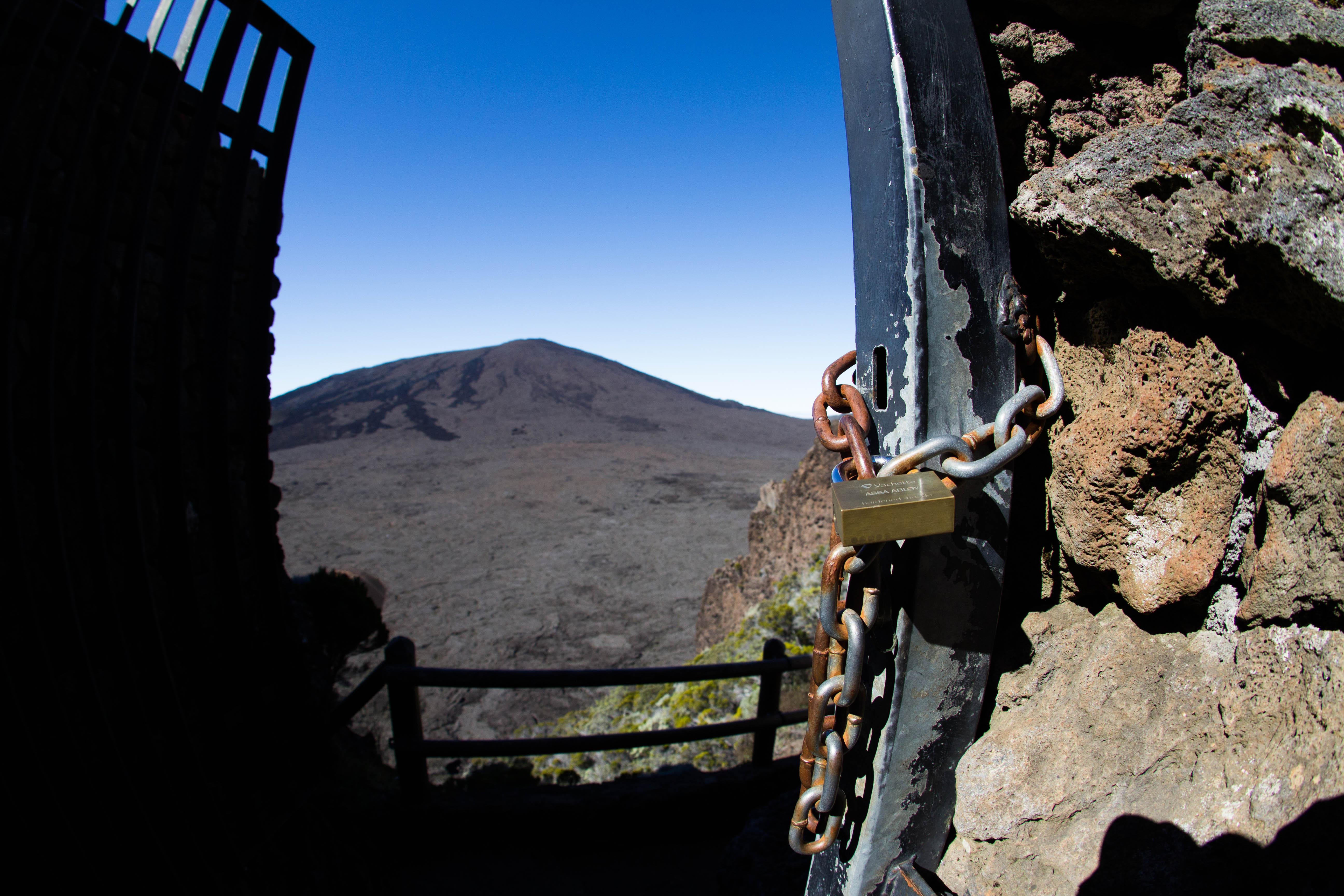
Walking into the Moon
The hike to the summit begins at the Pas de Bellecombe, where a parking lot, a kiosk, and a viewing platform mark the edge of the inner caldera. From here, stairs descend to a plain that looks less like Earth than like a lunar landing site: black rock, volcanic ash, and the miniature crater called Formica Leo, which resembles an ant lion's pit scaled up to geological proportions. White paint markings on rock guide hikers 14.5 kilometers across the caldera floor and up the dome to the rim of the Dolomieu crater, roughly 1,000 meters long and 700 meters wide. Budget at least ten hours for the round trip. The route is not technically demanding, but the terrain -- uneven basalt, no shade, no water sources -- punishes the unprepared. Fog rolls in most afternoons even during the dry season, and hikers who stray from the white markers in low visibility have frozen to death on this tropical volcano.
When the Furnace Lights Up
With two to three eruptions every year, Piton de la Fournaise offers better odds of witnessing live volcanism than almost any other volcano on the planet. The March 1998 eruption lasted 196 days. The July 2017 eruption began on Bastille Day and continued through late August. Because the lava is fluid rather than explosive, eruptions are generally safer to watch than at most volcanoes -- ash clouds are rare, and geophysical monitoring stations detect seismic precursors in advance. Authorities close the caldera at the first signs, then reopen access to safe viewing areas once the eruption is mapped. Helicopter and ultralight sightseeing flights offer aerial views, and when the volcano erupts at night, the glow of molten rock against the dark sky draws crowds to the coastal road below, where lava has occasionally cut across the highway. Road crews simply rebuild on top of the fresh rock and post the year of the eruption on signage.
Life Reclaiming the Rock
Every eruption rewrites the landscape, but nature is a persistent editor. Lichens colonize fresh lava first, followed by ferns, then shrubs, then trees. In the lower valleys, a full forest can reestablish itself within decades. The Plaine des Tamarins, a high plateau southeast of the caldera, hosts remarkable stands of tamarin trees endemic to the island, while agaves send bloom stalks ten meters into the air. Reunion itself receives roughly 12 meters of rain annually, making it one of the wettest places on Earth -- it holds world records for the most rainfall in 12, 24, 72, and 96 hours. That relentless moisture, combined with tropical warmth, means the volcano's destructive power is constantly being undone by growth. The cycle of eruption and regeneration has played out here for hundreds of thousands of years, and the furnace shows no signs of cooling.
From the Air
Piton de la Fournaise is at 21.24S, 55.71E on the southeastern third of Reunion Island in the Indian Ocean. The summit reaches 2,631 m (8,632 ft). The caldera and Plaine des Sables are clearly visible from above. Nearest airport is Roland Garros International (FMEE) in Saint-Denis, approximately 80 km northwest. The volcano's distinctive horseshoe-shaped caldera opens to the east toward the coast. Active lava flows may be visible during eruptions. Expect afternoon cloud buildup over the summit.