Point Charles Light
In 1891, a lighthouse arrived in Australia in pieces. Packed into crates in Birmingham by Chance Bros — one of England's great lighthouse manufacturers — it was shipped to Adelaide, then forwarded aboard the SS Inaminka to Port Darwin, then transferred to the SS Airie for the short coastal voyage to Point Charles. When workers began unpacking it, they found the ironwork badly rusted from the long journey. Construction was delayed. On 1 February 1893, Charles James Dashwood, the Government Resident of the Northern Territory, formally opened the lighthouse that now bears the point's name.
Why a Lighthouse Was Needed
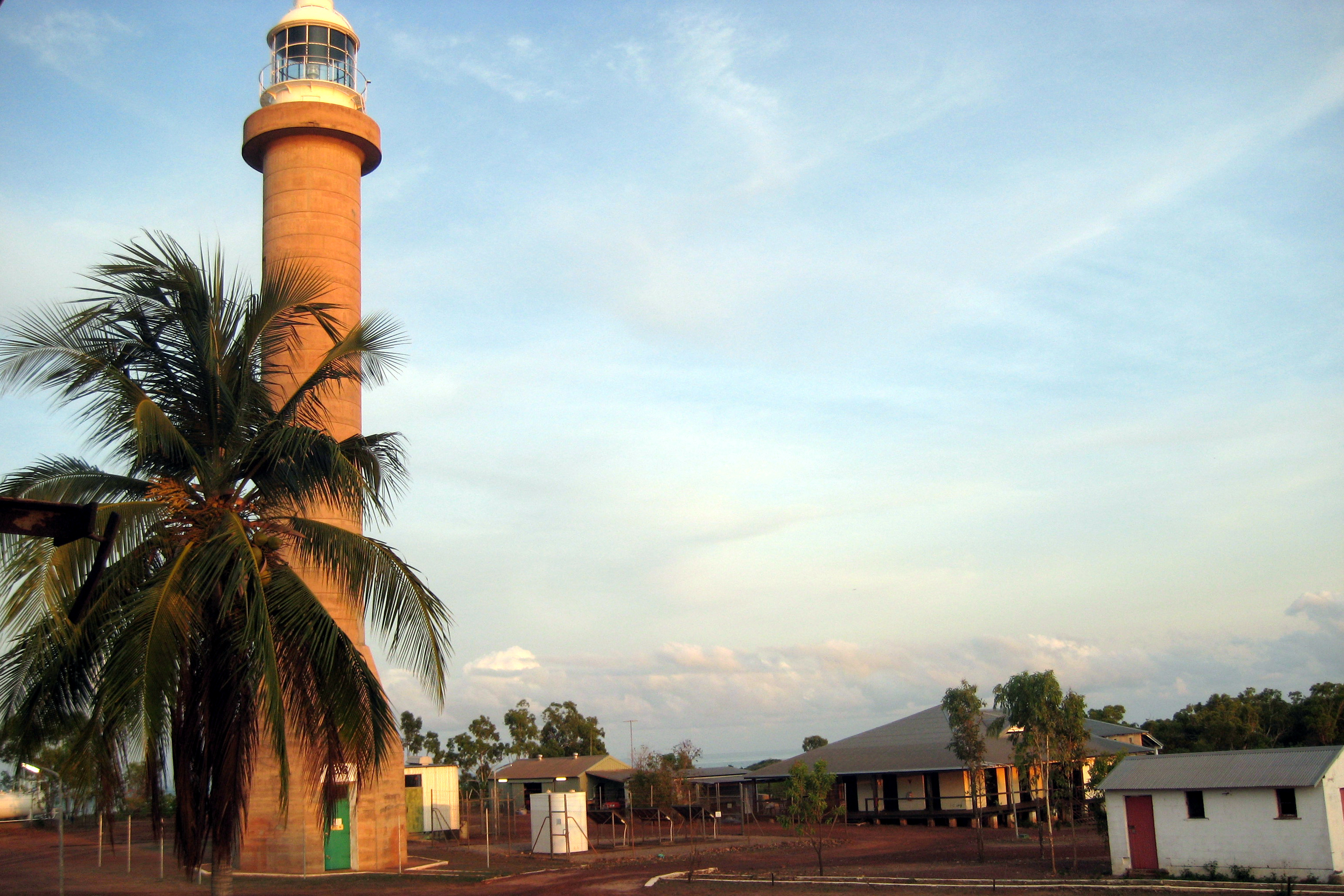
Ships were being wrecked in the approaches to Port Darwin throughout the 1880s. The Marine Board surveyed the situation in 1888 and recommended lights at Capes Fourcroy and Don and at Points Emery and Charles. Funding came through a loan, and the contract for the Point Charles lighthouse went to the Birmingham firm that supplied lighthouse components to ports across the British Empire. The choice of wrought iron was practical — it shipped as prefabricated sections, could be assembled by local workers, and resisted the tropical climate better than timber. The 92-foot tower consists of a central tube almost two metres in diameter, with struts, braces, and a spiral staircase running up through the centre to the lantern room.
Light and Technology
The original lantern housed a revolving first-order dioptric lens, powered by a vapourised kerosene burner producing 100,000 candela. The light characteristic — one white flash every 30 seconds, with red and green sectors — was visible for 17 nautical miles, which meant ships approaching Darwin from the Timor Sea could see it from well offshore. In 1894, insect problems forced a change to 'Trinity' burners. By 1933, the lighthouse had been automated and demanned, the kerosene replaced by acetylene gas.
In 1965, Radio Australia installed tall transmission masts at Point Charles with powerful lamps atop them. These were visible for 22 nautical miles and rendered the lighthouse functionally obsolete. In 1971, the light was extinguished and the tower downgraded to a day marker. Then came Christmas Eve, 1974.
Cyclone Tracy and the Comeback
Cyclone Tracy devastated Darwin on Christmas Eve 1974. It destroyed or damaged a large portion of the city, killing 66 people and levelling thousands of buildings. At Point Charles, the Radio Australia broadcast masts were extensively damaged. The lighthouse, however, survived almost intact. Within a month, a small battery-powered lamp had been reinstated in the lantern room — the lighthouse was suddenly useful again. Diesel alternators followed in 1982; full electrification and a 1,000,000 candela lamp came in July of that year. Today the light is solar-powered, running a 37,000 candela halogen lamp that flashes white every five seconds, visible for 17 nautical miles. The Australian Maritime Safety Authority operates it, accessing the site by helicopter.
A Complicated Approach
Access to the lighthouse has been contentious. The Radio Australia facility at Point Charles closed in July 1997. Its buildings were subsequently leased to the Christian Voice Broadcasting Service, which fenced the area in 2003 and prevented public access to the lighthouse entirely. That lease expired in June 2010. Road access is now available through agreements with the Indigenous landholders — the land around Point Charles belongs to Aboriginal country, and the lighthouse itself sits within a landscape that has its own prior history quite separate from European navigation. The tower on the point, still flashing every five seconds, connects the practical demands of maritime safety to the longer, older story of who has always lived here.
From the Air
Charles Point Lighthouse is located at 12.39°S, 130.63°E on the tip of the Charles Point Peninsula, approximately 50 km west-southwest of Darwin across the Cox Peninsula. The wrought-iron tower is visible from low altitude near the coastline. The lighthouse marks the western approach to Darwin Harbour. Darwin Airport (YPDN) is the nearest major facility, approximately 60 km to the east by air. The point is accessible by road through Indigenous landholdings; permission is required. Views are best from low coastal approaches.