Point Grenville
On July 12, 1775, the Santiago and Sonora dropped anchor off a rocky headland on Washington's Olympic Peninsula, their crews struggling against underwater shoals that would claim ships for two centuries. When the Spanish sailors waded ashore, they became the first Europeans to set foot on what is now Washington state. The Quinault people had been watching from the 120-foot cliffs above - from a place they called a'tsak, 'Inside Point,' a sacred lookout used for generations. What happened next gave the headland one of its many names: Punta de los Martires, Point of the Martyrs. Today the Quinault call it Point Haynisisoos - 'thundering elk.'
Fifty Million Years of Stone
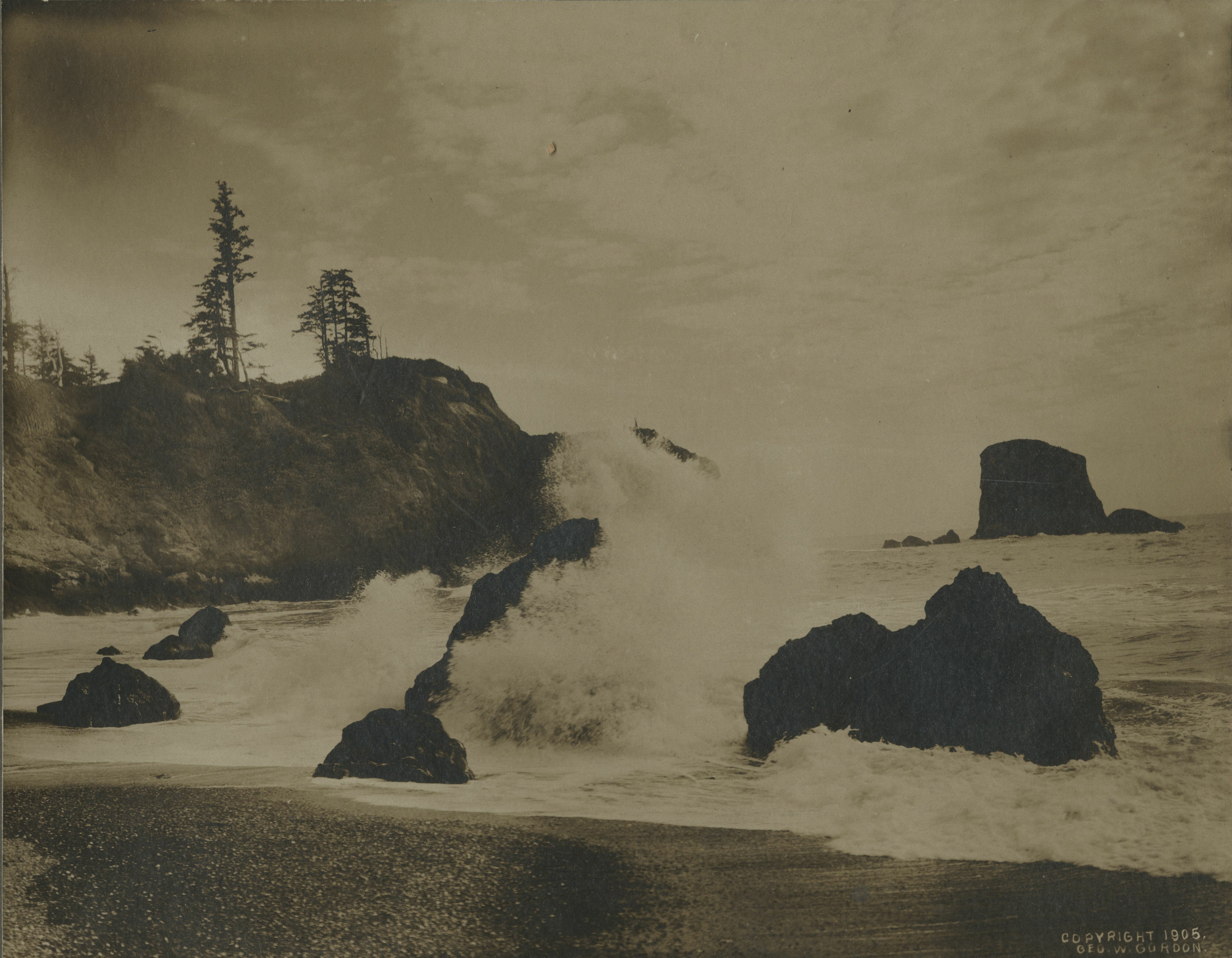
The cliffs at Point Grenville are volcanic breccia, a jagged patchwork of ancient rock shot through with deep cracks and folds. Fossils in the siltstone beds date to 45 to 50 million years ago, among the oldest found on the Washington coast. Offshore, sea stacks jut from the water like broken columns. The Grenville Arch curves above the waves.
Seventeen thousand years ago, the headland extended several miles farther west into the Pacific. Erosion has been carving it back ever since, and piddocks - small bivalve molluscs - bore into the uplifted bedrock, dissolving what took millennia to build. To the south, the point shelters Grenville Bay, where a sandy beach spirals four miles down the coast to the Moclips River. The promontory marks a geological boundary: rocky coast to the north, wide sandy beaches to the south.
First Contact and Its Costs
Bruno de Heceta and a Catholic priest named Benito de la Sierra performed a ceremony on the beach claiming the land for Spain's Nueva Galicia. They named the spot Rada de Bucareli, after the Viceroy of New Spain. The next day, a resupply party of six came ashore. Several hundred Quinault attacked them, killing four and wounding the remaining two so severely they died swimming back to the ships. As the Spaniards fought their way out through the shoals, Quinault canoes surrounded them.
Seventeen years later, George Vancouver sailed past and put the headland on British charts as Point Grenville, honoring his friend William Wyndham Grenville, then Secretary of State. Vancouver's draughtsman, Benjamin Thomas Pouncy, published an engraving of the point's profile. The spelling drifted over the decades - Granville, Grennville Point - before settling. In 2013, the Quinault Nation formally renamed it Point Haynisisoos, after tribal elder Phillip E. Martin, known by that Quinault name meaning 'thundering elk.' Martin had spent decades advocating for the point's preservation.
Shipwrecks and Signal Beams
The same shoals that nearly trapped Bodega y Quadra's expedition became a graveyard. The lumber ship Decatur went down in 1865, the French vessel Lilly Grace in 1886, the fishing trawler Tahoe in 1931, and the SS Seagate in 1956. To help mariners avoid these hazards, a Coast Guard LORAN station was established at the point in 1945, broadcasting hyperbolic radio signals that allowed ships to triangulate their position offshore. At its peak in 1948, the station housed a commissioned officer and 19 enlisted personnel.
A fire lookout tower had stood on the windward slope since before 1930 - a 77-foot steel structure on four legs that was already abandoned and crumbling by 1962. The Point Grenville Light, a lighthouse erected in 1967, arrived nearly half a century after the site was first reserved for that purpose. When the LORAN station shut down in 1980, the light was automated. Today, only concrete footings and rotted wood mark where the lookout once stood.
The Otters Come Home
Before 1911, tall wooden derricks lined Point Grenville Beach, platforms from which sharpshooters picked off sea otters for the fur trade. The otters vanished from Washington's coast entirely. On July 31, 1969, wildlife managers released 29 sea otters translocated from Amchitka Island in Alaska's Aleutians. Thirty more were released the following year at La Push, farther north. The population crashed to as few as 10 individuals before slowly recovering - 208 by 1989, and over 2,000 by 2017, ranging from Point Grenville north to Cape Flattery and east along the Strait of Juan de Fuca.
The headland's outlying rocks belong to Copalis National Wildlife Refuge, one of the earliest refuges in the system, created by Theodore Roosevelt in 1907. Tufted puffins, common murres, and black oystercatchers nest on the coastal bluffs each summer. Caspian terns and sooty shearwaters pass through during migration. Below the cliffs, Pacific razor clams burrow in the sand, harvested by Quinault tribal members under the supervision of the Quinault Department of Fisheries - a resource threatened in recent years by hypoxia from deep-sea upwelling.
A Place Reclaimed
Where the LORAN station once beamed navigation signals, Haynisisoos Park now stands. A totem pole carved from an 800-year-old Western red cedar honors Quinault elder Emmett Oliver. In 2013, during the Paddle to Quinault, nearly 15,000 people gathered to watch 89 canoes arrive, representing some 100 Northwest tribes and Canadian First Nations, along with Hawaiian and Maori groups.
The point was once a popular surf break. Riders discovered the consistent waves in the 1940s, and by 1960 the beach was packed. But littering, graffiti on the rocks, and destruction of clam beds led the Quinault to close the beach in 1969. Washington's Attorney General upheld the decision, citing an 1873 executive order by President Ulysses S. Grant that had withdrawn the reservation from public domain. Today, access requires accompaniment by an enrolled Quinault member. The headland belongs, again, to the people who named it first.
From the Air
Located at 47.30N, 124.28W on the central Olympic Peninsula coast. The headland's 120-foot cliffs and offshore sea stacks are clearly visible from altitude, marking the transition between rocky coastline to the north and sandy beaches to the south. Grenville Bay lies sheltered to the south. Nearest airports: Bowerman Airport (KHQM) in Hoquiam, approximately 40 miles southeast; Copalis State Airport (S16) closer but limited facilities. The Olympic Coast National Marine Sanctuary extends offshore. Expect persistent marine layer and overcast conditions typical of the Washington coast.