Point Isabel Regional Shoreline
The beach at Point Isabel is not made of sand. Walk the western shoreline and you will crunch across thousands of porcelain shards — fragments of plates, cups, and saucers dumped here over fifty years by the Technical Porcelain and Chinaware Company, which churned out 30,000 pieces of dinnerware a day from its El Cerrito factory. The broken dishes built the land itself, filling in the mudflats of San Francisco Bay alongside battery casings, contaminated soil, and decades of industrial refuse. That this toxic dumping ground became one of the most beloved parks in the East Bay is a story of cleanup, community stubbornness, and a few thousand very happy dogs.
Dynamite, Bullets, and Batteries
Point Isabel's industrial history reads like a catalog of things you would not want buried beneath a public park. In the 1850s, hunters peppered the peninsula with lead shot while pursuing birds along the bayshore. By the early 1900s, a dynamite factory operated on the point. When it closed, a rifle club took over the site for target practice from the late 1930s through the late 1950s. Meanwhile, the Santa Fe Land Improvement Company was burying battery casings in the adjacent land that would become North Point Isabel, earning it the grimly descriptive nickname Battery Point. Between 1951 and 1959, the Santa Fe Railway leveled the original hilly peninsula entirely, filling the surrounding mudflats to make way for a sewage plant and business park. The land that exists today bears almost no resemblance to the wooded hill that once stood here.
Porcelain Tide
TEPCO — the Technical Porcelain and Chinaware Company — was founded in 1918 by John Pagliero and grew into a major producer of commercial dishware. For fifty years, until Pagliero's death in 1968, the factory discarded its broken pieces and seconds along the banks of Point Isabel. The managers of the surrounding land, as El Cerrito Historical Society president Dave Weinstein has noted, actively encouraged dumping of all kinds to create new acreage from the bay. Nobody objected until the late 1960s, when the environmental organization Save the Bay began fighting to stop the infill swallowing San Francisco Bay's edges. The dumping stopped, but the porcelain stayed. Today, TEPCO beach remains a strange and oddly beautiful stretch of shoreline — a beach made not by geology but by industry, where visitors still find intact maker's marks on shards half-buried in the clay.
From Poison to Park
In 1975, the United States Postal Service leased the land to the East Bay Regional Park District, free of charge, as mitigation for building a massive bulk mail facility next door. The lease ran fifty years, with one condition: free public access. The park started at 23 acres, but the contamination lurking beneath the surface was far from resolved. In 1980, the California Department of Fish and Game discovered widespread pollution, and the San Francisco Bay Water Control Board ordered a sweeping cleanup. Beginning in 1985, crews spent 14 months removing battery casings and contaminated soil, capping the landfill with specially prepared earth, and installing rocks to prevent shoreline erosion. An additional 20 acres across the Hoffman Channel were added in 2002. Even after the cleanup, pockets of contamination have surfaced — lead leaks detected in 2018 proved the original remediation was incomplete, and several fenced-off areas remain permanently off-limits.
Off-Leash Paradise
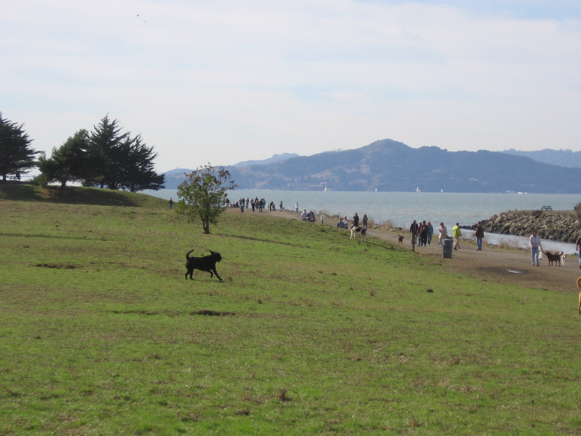
Ask any East Bay dog owner about Point Isabel and you will get directions before you finish the question. PETA named it the number one dog park in the country in 2006, and it consistently ranks among America's best places to walk dogs off-leash. The park draws an estimated 1.5 million visitors annually, up from 500,000 in 2000. The Mudpuppy's Tub and Scrub dog wash and adjacent Sit and Stay Cafe cater to the canine clientele and their humans. Point Isabel Dog Owners and Friends, a volunteer nonprofit with approximately 7,500 members, has been the park's fiercest advocate since 1985, when an on-leash-only rule threatened to change the park's character. By 1987 they had successfully negotiated the return of off-leash privileges. The park also draws windsurfers and kayakers to an improved launch area, birdwatchers tracking the monarch butterflies that overwinter in the eucalyptus groves, and photographers drawn by panoramic views of Marin County, San Francisco, and the Golden Gate Bridge.
Ghosts Beneath the Grass
Long before the factories and the dumping, the Castro family operated Rancho San Pablo from an adobe home where El Cerrito Plaza stands today. From their dock at Point Isabel, they ferried cattle, hides, and beef to Mission Dolores and then to booming San Francisco during the Gold Rush. That earlier history lives mostly in the archives now. What lives in public memory is darker: in 2003, the remains of Laci Peterson washed up at Point Isabel, and those of her unborn son, Connor, were found a short distance north along the shoreline. The park holds these layers of history beneath its trails and grassy slopes — ranchers and porcelain factories, dynamite and dog walkers, toxins capped but not forgotten. The fifty-year postal lease expired in October 2025, but the park continues to operate, still free, still open, still built on the complicated ground where the bay's industrial past meets its recreational present.
From the Air
Located at 37.899°N, 122.324°W on the eastern shore of San Francisco Bay in Richmond, California. The park occupies a distinctive peninsula visible from the air, jutting into the bay between the Hoffman Channel and the main shoreline. Look for the adjacent USPS bulk mail facility and the Bay Trail corridor. Panoramic views stretch to the Golden Gate Bridge, San Francisco skyline, and Marin County headlands. Nearest airports include Oakland International (KOAK, ~14 nm south) and Buchanan Field (KCCR, ~14 nm northeast). Marine layer and fog common in morning hours, especially summer.