Point Reyes National Seashore
On January 6, 1603, the Spanish captain Sebastián Vizcaíno sighted a fog-wrapped headland jutting into the Pacific and named it la Punta de los Reyes, Point of the Kings, in honor of Three Kings' Day. Four centuries later, fog still defines this place. It rolls through the gap between Inverness Ridge and the open ocean with such regularity that the Point Reyes Lighthouse was built not on the highest ground, as lighthouses usually are, but down below the fog line, 308 steps beneath the clifftop. That counterintuitive design tells you something essential about this peninsula: nothing here follows the expected rules.
A Peninsula Adrift
Point Reyes is not, geologically speaking, part of California. The San Andreas Fault runs directly beneath Tomales Bay and Olema Creek, cleanly separating the 71,028-acre peninsula from the North American Plate. The land beneath your feet here belongs to the Pacific Plate, the same tectonic slab that carries Los Angeles, and it is sliding northward at roughly two inches per year. The rocks on the peninsula are granitic, part of the Salinian Block, while just across the fault zone lies the Franciscan Complex with its entirely different soil and flora. Inverness Ridge rises along this geological seam before dropping sharply to the rift valley. It is one of the most visible fault lines on Earth, and from the air, the long finger of Tomales Bay traces the fracture like a scar.
Where Two Worlds Converge
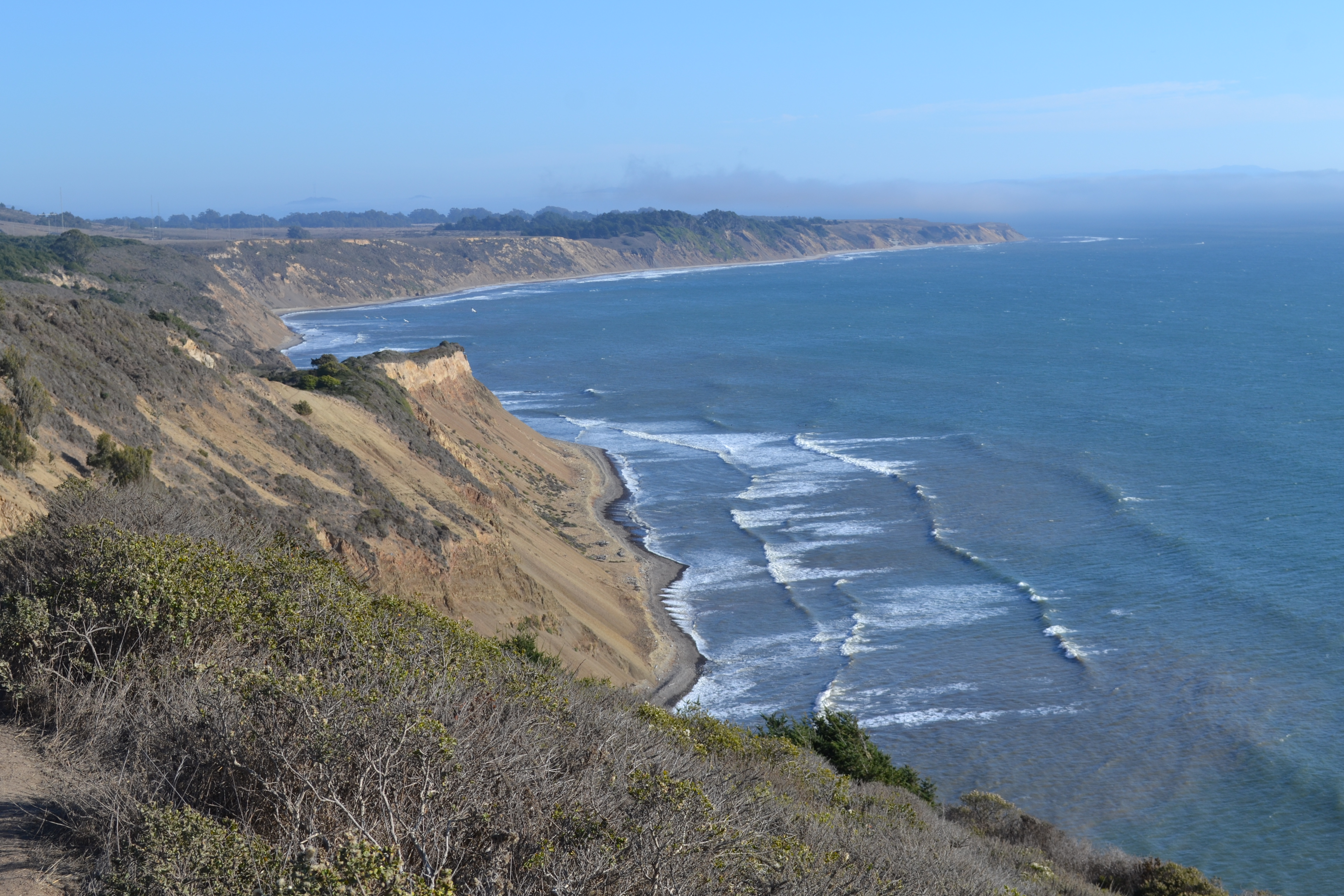
The peninsula sits at the collision point of two marine provinces, the southern Oregonian and the northern Californian, creating a biological richness that defies the park's modest size. Point Reyes harbors 54 percent of North America's bird species and 18 percent of California's plant species across its 100 miles of coastline. But the park's most remarkable claim is unique on the planet: it is the only place where breeding hoofed megafauna and marine megafauna coexist. Tule elk graze the coastal scrub at Tomales Point while elephant seals haul out on the beaches below Chimney Rock's hundred-foot cliffs. The seals established their first rookery here in 1981, and the colony has grown steadily since. During the federal government shutdown of January 2019, with no rangers on duty, elephant seal mothers gave birth right in the Drakes Beach parking lot.
The Elk Come Home
By the nineteenth century, tule elk had been completely extirpated from the peninsula. In 1978, ten animals were brought from the San Luis National Wildlife Refuge near Los Banos and released at Tomales Point, where they multiplied to over 440 by 2009. But a controversial eight-foot fence confined the herd to just 2,900 acres at the peninsula's northern tip, and during the drought of 2020, elk died of thirst behind the barrier while conservationists illegally hauled in water. The fence became a flashpoint between ranchers and wildlife advocates for years. In December 2024, the National Park Service finally breached it, allowing the elk to roam freely for the first time in decades. A month later, a deal brokered by The Nature Conservancy bought out most of the peninsula's ranchers, reducing cattle from roughly 10,000 to 200 and returning nearly 17,000 acres to wilderness. After more than 35,000 public comment letters and years of legal battles, Point Reyes was choosing its wilder self.
Forests That Weren't Supposed to Be Here
The Douglas-fir forests that blanket the southern half of Inverness Ridge look ancient and permanent, with unlogged stands containing trees over 300 years old and up to six feet in diameter. But they may be an accident of colonialism. The Coast Miwok people who lived here for thousands of years set frequent fires to clear brush and encourage game, and early European explorers described the hills as bare and grassy. When European settlement displaced the Miwok and their fire practices, the forests advanced into the vacuum. The peninsula's other signature tree, the Bishop pine, tells a more dramatic story. Thick swaths of these closed-cone conifers sprang from seeds released by the 1995 Mount Vision fire, their germination triggered by the very flames that destroyed the parent trees. Point Reyes is also the sole home of the endangered Sonoma spineflower, found nowhere else on Earth.
Layers Upon Layers
History at Point Reyes accumulates in strata. The Coast Miwok lived in villages of seventy-five to several hundred people, harvesting crab, clams, and oysters from these shores. Francis Drake likely camped here in 1579 aboard the Golden Hind, claiming the land for Elizabeth I. A reconstructed Miwok village called Kule Loklo stands a short walk from the visitor center. Down the coast, the Point Reyes Lifeboat Station survives as the last rail-launched lifeboat station on the Pacific, now a National Historic Landmark. And threading through it all are 150 miles of hiking trails, from the fern-choked Bear Valley corridor to the wildflower displays along Chimney Rock. Point Reyes is a terminus of the American Discovery Trail, the only transcontinental trail in the United States. Two and a half million visitors come each year, drawn by gray whales migrating past the lighthouse in January and March, by the solitude of four backcountry camps, and by a landscape that is, in every geological and ecological sense, a world apart.
From the Air
Located at 38.07°N, 122.88°W on the Point Reyes Peninsula in Marin County, California. The peninsula is dramatically visible from the air, separated from the mainland by the linear trace of the San Andreas Fault along Tomales Bay. Best viewed at 2,000-4,000 ft AGL. The long white sand beaches, Drakes Estero lagoon system, and the Inverness Ridge forest line are clear landmarks. Nearest airports: Gnoss Field (KDVO) approximately 25 nm east, San Francisco International (KSFO) approximately 35 nm southeast. Fog is extremely common, especially summer months; best visibility in autumn.