Pololū Valley
The word pololū means "long spear" in Hawaiian, and the valley lives up to its name. A deep, narrow gash in the windward flank of Kohala Mountain, Pololū is the northernmost in a chain of erosional valleys that give the northeast coast of Hawaiʻi Island its dramatic, scalloped profile. Where the valley meets the Pacific, a black sand beach stretches beneath sea cliffs, backed by a yellow sand dune that shields the green interior from ocean storms. It is a place shaped entirely by water and time — by the rain that carved the valley, the streams that still run through it, and the waves that continue to reshape its shore.
Crimson Stems and Rice Paddies
Before European contact, Pololū Valley was renowned for its kalo — taro — farming. The valley produced a distinctive variety called kalo Pololū, recognizable by its crimson stems, a cultivar specific to this place. Taro was the staple food of Hawaiian civilization, and valleys like Pololū were the breadbaskets that sustained communities along the Kohala coast. When Western agriculture arrived in the 1800s, rice paddies joined the taro patches, and for a time the two crops grew side by side. But by the 20th century, farming had largely ceased. The valley fell quiet. Today the old agricultural terraces are overgrown, though the Kohala Ditch — an engineering project that diverts water from neighboring Honokane Valley to the sugarcane fields of the North Kohala district — still runs along the valley walls, a reminder of the era when sugar was king.
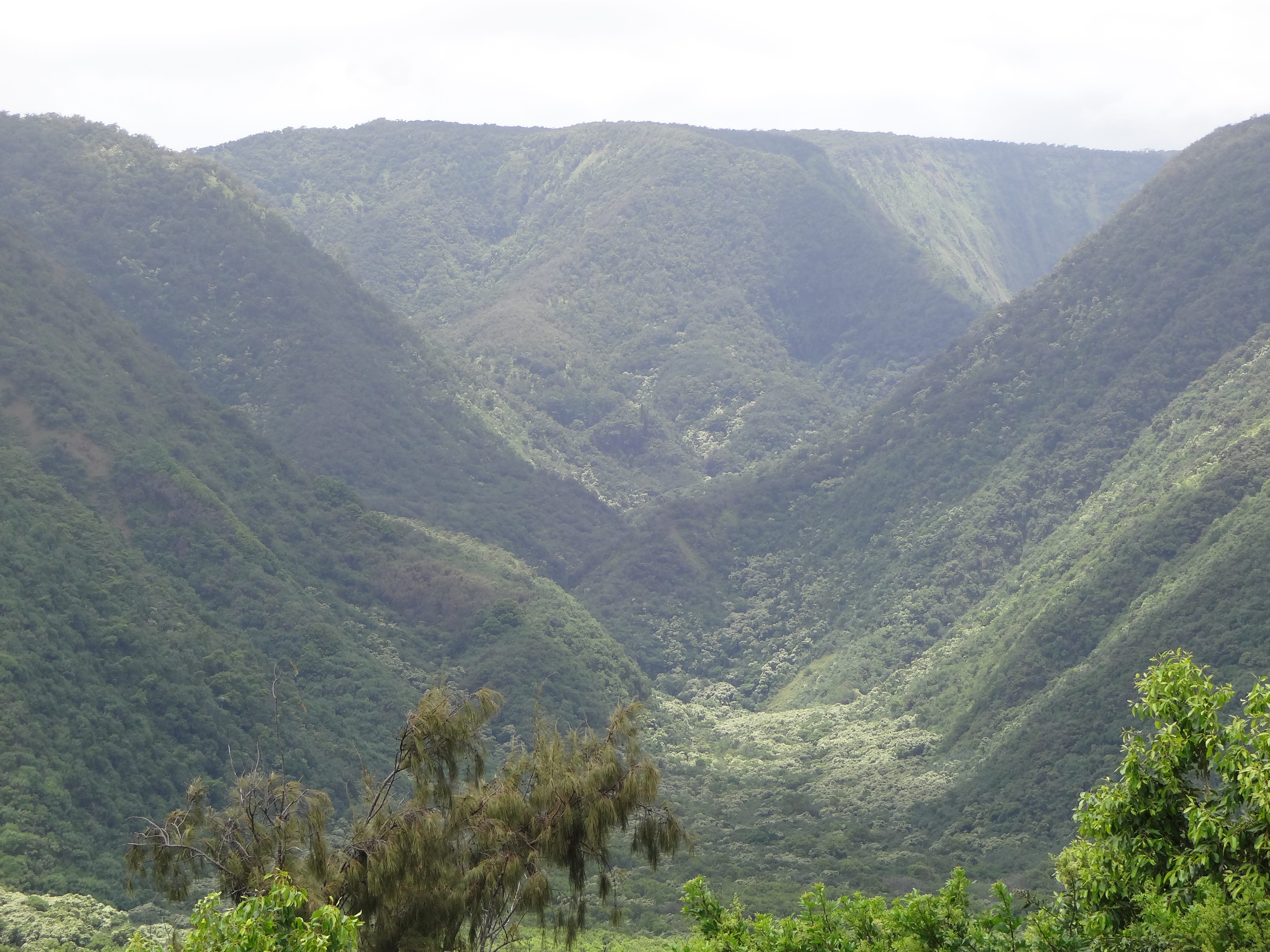
A Valley Carved by Erosion
Pololū owes its existence to the slow, relentless work of water on volcanic rock. Kohala is the oldest of the five volcanoes that built Hawaiʻi Island, and its windward slopes receive enormous rainfall driven by the northeast trade winds. Over hundreds of thousands of years, Pololū Stream cut deeper and deeper into the basalt, carving the valley from summit to sea. The result is a landscape of startling verticality: sheer green walls dropping to a flat valley floor, the stream threading through it all before spilling onto the beach. Hiking trails crisscross the valley, connecting to a route that climbs over the ridge into neighboring Honokane Nui Valley. The trail from the lookout at the end of Highway 270 — the terminus of Akoni Pule Highway — is short but steep, descending through thick, shaded foliage to the valley floor.
The View from the Edge
Most visitors experience Pololū from above. The lookout at mile 28, where the road simply ends, offers one of the most photographed views on the Big Island: the valley dropping away below, its black sand beach curving between dark headlands, the Pacific stretching to the horizon. From here you can see why this coast is called the Kohala Cliffs. The valleys march southward in succession — Pololū, Honokane Iki, Honokane Nui — each one deeper and more remote than the last. For those who hike down, the reward is solitude. The beach sees far fewer visitors than the famous strands of Kona or Waikiki, and the only sounds are the surf and the wind moving through ironwood trees along the shore. It is one of the last stretches of Hawaiian coastline that feels truly wild.
From the Air
Located at 20.20°N, 155.73°W at the northern tip of Hawaiʻi Island's Kohala coast. The valley appears as a dramatic V-shaped notch in the green sea cliffs when approaching from the north or northeast. The black sand beach at the valley mouth is visible from 2,000–3,000 feet AGL. The series of windward valleys (Pololū, Honokane Iki, Honokane Nui, Waipiʻo) creates a distinctive scalloped coastline stretching southeast. Nearest airport: Waimea-Kohala Airport (PHMU) approximately 12 nm south-southwest. Upolu Airport (PHUP) is closer at roughly 8 nm west. Trade wind clouds frequently build along this coast, with morning offering clearer conditions.