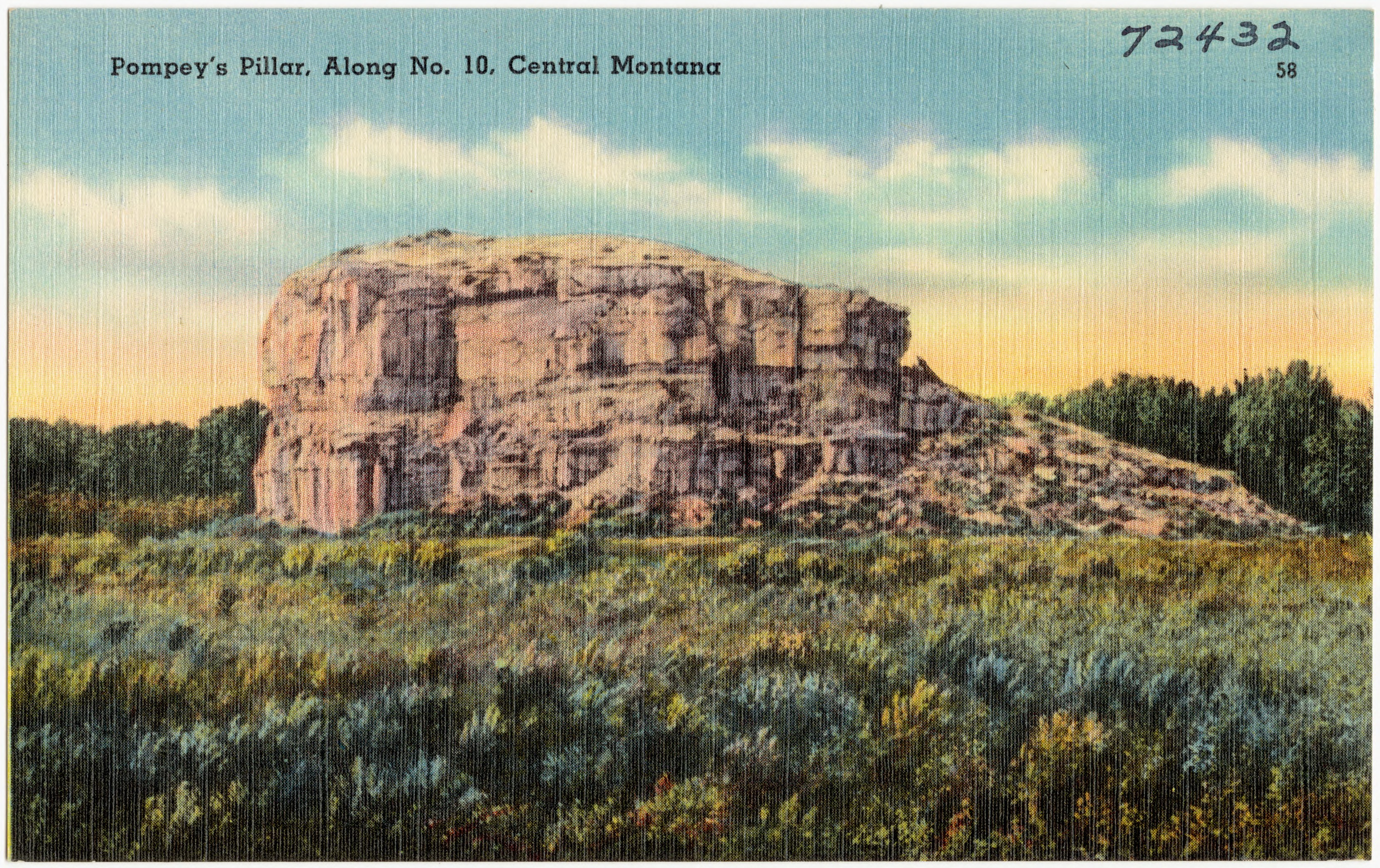
Pompeys Pillar National Monument
Carved into the sandstone are two words and a date: Wm Clark, July 25, 1806. This simple inscription, protected now by glass, represents the only surviving physical evidence from the entire 8,000-mile Lewis and Clark Expedition. The pillar itself rises 150 feet above the Yellowstone River, a massive sandstone sentinel that has drawn human attention for at least 11,000 years. Clark named it for Sacagawea's infant son, Jean Baptiste Charbonneau, whom he affectionately called "Pompey."
Deep Time Made Stone
The pillar emerged from the Hell Creek Formation, sandstone deposited during the late Cretaceous period between 75 and 66 million years ago. This makes the rock contemporaneous with the final dinosaurs, and the formation is famous among paleontologists for its wealth of Tyrannosaurus rex and Triceratops fossils. The stone that would bear Clark's signature was already ancient when the first humans arrived in Montana. The geological forces that shaped this landscape left the pillar standing as an isolated butte, commanding views in every direction across the Yellowstone River valley.
Eleven Millennia of Visitors
Archaeological evidence reveals that humans have gathered at this prominent landmark for over 11,000 years. Native American petroglyphs cover the rock face, testimony to countless generations who recognized this place as significant. The pillar served as a natural meeting point, a navigational landmark visible for miles across the plains. When Clark climbed it on that July day in 1806, he noted that he "had a most extensive view in every direction on the Northerly Side of the river." He was far from the first to appreciate that vantage point. Hundreds of pioneers following him also carved their initials into the soft stone, creating an inadvertent timeline of westward expansion.
A Name for a Child
Clark originally called the formation "Pompey's Tower," naming it after the toddler who had traveled the entire expedition strapped to his mother's back. Jean Baptiste Charbonneau, nicknamed Pomp, was just two months old when the expedition departed and not yet two years old when Clark carved the inscription. The explorer had grown fond of the child, and would later offer to educate the boy when he was older. In 1814, the name evolved to Pompeys Pillar, though the affection behind the naming remained clear. The pillar became a National Historic Landmark in 1965 and was designated one of America's smallest national monuments in 2001.
The Interpretive Center
The modern Pompeys Pillar Interpretive Center opened in 2006, exactly 200 years after Clark's visit. The 5,700-square-foot facility tells the story of Clark's detachment of the expedition as they traveled down the Yellowstone River valley. Exhibits detail how Clark, Sacagawea, and Pomp separated from Lewis's group to explore this alternate route. The pillar itself draws 50,000 visitors annually, a remarkable number for a monument managed by the Bureau of Land Management in this remote corner of Montana, 25 miles northeast of Billings along Interstate 94.
From the Air
Located at 45.995N, 108.006W, Pompeys Pillar rises distinctively from the Yellowstone River valley floor. Best viewed at 2,000-3,000 feet AGL for scale perspective. The sandstone formation appears golden-brown against the surrounding terrain. Billings Logan International Airport (KBIL) lies 25 miles southwest. The Yellowstone River provides excellent visual navigation reference, with the pillar standing prominently on its north bank. Clear weather recommended for best visibility of this relatively small but distinct geological feature.