Port of Keelung
In 1984, the Port of Keelung ranked seventh among the world's cargo ports - a remarkable position for a harbor whose mouth measures barely four hundred meters across. Ships queued in the East China Sea waiting for berth space. Cranes swung containers around the clock. The port drove Keelung to fourth place among Taiwan's cities, trailing only Taipei, Tainan, and Kaohsiung in population and economic weight.
Three decades later, the container rankings had moved on, and so had Keelung. The narrow harbor that once handled global freight now welcomes cruise ships - Princess, Royal Caribbean, Costa, Star Cruises - and the port that built a city on cargo has rebuilt itself on tourism. The transformation is one of the more successful pivots in Asian maritime history, and it started with a geographic limitation that turned out to be an advantage.
The Narrow Gate
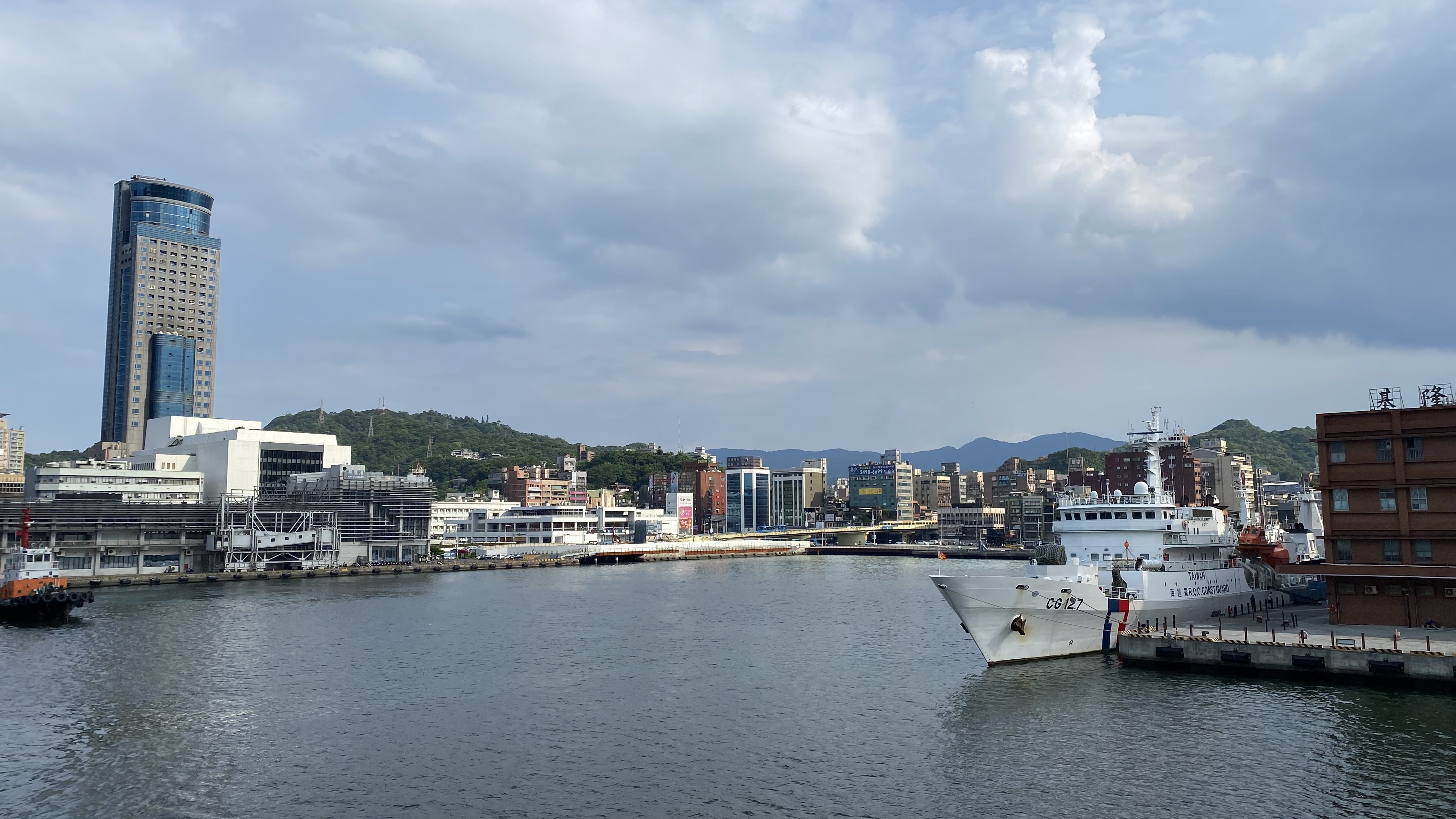
Keelung Harbor is shaped like a sleeve: roughly two thousand meters long and four hundred meters wide, running from an inner basin in the southwest to the harbor mouth in the northwest, where the waterway opens to the Pacific. The dimensions are natural, carved by geology rather than engineers, and they gave the port both its strength and its eventual constraint. The narrow entrance provided shelter from typhoons and rough seas - ships inside the harbor rode calm water while storms raged beyond the breakwaters. But that same narrowness limited the size and number of vessels that could transit simultaneously. As container ships grew larger through the late twentieth century, the port that geography had gifted became the port that geography constrained. Deeper harbors at Kaohsiung and Taipei absorbed the mega-vessels that Keelung could not accommodate.
Empire's Doorstep
The port opened officially in 1886, but its strategic value was recognized long before that. During the Japanese colonial administration beginning in 1895, the Government-General of Taiwan invested heavily in Keelung Harbor's development, understanding that control of Taiwan's northern port meant control of the island's trade with Japan, China, and the broader Pacific. The harbor became the largest port in Taiwan by the early twentieth century. It was through Keelung that the retreating Japanese army departed after the Second World War, and through Keelung that Chinese officials from the Republic of China arrived to assume administration of the island. The port served as both exit and entrance, a hinge point in the transfer of sovereignty. Taiwan's subsequent economic boom in the 1960s and 1970s poured export cargo through the harbor, and the world took notice when Keelung climbed to seventh place globally in 1984.
From Containers to Cabins
The decline in cargo throughput during the 1990s forced a reckoning. Keelung could not widen its harbor mouth or deepen its channels enough to compete with purpose-built container megaports. Instead, the port authority pivoted to passengers. Cruise ships, it turned out, fit the harbor's dimensions nicely - large enough to be impressive, small enough to navigate the narrow entrance, and filled with tourists eager to spend money in a city that already had world-class night markets and convenient rail connections to Taipei. The strategy worked. In 2017, Keelung won the title of Asia's best cruise home port at the Asia Cruise Forum in Jeju, South Korea. Five years later, at the same forum, the port received a Special Achievement Award for its post-pandemic recovery. By 2024, Keelung recorded 331 cruise calls and served 787,000 passengers, numbers still climbing back toward pre-COVID levels but representing a fundamentally different economic engine than the container trade it replaced.
Islands and Outbound
The port still serves routes that no cruise line covers. Ferries depart for the Matsu Islands, the remote archipelago in the Taiwan Strait that served as a military frontier during the decades of cross-strait tension. Service runs to Xiamen on the Chinese mainland and to Okinawa in Japan's Ryukyu chain. A small vessel carries visitors to Keelung Islet, the rocky island visible from the harbor mouth that was closed to tourists for five years before reopening in 2019. These routes connect Keelung to its older identity as a working harbor - a place where water is not scenery but transportation, and where the sea connects rather than separates. Keelung Station, the terminus of the Taiwan Railway line from Taipei, sits a short walk from the port, making the harbor one of the most accessible in East Asia. A forty-minute train ride from Taipei, a short walk through the city center, and the Pacific opens before you.
From the Air
Located at 25.13°N, 121.74°E on Taiwan's northern coast. The port is the dominant feature of Keelung City, visible from altitude as a narrow waterway approximately 2km long and 400m wide, opening to the northwest. Look for the cruise terminal, container cranes, and breakwaters defining the harbor entrance. Keelung Islet is visible as a small rocky island offshore to the northeast. Taiwan Taoyuan International Airport (RCTP/TPE) is approximately 60km southwest. Songshan Airport (RCSS/TSA) is about 30km south. The port is surrounded by steep green hills forming a natural amphitheater. Weather is frequently overcast with rain, especially from October through March.