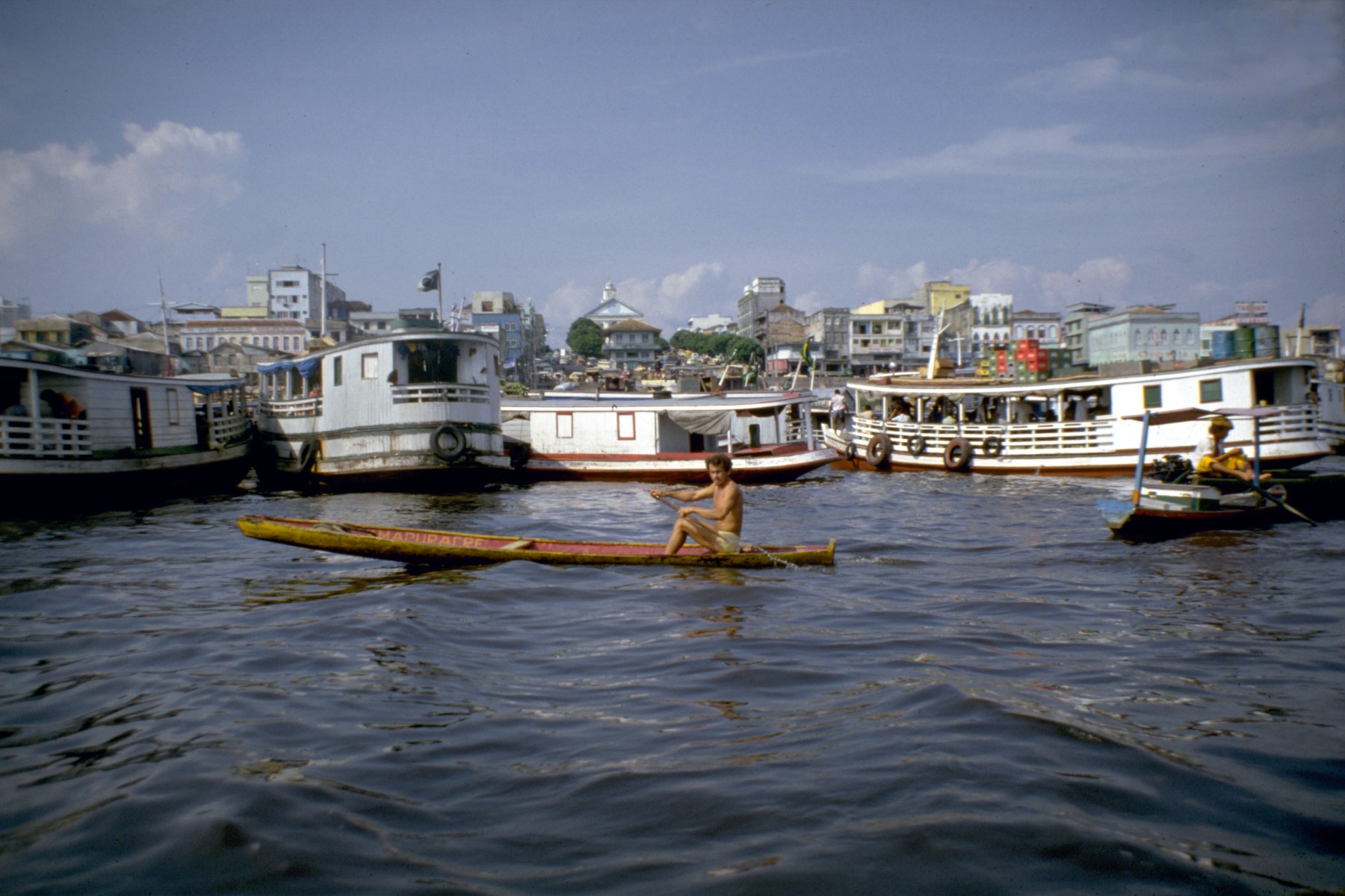
Port of Manaus
The quays float. They have to. The Rio Negro rises and falls by as much as fourteen meters between the dry season and the flood, and no fixed dock could keep working through that kind of swing. So when a Polish engineer named Bronislaw Rymkiewicz arrived in Manaus in 1892 to modernize the port, he built the warehouses and wharves on pontoons. They ride the river. Today, ocean-going ships still tie up here, more than a thousand miles from the Atlantic, at a harbor that goes up and down with the seasons.
The Rubber That Built It
The port exists because of latex. In the late nineteenth century, the only place on Earth that produced natural rubber in commercial quantities was the Amazon basin, and the world had just discovered that it needed rubber for bicycle tires, electrical insulation, and eventually automobiles. Money poured into Manaus. Governor Silverio Jose Neri insisted that raw rubber be processed in Amazonas rather than shipped downriver to Para, which meant the port needed real infrastructure. In June 1903 he inaugurated the facilities that Rymkiewicz and his company had built: a customs house, a stone quay, storage sheds, and those floating wharves. Many of the buildings were ordered whole from Europe and reassembled on site. For about two decades, Manaus was one of the wealthiest cities in South America, and the port was its front door.
Where Two Rivers Refuse to Mix
A few kilometers downstream from the port, one of the strangest water features in the Amazon becomes visible from any passing boat. The black waters of the Rio Negro meet the sediment-heavy brown waters of the Solimoes and flow side by side without blending for about nine kilometers before the two rivers finally combine into what the world calls the Amazon. The temperature, density, and speed of each river differ enough that the boundary holds, a sharp line between coffee and cola. Tour boats leave from the port every morning to show visitors the Meeting of the Waters. It is the kind of thing that needs to be seen to be believed, and the kind that is hard to forget once you have.
The Collapse and the Comeback
The rubber wealth did not last. By the 1920s, plantations in British Malaya and the Dutch East Indies, grown from seeds smuggled out of the Amazon decades earlier, were producing latex more cheaply than wild Brazilian trees ever could. The bottom fell out. Manaus slid into a decades-long decline, and the port handled a fraction of what it once had. The revival came from an unexpected direction. In 1967, the Brazilian government made the city a free trade zone, and manufacturers moved in. Today the port handles cargo for electronics factories that assemble mobile phones, motorcycles, and televisions for the Brazilian market. Ocean ships still come upriver to load and unload, just as they did during the rubber boom, but what they carry now is circuit boards instead of latex.
The City That Grew Around It
Manaus began as a small Portuguese fort built in 1669, around which a Christian mission and a village called Villa de Barra took root. In 1850 the town was renamed Manaos after an indigenous river people, and the current spelling was adopted in 1939. The rubber boom brought operatic ambitions: Manaus was one of the first cities in Brazil to have electricity, and the Amazon Theatre, inaugurated a few years before the port itself, still stands a few blocks from the waterfront. The pied tamarin, one of Brazil's most endangered primates, lives in forest patches within the city limits. Boats leaving the port carry tourists upriver to jungle lodges, and the eco-tourism business has become a serious part of the local economy.
The Harbor Today
The floating pontoons designed in the 1890s are still the core of how the port works, because the problem they solved has not gone away. The Rio Negro still rises and falls. Containers come off ocean freighters onto structures that drift slowly upward through the wet months and gradually sink back toward the low-water mark in August. The old customs house remains, and some of the iron warehouses ordered from Europe are still standing after more than a century of tropical humidity. From a plane passing overhead in the dry season, the port reveals its strange skeleton of cables and gangways, and in the wet season it looks almost like a different place entirely, the buildings farther away from solid ground and closer to the river itself.
From the Air
Located at 3.14 degrees S, 60.02 degrees W on the north bank of the Rio Negro, about 18 km upstream from the Meeting of the Waters with the Solimoes. The nearest airport is Eduardo Gomes International (SBEG), roughly 15 km north of the port. Best viewed from 5,000 to 8,000 feet in the morning when haze is light; the dark Rio Negro and brown Solimoes flowing without mixing are clearly visible from altitude in clear weather.