Port of Santos
Ships used to avoid it. In the 19th century, the Port of Santos earned a reputation so grim that sailors called it the "port of death" -- a place where yellow fever lurked in the floods that pooled around its wooden plank docks, and where docking meant risking an epidemic. Today, the same harbor handles more cargo than any other port in Latin America. The transformation from pestilent backwater to continental trade hub is one of Brazil's great infrastructure stories, and it begins with a simple geographic fact: Santos sits at the one point along the São Paulo coast where the Serra do Mar mountain range can be crossed without impossible difficulty.
Gateway Through the Mountains
The Serra do Mar runs along Brazil's southeastern coast like a wall, separating the interior plateau from the sea. Santos grew where it did because the escarpment dips low enough here to allow passage. When the first railway link from the port to São Paulo City was completed in 1864 -- covering 79 kilometers of steep, winding terrain -- it unlocked the agricultural wealth of the interior. Coffee poured down the tracks. By the 1890s, production flowing through Santos had surpassed Rio de Janeiro's port, making Santos the world's largest coffee-exporting center. At its peak, the port handled more than half the world's coffee supply, a dominance that lasted through World War I. The brown bean built modern Santos.
Millions Walked These Docks
Coffee flowed out; people flowed in. In the late 19th and early 20th centuries, millions of immigrants arrived at the Port of Santos and stepped onto Brazilian soil for the first time. Italians came first, in the largest numbers, followed by Spaniards, Germans, Japanese, and others drawn by the promise of work on São Paulo state's vast coffee plantations. They disembarked, boarded the railway that climbed the serra, and scattered across the interior to farms that needed their labor. For these arrivals, Santos was not a destination but a threshold -- the first taste of a country most of them would never leave. The port's role in Brazilian immigration mirrors Ellis Island's role in American history: a narrow funnel through which a nation's demographic future was poured.
From Plague Docks to Modern Port
The port that welcomed those immigrants had recently been rebuilt from the ground up. Founded formally on February 2, 1892, the modern Port of Santos replaced the disease-ridden wooden docks that had earned its lethal nickname. Early 20th-century urbanization and sanitation campaigns eliminated the flooding that bred yellow fever, and industrial-age infrastructure replaced improvised plank wharves with engineered quays. CODESP, the port authority, became the central institution of Santos's economy, creating a worker culture so tightly bound to the city that a port strike could paralyze the entire municipality. The port was not just Santos's employer -- it was its identity.
A Continental Engine
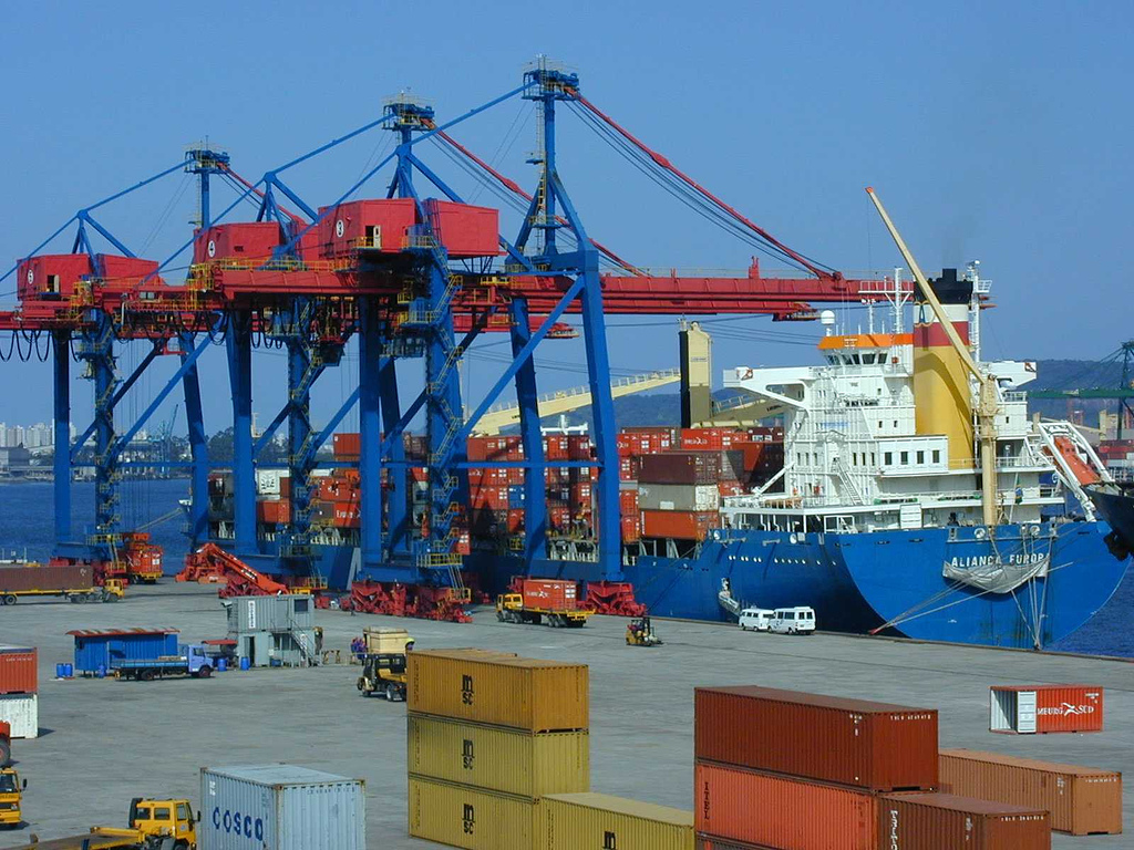
Coffee is no longer king. Today the port moves cars, machinery, orange juice, soybeans, and containerized cargo of every description. Ranked the 40th largest container port in the world and Latin America's busiest, Santos handles operations around the clock, fed by the Anchieta and Imigrantes highways and by rail lines that still follow the routes cut through the serra more than 150 years ago. Growth has brought growing pains: the port's access roads narrow to three lanes at the gates, two inbound and one outbound, creating chronic congestion. Expansion plans aim to triple cargo throughput from roughly 97 million tons to 230 million tons. The challenge is the same one Santos has faced since the 1860s -- moving goods efficiently between the coast and the vast interior beyond the mountains.
From the Air
Located at 23.96°S, 46.31°W on the coast of São Paulo state. The port complex stretches along the Santos estuary and is clearly visible from altitude -- look for the long line of container cranes and cargo vessels along the waterfront, adjacent to the dense urban grid of Santos city. The Serra do Mar escarpment rises dramatically to the northwest, providing striking visual contrast between the coastal flatlands and the forested mountain wall. Nearest airports: Congonhas-São Paulo (SBSP, 69 km inland), Guarulhos International (SBGR), and the small Santos Air Base (SBST). Recommended viewing altitude: 3,000-5,000 feet for the port layout and mountain backdrop.