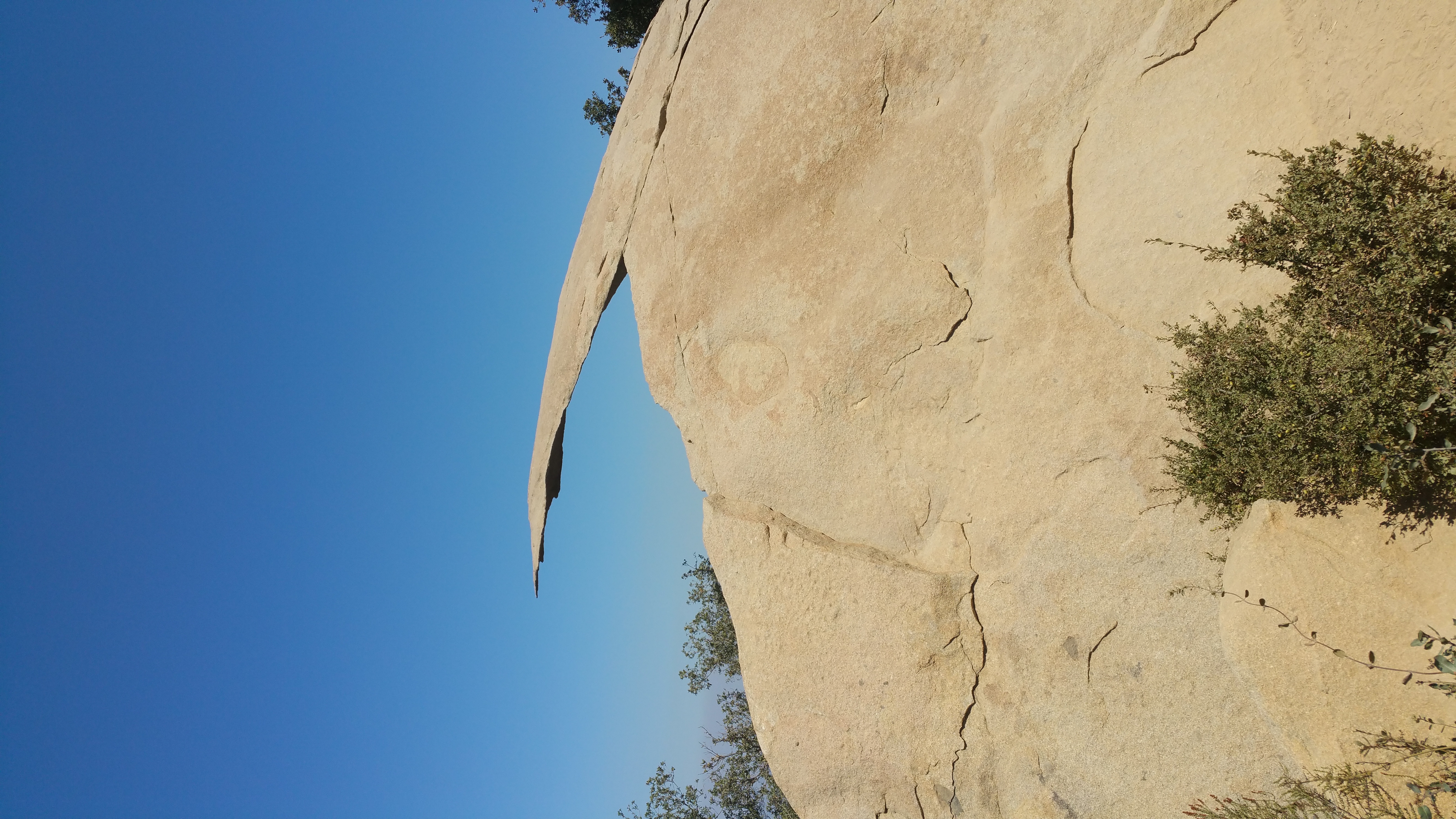
Potato Chip Rock
The rock doesn't look like much in photographs — a flat slab jutting out from a granite outcrop near the summit of Mount Woodson, hovering above the valley floor at somewhere between 2,700 and 2,800 feet. But photographs are how Potato Chip Rock became famous, and photographs are why people hike hours in the Southern California heat to stand on it. The slab is thin — cantilevered 14 feet into open air — and the perspective trick of standing at its tip while a hiking partner photographs from below creates the illusion that you are standing on a wafer above oblivion. Social media made it a phenomenon. The rock was famous before most people had heard of it.
Three Routes Up
Potato Chip Rock sits about 100 feet below Mount Woodson's true summit, accessible from three different trailheads. The most popular approach begins at the Lake Poway trailhead to the west — a 6.6-mile round trip that climbs steadily through chaparral before reaching the boulder-strewn summit zone. A shorter option starts along Highway 67 on the mountain's east side, following Mt. Woodson Road for a paved and steep 3.75-mile round trip. The third route, the Fry-Kogel Trail, runs about four miles. None of the approaches are particularly forgiving in summer: the granite reflects heat, the chaparral provides little shade, and the trail is crowded enough on weekends that the queue for the rock itself can stretch back thirty feet.
The Geology of the Joke
The rock is a product of differential weathering — the same process that leaves granite landscapes studded with rounded boulders and jutting fins. As softer rock erodes around harder formations, shapes emerge that no landscape architect would design on purpose: balanced rocks, arches, and thin cantilevers that look structurally impossible. Potato Chip Rock is a fin of harder granite left standing after the surrounding material was carried away over millions of years. Its thinness is not a sign of fragility — the rock has been holding that pose far longer than anyone has been hiking to it. Whether it will continue to do so is a question no geologist worries much about, but a Poway mayor once exploited the uncertainty to memorable effect.
The April Fools Mayor
On April 1, 2017, Poway Mayor Steve Vaus posted to social media with apparent urgency: part of Potato Chip Rock had snapped off and fallen into Lake Poway below. He included a photograph as proof. The prank went viral before people realized the date. Local news stations ran with it briefly; hikers started texting each other; the rock that had stood for millions of years was, for a few hours, declared broken. The joke worked because the rock looked breakable — that was its appeal. Vaus later confirmed the obvious, but the episode became its own footnote in the site's mythology: a rock famous for photographs generated its most famous photograph as a fabrication.
From the Air
Potato Chip Rock is located at 33.0092°N, 116.9742°W near the summit of Mount Woodson, between Poway and Ramona. The granite outcrop is most visible at low altitudes (2,000–4,000 ft AGL) in clear conditions. The summit area appears as a jumble of white granite boulders among chaparral. Nearby airports: KSEE (Gillespie Field, ~10 nm southwest), KRNM (Ramona Airport, ~8 nm east). Lake Poway is visible to the west.