Pra River
Before it was a river in crisis, the Pra was a border. In the nineteenth century, this waterway marked the line between the Ashanti Confederacy and the British-controlled Gold Coast -- a political frontier drawn by geography, where the forest thickened and the Ashanti sphere of influence ended. The Pra carried that weight quietly, as rivers do. It still carries weight today, though now the burden is mercury, sediment, and the consequences of a gold rush that never quite ended.
From Plateau to Gulf
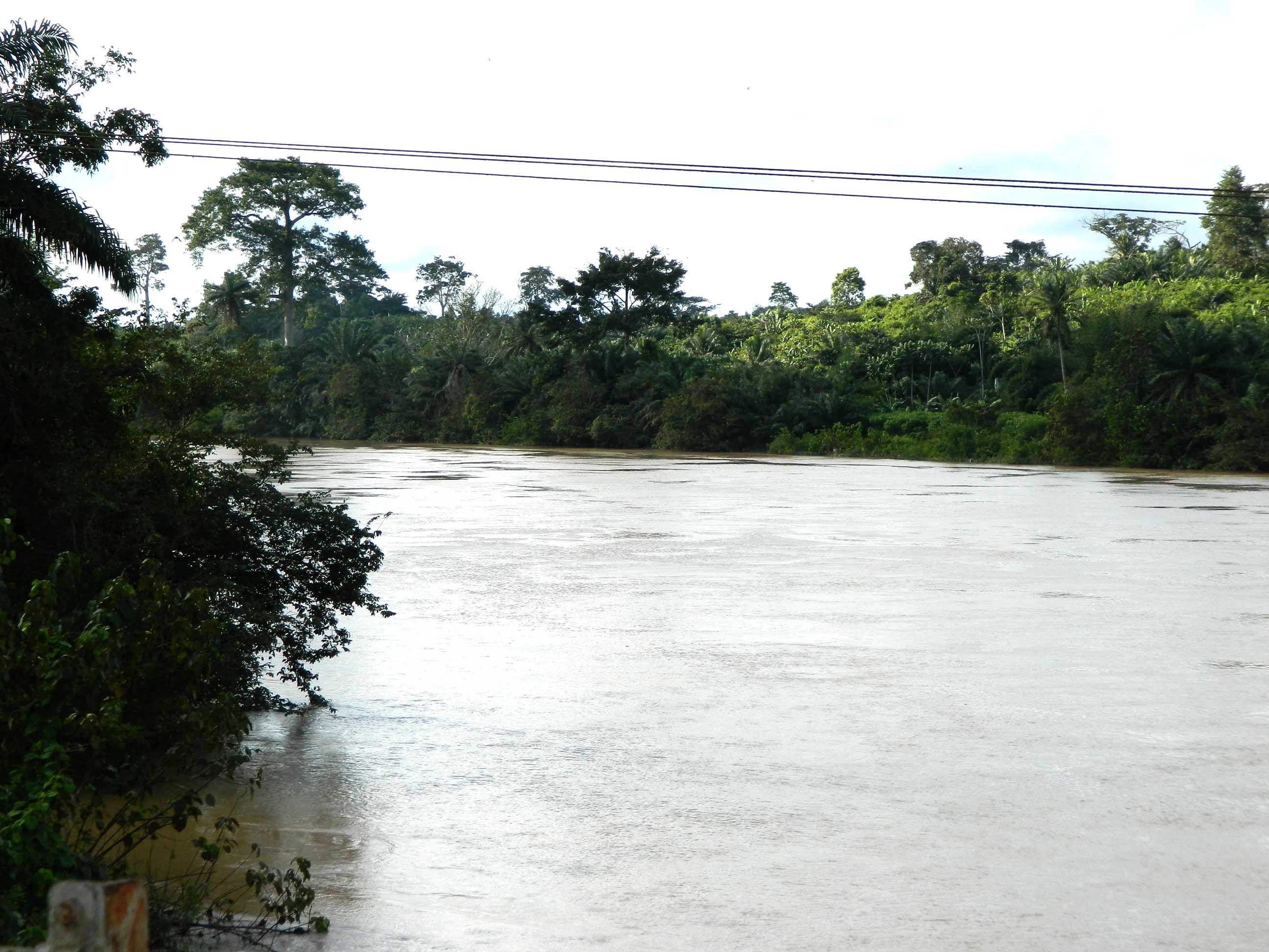
The Pra begins on the Kwahu Plateau near Mpraeso, emerging from the same escarpment that serves as Ghana's continental divide. From there it flows 240 kilometers southward through some of the country's richest agricultural land -- cocoa farms, timber forests, the fertile Akan lowlands -- before emptying into the Gulf of Guinea east of Takoradi. It is the largest of the three principal rivers draining south of the Volta divide, fed by major tributaries: the Ofin from the west, the Anum, and the diamond-rich Birim from the east. The Birim valley alone has yielded diamonds for decades, adding mineral wealth to a basin already defined by gold and cocoa. Akim Oda, situated along the river's upper course, serves as the commercial center of the northern Pra basin, a market town where the products of the forest and river economy converge.
A River That Defies Navigation
Despite its length and volume, the Pra is remarkably hostile to boats. Cataracts punctuate its course, most notably the Bosomasi Rapids at Anyinabrim, and for most of its length the river is unnavigable even by canoe. Where other West African rivers became arteries of communication and commerce, the Pra remained wild, its rapids and rocky stretches defeating anyone who tried to travel it by water. This mattered less in the early twentieth century, when the timber industry found another use for the current: floating logs downstream to the coast for export. Felled trees from the interior forests were rolled into the Pra and carried to coastal ports by the water itself, the rapids that stopped canoes proving less of an obstacle to buoyant hardwood. That era ended when roads and railways proved more reliable, but the practice shaped the river's identity -- less a highway for people than a conveyor for resources.
The Frontier River
The Pra's political significance peaked in the nineteenth century, when it served as the de facto border between two worlds. To the north lay the Ashanti Confederacy, the powerful Akan empire centered on Kumasi, with its gold trade, military discipline, and centralized authority under the Golden Stool. To the south lay the British Gold Coast, a colonial territory expanding inland from its coastal forts at Cape Coast and Elmina. The river sat between them, a natural boundary reinforced by the dense forest on either bank. British expeditions crossed the Pra multiple times during the Anglo-Ashanti Wars, and each crossing represented a step deeper into contested territory where European military technology met Ashanti tactical skill. The river was not just a geographic feature -- it was the line where empires met, and where the forest itself seemed to take sides.
Gold, Mercury, and Galamsey
Indigenous communities mined gold along the Pra's banks long before Europeans arrived, using simple tools to extract alluvial deposits from the riverbed. That tradition persists, but its modern form has become destructive on a scale the original miners could not have imagined. Artisanal miners -- known locally as galamsey operators -- still work the northern reaches of the Pra, using metallic mercury to separate gold from sediment. The mercury enters the water, exceeding World Health Organization guideline values by significant margins. Once in the ecosystem, mercury can persist for up to a thousand years, contaminating fish and crops irrigated with river water. The damage became impossible to ignore when Ghana Water Ltd. announced it could no longer adequately treat water from the Pra for the city of Cape Coast and surrounding areas. Over 4,700 hectares of land across multiple regions have been destroyed by illegal mining, turning forested riverbanks into barren, muddy wastelands visible even from the air. A river that once divided empires now divides opinion: between those who depend on its gold and those who depend on its water.
From the Air
Located at 6.62N, 0.80W in southern Ghana. The Pra River flows 240 km from the Kwahu Plateau to the Gulf of Guinea, visible as a winding brown waterway through dense green forest. From altitude, the contrast between forested riverbanks and cleared mining areas is stark -- look for muddy brown patches and exposed earth along the upper reaches. Nearest airports: Kumasi (DGSI) to the northwest, Accra International (DGAA) to the east. Takoradi airport (DGTK) near the river mouth. Best viewed at 2,000-4,000 ft AGL to trace the river's course through the forest canopy.