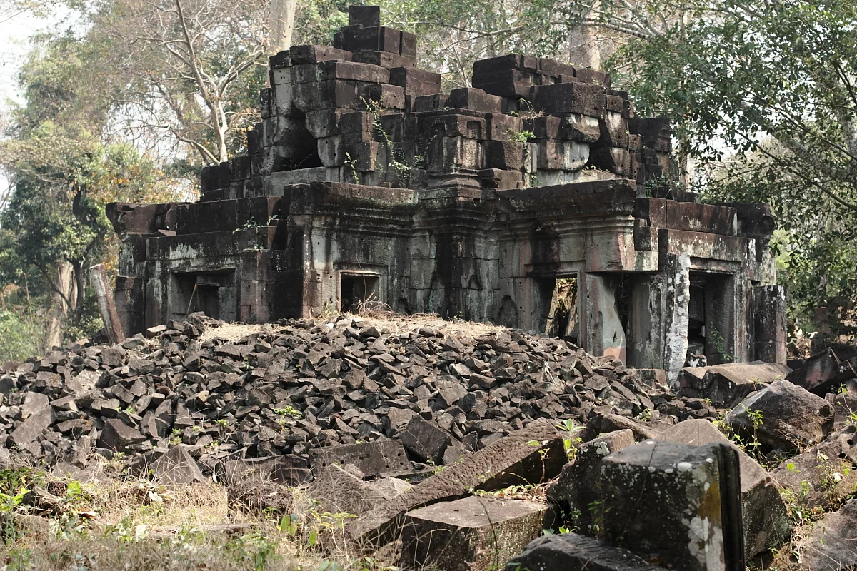

Preah Khan Kompong Svay
The single largest construction the Khmer Empire ever raised is not Angkor Wat. It is not Angkor Thom either — it is bigger than Angkor Thom. It sits a hundred kilometres east of Angkor in Preah Vihear province, its outermost wall enclosing roughly 22.5 square kilometres of forest, and on a typical day a handful of visitors make the drive. Cambodians call it Prasat Bakan; the maps call it Preah Khan of Kompong Svay. The archaeologist Mitch Hendrickson, who has spent years working the site, puts it plainly: this is the largest thing the Khmer ever built. It is also, by most accounts, the most thoroughly looted archaeological site in Cambodia. Those two facts are not unrelated.
Four Walls and a Dry Sea
The complex is built as four concentric enclosures, one nested inside the next, and it faces northeast — an oddity, since Khmer temples almost always open to the east. Along its western side stretches a baray, an artificial reservoir 2.8 kilometres long and 750 metres wide, now largely dry and grown over. On an island in the middle of it stands Preah Thkol, a cruciform sandstone temple with a tall central tower. At the southeastern corner rises Preah Damrei, a laterite step pyramid fifteen metres high, with stone elephants at its upper corners. Prasat Preah Stung, on the baray's west bank, carries the four-faced towers familiar from the Bayon and a naga-flanked landing stage where boats once tied up. A causeway runs from there to the central enclosure — 701 by 1,097 metres, moated, with gateways modelled on those of Angkor Thom.
Kings Who Kept Passing Through
For a place this size, the historical record is thin to the point of frustration. French scholars have generally put its founding in the eleventh century, probably under Suryavarman I. It served as a royal residence during Suryavarman II's reign, the king who built Angkor Wat, and later as a forward base for Jayavarman VII during the long war against the Cham in the late twelfth century. Archaeologists including Hendrickson and Damian Evans have floated competing readings of what it actually was: a rival Khmer polity, a trading entrepôt, a fortified frontier command, or something that changed function every time a new king found a use for it. Ceramics scattered across the site — stoneware, earthenware, imported porcelain — point to people living here from the eleventh century into the seventeenth.
Fire and Iron
About thirty kilometres east lies Phnom Dek, Iron Mountain, Cambodia's principal source of iron ore. The Kuay, an ethnic minority of that region, smelted iron there for centuries and only stopped in the middle of the twentieth. Preah Khan sat between the ore and the capital, and slag mounds around one of its reservoirs, Boeng Kroam, show that iron was worked here on a serious scale. The surprise was the dating: radiocarbon results put the intensive smelting in the mid-thirteenth century, decades after the temple complex itself was finished. Sediment cores tell a parallel story — widespread burning appears in the mid-fourteenth century, with almost no sign of it before, just as Angkor's political centre entered its long decline. Temple maintenance stopped around the same time. Something left, and something else moved in and put the place to work.
What Was Carried Away
In 1873 the French explorer Louis Delaporte reached the ruins and, with royal permission, hauled reliefs and sculptures back to France; they went first to the Trocadéro and then, in 1927, to the Musée Guimet. Victor Goloubew's aerial survey of 1937 finally showed the complex's true extent. The heavier losses came later. Through the 1970s and 1980s — the war years, the Khmer Rouge, and the fractured decade that followed — sculpture was cut out of the temples and moved west by people operating under armed control, in a country where the alternative to that work was often starvation. The dealers who paid for the pieces and the collectors who bought them were not the ones living in the forest. The thefts continued into the late 1990s, and in 2003 the central tower collapsed during a looting attempt. Of Preah Damrei's four elephants, two remain on the pyramid. One is in the National Museum of Cambodia. One is in Paris.
Still There, Mostly
What survives is not a ruin so much as a landscape that used to be a city. Trees have taken the causeways. The baray holds water only briefly. A putative head of Jayavarman VII from this site is one of the treasures of the National Museum of Cambodia, and the carvings that were not carried off are counted among the high points of Khmer art. Cambodia put the complex on UNESCO's World Heritage Tentative List on 27 March 2020, formalising a nomination first proclaimed back in 1992. Getting there still means a long approach on rough road, which is the main reason it stays quiet, and the main reason its recovery is slow. The isolation that made it a target is now the closest thing it has to protection.
From the Air
Preah Khan of Kompong Svay lies at 13.408°N, 104.748°E in Preah Vihear province, roughly 100 km east of Angkor across low, forested plain. From the air the giveaway is not the temples — the forest hides most of the masonry — but the geometry of water: the great baray, a hard-edged rectangle 2.8 km by 750 m, reads clearly even when dry, and the moat around the 701 by 1,097 metre central enclosure traces a second, smaller rectangle inside it. Look for straight lines in a landscape that has none. Best viewed at 3,000 to 6,000 feet AGL, and best in the dry season from December to March, when the baray holds enough residual moisture to darken against the surrounding scrub and the canopy is thinnest. Terrain is flat, generally under 300 feet elevation. Nearest airports of consequence are Siem Reap–Angkor International (VDSA) about 55 nm west, Phnom Penh International (VDPP) roughly 100 nm south-southwest, and Stung Treng (VDST) to the east. Expect haze and afternoon convection during the May–October southwest monsoon, and smoke from agricultural burning in February through April.
Nearby Stories
- Koh Ker 10 km away
- Cambodian Landmine Museum 16 km away
- Stung Sen Dam 22 km away
- Spean Praptos 28 km away
- Prey Lang Wildlife Sanctuary 54 km away
- Emerald Triangle (Southeast Asia) 70 km away
- Pursat 74 km away
- 2014 Thai Coup d'Etat 332 km away