Presidio San Agustin del Tucson
An Irish mercenary named Hugh O'Conor picked this spot on August 20, 1775, standing on the east terrace overlooking the Santa Cruz River floodplain. Near the O'odham village of Cuk Son, whose name means "black base" after nearby Sentinel Peak, O'Conor planted the flag of Spain and declared a presidio would rise here. From that single decision, Tucson was born. The fortress he envisioned would stand for 81 years, changing hands from Spain to Mexico to the Confederacy to the Union, surviving Apache sieges and Civil War intrigue before finally crumbling into the Arizona dust. Today, only a reconstructed corner remains, but the story of this presidio is the story of the American Southwest itself.
Walls of Adobe and Blood
The soldiers marched north from Tubac Presidio in 1776 and began raising walls from the desert floor. Mismanagement of construction funds nearly doomed the project, and it took a near-disastrous Apache raid in June 1782 to spur completion. By May 1783, the fort finally stood complete, its massive adobe walls enclosing a square compound with towers at the northeast and southwest corners. The main gate faced west, a chapel lined the east wall, and the commandant's house occupied the center. Inside those walls, Spanish soldiers dressed in seven-layered deerskin armor, carried shields of half-tanned rawhide, and wielded nine-foot lances against Apache warriors who controlled the surrounding mountains. The blacksmith even used a meteorite as an anvil, a cosmic tool that now resides in the Smithsonian. Despite being outnumbered by thousands, the Spanish held their ground, though they could never fully stop the raids.
Three Flags Over Tucson
Mexico won independence in 1821, and the Spanish garrison simply switched allegiances. But Mexican rule brought hard times. The new nation slipped into depression, supply lines withered, and old alliances with native tribes dissolved. Apache raids intensified. When the Mexican-American War began in 1846, Tucson held its largest garrison ever: 200 dragoons with two cannons. The Mormon Battalion approached from the southeast, and Mexican Captain Antonio Comaduron faced a decision that would shape history. He chose not to fight, withdrawing his forces to San Xavier and then Tubac. The Mormons passed through, the Mexicans returned, but Tucson's fate was sealed. The Gadsden Purchase of 1853 made it American territory, though Mexican soldiers did not actually leave the presidio until March 1856.
Civil War at the Desert's Edge
The isolation that defined Tucson became deadly when the Civil War emptied its protective forts in 1861. Apache war chiefs Cochise and Mangas Coloradas controlled every mountain around the city. The Butterfield Overland Mail company shuttered. Tucson stood alone. Confederate Captain Sherod Hunter arrived in late April 1862 with 75 men, raised the rebel flag, and sent Jack Swilling, who would later found Phoenix, to burn Union supply stations. The Battle of Picacho Pass, fought just north of Tucson, delayed Union forces for weeks. But reinforcements never came for Hunter. On May 20, 1862, James H. Carleton and 2,000 California Column soldiers captured Confederate Tucson without firing a shot. The following year, with help from Charles D. Poston, Arizona's founding father, Union Arizona Territory was created with Tucson as its capital.
Buried and Reborn
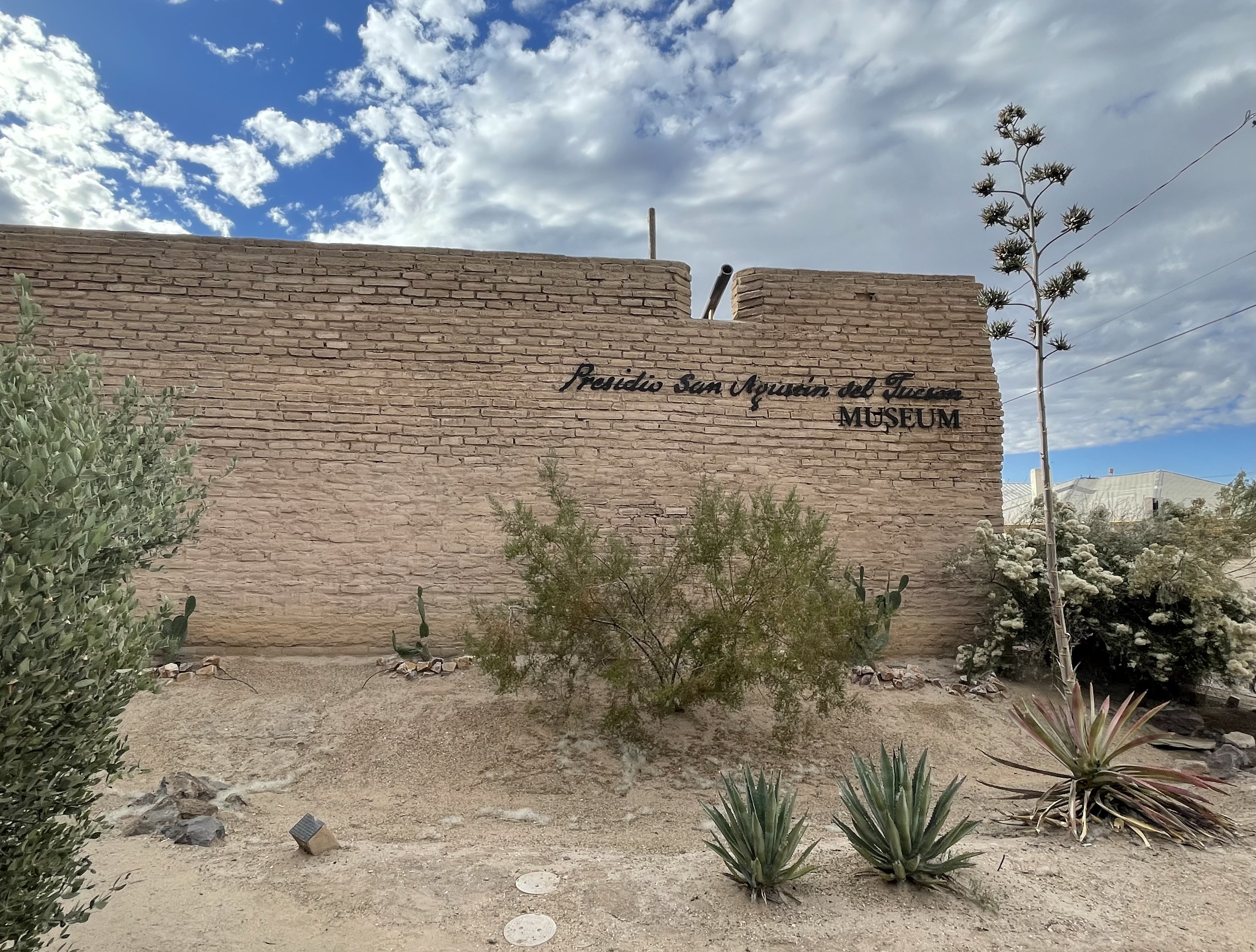
After Geronimo's surrender in 1886, the presidio walls no longer served as refuge. Development consumed the old fortress. By 1910, only one portion of wall remained, three feet thick and a few feet tall, wedged between American buildings. It was demolished in 1918. A pair of local women placed a plaque to mark where Tucson began. In 1954, when a boarding house was demolished for a parking lot, archaeologists found the northeastern bastion. They also discovered a Hohokam pit house beneath the Spanish foundations, evidence that this spot had drawn people for millennia. Attempts to create a park failed. The parking lot was built. But between 2001 and 2006, archaeologists returned. They found the bastion, the east wall, and trash-filled pits that told the story of daily life. In 2007, the northeastern corner of the fort was reconstructed as a museum, where visitors can now walk through history that three nations built, fought over, and nearly forgot.
From the Air
Located at 32.22N, 110.97W in downtown Tucson. The reconstructed museum is visible near the Old Pima County Courthouse. Best viewed from 3,000-5,000 feet AGL. Nearby airports: KTUS (Tucson International, 8nm south), KDMA (Davis-Monthan AFB, 6nm southeast). The Santa Cruz River floodplain that attracted the original settlement runs north-south through the city. Sentinel Peak, the 'black base' that gave Tucson its name, is visible to the west.