Princess Louisa Inlet
In 1792, George Vancouver sailed the length of Jervis Inlet, charting its every cove and headland for the British Admiralty, and found the entrance to a hidden fjord branching off to the northeast. He did not go in. The tide was ebbing through Malibu Rapids, and the current was too strong. That moment of deferral captures something essential about Princess Louisa Inlet: it does not give itself up easily. The 6-kilometer fjord, tucked within the swiya -- the traditional territory -- of the shishalh Nation, sits behind a tidal gate that opens only at slack water. Those who time it right enter a place where granite walls climb thousands of feet straight from the waterline and waterfalls pour down from snowfields invisible above.
A Fjord Within a Fjord
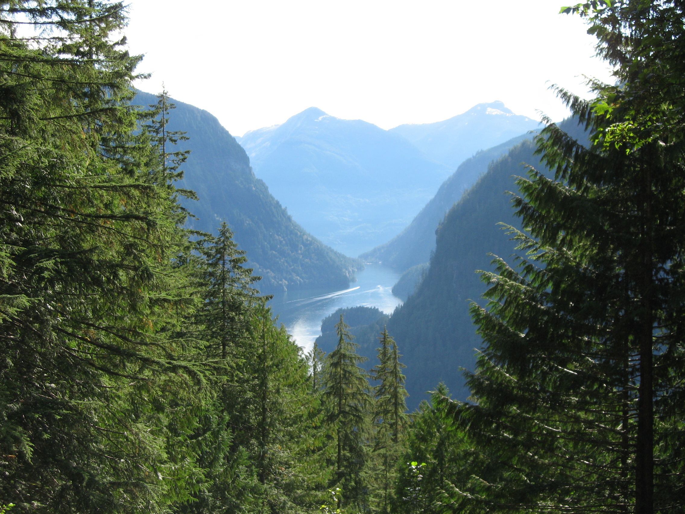
Princess Louisa Inlet branches off the northeastern end of Queens Reach, itself the upper arm of Jervis Inlet, one of the longest fjords on the BC coast. The entrance is Malibu Rapids, a shallow, narrow passage where tidal currents reach 9 knots during peak flow. Beyond the rapids, the inlet stretches 6 kilometers to its head at Chatterbox Falls, where Loquilts Creek crashes down a rock face into the fjord. Just upstream of Chatterbox, James Bruce Falls drops 2,755 feet down the mountainside -- the tallest waterfall in North America. The fjord's walls are so steep and the water so deep that anchoring is nearly impossible along most of its length. MacDonald Island, about 4 kilometers in, offers one of the only shallow spots where boats can find holding ground.
Hamilton's Dream, Abandoned
The modern history of Princess Louisa Inlet pivots on a single transaction. In 1940, Herman Caspar, a squatter who had no legal title to the land, sold his claim at the inlet's entrance to Thomas F. Hamilton for $500. Hamilton was an American aviation executive with grand ambitions. He purchased all the land surrounding Princess Louisa Inlet and planned a series of themed luxury resorts to attract yachtsmen and Hollywood celebrities. He named his lone completed resort after his yacht, the Malibu. For a decade, the Malibu Club operated as an exclusive getaway. Then, in 1950, a polio outbreak forced its closure and quarantine. The resort was abandoned. Years later, the property was acquired by Young Life, a youth organization, and the Malibu Club became a summer camp -- a transformation that traded champagne for campfire songs but preserved the setting that had attracted Hamilton in the first place.
Royal Names on Glacial Walls
The inlet's name likely honors Princess Louise, daughter of Queen Victoria, whose husband, the Marquess of Lorne, served as Governor General of Canada. Princess Louise visited British Columbia in 1882 with her husband and became so popular in the province that when the transcontinental railway's route was announced through the Selkirk Mountains rather than to Vancouver Island, Premier Robert Beaven reportedly asked whether the island could become a separate kingdom with the Princess as Queen. The actual naming origin remains uncertain, but the royal theme extends throughout the surrounding geography. Prince of Wales Reach honors Edward VII. Princess Royal Reach was named for Empress Frederick of Germany. Five mountains ringing Queens Reach bear the names of Victoria's children: Mount Victoria, Mount Alfred, Mount Alice, Mount Arthur, and Mount Helena.
The shishalh Homeland
Long before the fjord carried a princess's name, the shishalh Nation knew this landscape as part of their swiya. A village called asxwikwu stood at the mouth of the inlet, and the surrounding waters, forests, and salmon streams sustained communities whose presence here stretches back thousands of years. The shishalh connection to the inlet is not historical in the past-tense sense -- the Nation's traditional territory encompasses the entire waterway, and their relationship with it continues. Any honest account of Princess Louisa must begin with the recognition that its remoteness is relative. It was remote to Vancouver and Hamilton and the Hollywood set. To the shishalh, it was home.
Getting There Is the Story
No road comes within 50 kilometers of Princess Louisa Inlet. The nearest point of vehicle access is the BC Ferries landing at Earls Cove on Highway 101. From there, visitors proceed by boat, floatplane, or water taxi, navigating the length of Jervis Inlet before timing their transit through Malibu Rapids. This inaccessibility has shaped the inlet's character more than any park regulation. Princess Louisa Marine Provincial Park, established in 1965, protects the head of the fjord, and the Princess Louisa International Society helps maintain moorage and trails. But it is the rapids, with their twice-daily gate of churning water, that truly preserve the place. The effort required to reach Princess Louisa ensures that those who arrive have chosen to be there deliberately, and the inlet repays that intention with a landscape that feels, even in summer, profoundly untouched.
From the Air
Located at 50.18°N, 123.80°W, Princess Louisa Inlet is a narrow 6 km fjord branching northeast off Jervis Inlet on BC's Sunshine Coast. From the air, look for the constriction of Malibu Rapids at the inlet's entrance and the white ribbon of Chatterbox Falls at its head. Walls rise 2,000+ ft on both sides. Best viewed at 4,000-6,000 ft to see the full length. Nearest airport is Sechelt-Gibsons (CAP3), approximately 40 nm south. Powell River Airport (CYPW) lies roughly 35 nm north. The five royal-named peaks surrounding Queens Reach are visible landmarks. Low-altitude transits through the fjord are inadvisable due to steep terrain on all sides.