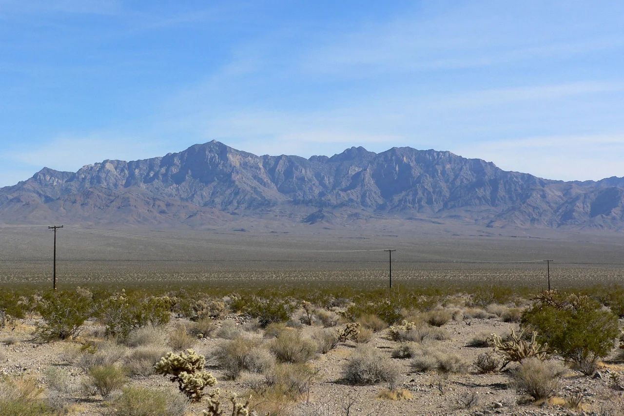
Providence Mountains
Francisco Garcés called the Providence Mountains the Sierra de Santa Coleta in 1776 — a name that honored a Christian saint and that nobody used for long. The American pioneers who came later had a different relationship with the range. After struggling across the surrounding Mojave Desert, they reached the mountains and, finding shelter and water, named them for the force they believed had delivered them. Providence: the intervention of a higher power in human affairs. The name stuck because it captured something true about what the mountains mean in the context of the desert around them — a sky island that offers what the desert floor withholds.
The Sky Island
Edgar Peak, at 7,162 feet, is the highest point in the Providence Mountains — high enough to support a biological community that has no equivalent on the desert floor below. Above 4,000 feet, pinyon pine and juniper replace the creosote and Joshua trees of the lower desert. The moisture that elevation attracts, combined with the cooler temperatures, creates conditions where woodland species can persist in what is otherwise an extreme desert environment.
This is the defining feature of a sky island: a mountain range that rises high enough above the surrounding desert to create its own ecosystem, isolated from other mountain ranges by the lowland desert that acts as a biological barrier. The Providence Mountains are separated from other comparable ranges by miles of desert that most woodland species cannot cross. The communities that have established themselves in the mountains are, in a meaningful sense, islanders.
The Mojave People
The Mojave people have known the Providence Mountains for thousands of years — long before any European friar assigned them a saint's name or any pioneer thanked divine intervention for reaching them. The mountains sit in the heart of Mojave territory, along the routes that connected the Colorado River to the Pacific Coast, and they provided resources — water, game, plant foods — that the surrounding desert could not.
Mojave oral traditions include the Providence Mountains as a feature of a landscape that the people understood in depth: where water was available at different seasons, what plants could be found at different elevations, which routes connected the mountains to other destinations. The knowledge accumulated over generations represented a form of geographic intelligence that the European explorers who arrived in the 18th and 19th centuries were only beginning to acquire.
Silver and the Mining Era
In 1863, silver was found in the Rock Springs Mining District in the Providence Mountains, drawing the prospectors whose attention the California mineral rush had scattered across every promising range in the state. The discovery was real — silver was present — but the deposits never achieved the commercial scale that would have transformed the mountains into a sustained mining district.
The pattern was familiar throughout the Mojave: finds that were genuine but grades that were marginal, operations that opened and closed without achieving profitability, ghost town remnants that marked the locations where someone had been briefly optimistic. The Providence Mountains held their silver but yielded it reluctantly, and the miners eventually moved on to other ranges and other prospects.
Two Species Found Nowhere Else
Mitchell Caverns, at 4,300 feet in the Providence Mountains, harbors two endemic insect species that live in the cave system and nowhere else on Earth. Cave-adapted species evolve in geological time — isolated populations in stable underground environments develop specialized traits over thousands of generations, eventually diverging far enough from their surface relatives that they constitute distinct species.
The Providence Mountains became part of Mojave National Preserve in 1994 through the California Desert Protection Act. The preserve boundary extended federal protection to the mountains, the caves, and the desert tortoise habitat on the surrounding slopes. From Edgar Peak on a clear day, the view extends across the Mojave in multiple directions — into Arizona to the east, Nevada to the north, the smear of Los Angeles light on the western horizon at night. The pioneers who named these mountains for providence were not wrong about what they had found.
From the Air
Located at 35.030°N, 115.528°W in eastern San Bernardino County within Mojave National Preserve. Edgar Peak at 7,162 feet is the high point and visible from long distances. The range's dark limestone appears distinctly different from surrounding terrain from the air. Mitchell Caverns State Recreation Area is accessible from Essex Road off Interstate 40. Nearest airports: Needles Airport (EED), approximately 30 miles east; Las Vegas (LAS), approximately 95 miles northeast.
Nearby Stories
- Clipper Mountains 8.7 km away
- Zzyzx, California 12 km away
- Ragtown, California 20 km away
- London Bridge (Lake Havasu City) 67 km away
- Boulder City and Hoover Dam 73 km away
- The PEPCON Disaster 88 km away
- Hoover Dam: The Depression-Era Marvel That Tamed a River 107 km away
- The 49ers of Death Valley: The Shortcut That Became a Deathtrap 126 km away