Province of Georgia
No rum. No slaves. No land beyond fifty acres. These were the rules James Oglethorpe laid down for his new colony in 1732, and nearly every one of them would be broken within two decades. The Province of Georgia stands apart in American colonial history not for what it became, but for what it tried to be. Chartered by King George II on April 21, 1732, and finalized by his privy council on June 9 of that year, Georgia was designed as something unprecedented among the Thirteen Colonies: a place where imprisoned debtors and "the worthy poor" of England could build new lives on small farmsteads, shielded from the plantation economy that dominated the South. That the experiment collapsed into the very system it opposed makes its story one of the most revealing chapters in early American history.
A Utopia with a Military Purpose
Oglethorpe's vision drew on the political philosophy of James Harrington, imagining an integrated society of smallholders rather than the plantation aristocracy that thrived in the Carolinas and Virginia. The charter explicitly prohibited slavery, not only on moral grounds but for strategic reasons: Georgia was designed as a garrison province, a buffer between the wealthy British colonies to the north and Spanish Florida to the south. Oglethorpe wanted sturdy, self-reliant farmers who could pick up muskets when needed, not a slave-dependent planter class. The original land grant was audacious in scope, stretching in a narrow strip all the way to the Pacific Ocean. Thirty-five families, numbering one hundred and twenty persons, were carefully selected from England's jails and poorhouses, their character and circumstances investigated by committee before departure.
The Short Life of Free Georgia
The restrictions that made Georgia idealistic also made it unpopular. Colonists who came at the trustees' expense received a modest plot: a 60-by-90-foot town lot plus a small farm. Those who paid their own passage could claim 500 acres and bring ten indentured servants, but no one could buy or sell additional land. Liquor was forbidden. Discontent festered. Settlers looked north at prosperous South Carolina, built on the very plantation system Georgia rejected, and demanded the same freedoms. One by one, Oglethorpe's prohibitions fell. Slavery was permitted beginning in 1749, though Scottish settlers within the colony voiced notable opposition. By the eve of the American Revolution, Georgia had become indistinguishable from its Southern neighbors: a slave-holding colony built on large landholdings, the utopian charter a distant memory.
The Reluctant Revolution
When tensions between the colonies and Britain exploded into violence at Massachusetts in 1775, Georgia hesitated. It was the last of the Thirteen Colonies to support the revolutionary cause, its population genuinely divided. But once radical Patriots stormed the royal magazine at Savannah and seized its ammunition, the momentum became irreversible. They drove Loyalists from the province and took control of the government. Royal Governor James Wright dismissed the assembly in 1775, became a prisoner of the revolutionaries, and escaped to a British warship in February 1776. By then, a provincial congress had already declared independence and drafted a new state constitution.
Battleground Between Empires
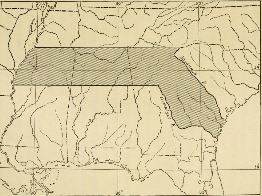
Georgia's war was uniquely chaotic. Wright became the only royal governor in all thirteen colonies to reclaim part of his domain after British forces captured Savannah on December 29, 1778. For years, the colony existed in a strange duality: British and Loyalist forces controlled the coast, while Patriots maintained an independent governor, congress, and militia in the interior. In 1779, the British repelled a combined assault by militia, Continental Army, and French military and naval forces on Savannah. It took the 1781 siege of Augusta to restore Patriot control over a major Georgia city. When the war finally ended, Wright and British forces evacuated Savannah on July 11, 1782. The Province of Georgia ceased to exist. In 1777, the original eight counties of the new state had been created from the old parish system, though settlement still clung to the Savannah River corridor, with the western territory remaining under Creek control.
From Colony to Keystone
Georgia became the fourth state admitted to the Union on January 2, 1788. But the colony's ambitions had always been larger than its settled territory. On April 24, 1802, Georgia ceded its western land claims to the U.S. Congress, lands stretching back to the colonial charter's sweeping grant. Those territories were folded into the Mississippi Territory and eventually became the states of Alabama and Mississippi. The Province of Georgia lasted barely fifty years as a British colony, yet it tested fundamental questions about liberty, labor, and social design that the nation would grapple with for centuries afterward.
From the Air
Centered at 31.76N, 82.36W, in south-central Georgia near the Altamaha River basin. The colonial settlements clustered along the Savannah River to the northeast, visible as the winding border with South Carolina. Savannah (KSAV) lies at the coast, while Augusta (KAGS) marks the inland frontier. At cruising altitude, the flat coastal plain stretching south toward Spanish Florida's former border reveals why Oglethorpe saw this land as a natural military buffer.