Puente Aranda
The name is literal: Aranda's Bridge. In the 16th century a Spanish landowner named Juan Aranda threw a crossing over the Chinúa River - now called the San Francisco - and the wet southern flats of Santafé turned into something a traveler could traverse. Four centuries later the bridge is gone, the river is a canalized trickle, and the name belongs to a locality of more than 300,000 people where most of Bogotá's chemicals, textiles, and beer are made. Puente Aranda is the district where the capital became industrial.
Where the Rivers Met
The Puente Aranda hacienda was established in the 16th century by the oidor Francisco de Anuncibay, a Crown judge who reached the New Kingdom of Granada in 1537. The land, first called the Hacienda de Aranda and sometimes the Roof of the Jorges, lay at the merging of the Chinúa and San Agustín rivers on the wetlands of the Bogotá savanna. It flooded often - any low place on the savanna did - and the estate sat astride the main western route out of Santafé toward the port of Honda on the Magdalena River, Colombia's most important fluvial artery. A bridge here made that western road possible. The crossing was rebuilt in 1768 with better masonry and became known as Puente de Aranda.
Bolívar Camped Here
In 1814, during the early chaos of the Patria Boba - the quarrelsome first phase of Colombian independence - Simón Bolívar brought his troops to rest in the Hacienda of Aranda. The savanna was still largely rural then, a patchwork of haciendas and indigenous fields. The Railway of Bogotá reached the area in 1898, running a southern line out toward the Tequendama Falls. Industry followed the rails. By the 1940s the city itself was rolling south to meet the haciendas, and in 1944 Aranda's bridge was torn down to build Avenida de Las Américas, a modern avenue backed by the Colombian Society of Architects. The intersection of Calle 13 and Las Américas became the site of a new bridge - and the neighborhood around it kept the old name.
The Industrial Corridor
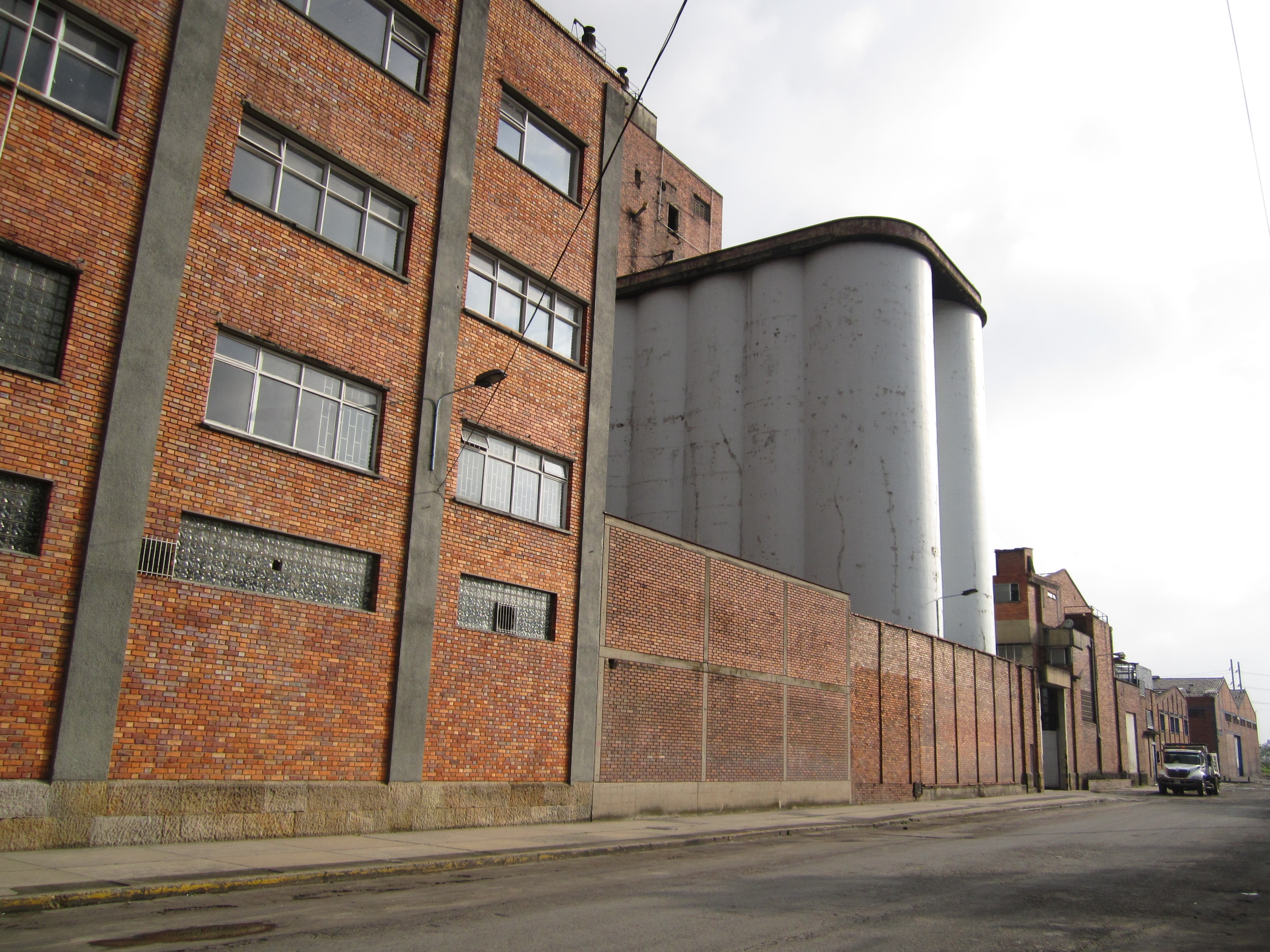
Puente Aranda was zoned industrial in the 1951 Pilot Plan for Bogotá and formally declared a sector of the city in 1963. What came after is the backbone of Bogotá's manufacturing: textiles, chemicals, metallurgy, food processing. Roughly 700 of the locality's 1,794 city blocks are industrial, and another 800 residential, making it a genuine mixed-use zone of working-class and lower-middle-class homes pressed up against factory walls. The Andina Brewery has its long facade along one of these blocks. On Avenida de Las Américas, a monument to Sía - the Muisca goddess of water - rises beside the modern roadway, acknowledging the wetland spirits the area once belonged to. The census numbers tell a curve: 221,776 people in 1973, 305,123 by 1985, then a dip to 282,491 in 1993 as families moved to newer suburbs, then a rebound to 370,292 in 2005. For a district of 17 square kilometers, that is dense human pressure on what was once a flood plain.
A Locality of Neighborhoods
Puente Aranda is not one place but a mosaic. Tibana, Ciudad Montes, San Rafael, Muzu, Primavera, Comuneros, El Jazmín, Santa Isabel, La Alquería, La Coruña, Ospina Pérez, Galán, Pradera, La Igualdad - each barrio has its own character, markets, and reputation, the result of the neighborhood-by-neighborhood way the industrial age expanded across the savanna. The TransMilenio bus rapid transit system threads through the district on the F and G lines, with stops at Marsella, Pradera, Distrito Grafiti, Puente Aranda, Carrera 43, and the Industrial Zone. The Distrito Grafiti station name is a literal one - the surrounding walls are covered in murals, and the area has become one of the most photographed outdoor galleries in Latin America. Puente Aranda is working Bogotá: loud, painted, busy, stitched together by bus lines and the memory of a lost river.
The Fucha Still Runs
The Fucha, the San Cristóbal, the Seco, and the Canal de los Comuneros still cross the locality, though mostly in concrete channels - the wetlands they drained are under asphalt now. The slight rise from east to west - barely perceptible walking, but enough to shed water - is a reminder that Puente Aranda is flat only by comparison. The Bogotá savanna, the high Andean plain where this district sits at about 2,560 meters, has been home to people since the Muisca confederation centered itself at nearby Bacatá a thousand years ago. The bridge that gave Puente Aranda its name was only a small improvement on a route people had used long before Juan Aranda's hacienda existed - the old crossing between the uplands and the Magdalena corridor. The bridge is gone. The path remains.
From the Air
Puente Aranda lies at 4.6125°N, 74.1067°W in central Bogotá on the Bogotá savanna, at about 2,560 m (8,400 ft) elevation. El Dorado International Airport (SKBO) sits just northwest, and approach tracks for many domestic flights pass over or near the district. From above, the area reads as a dense industrial grid between Calle 19 and Autopista Sur; Avenida de Las Américas cuts diagonally through it. The Eastern Hills rise sharply to the east. Bogotá's high altitude and frequent low clouds - especially in the afternoon - mean morning flights give the clearest view.