Puerto Natales
The town exists because of the mountains. Puerto Natales - 19,000 people scattered along the shores of Última Esperanza Sound - would be just another quiet Patagonian fishing village if it weren't for what lies 112 kilometers to the north: Torres del Paine, one of the most spectacular national parks on Earth. Every hiker heading for the famous 'W' circuit passes through here. Every trekking boot, every freeze-dried meal, every nervous glance at the weather forecast happens in this windy town where the sound meets the sea and the mountains fill the northern horizon.
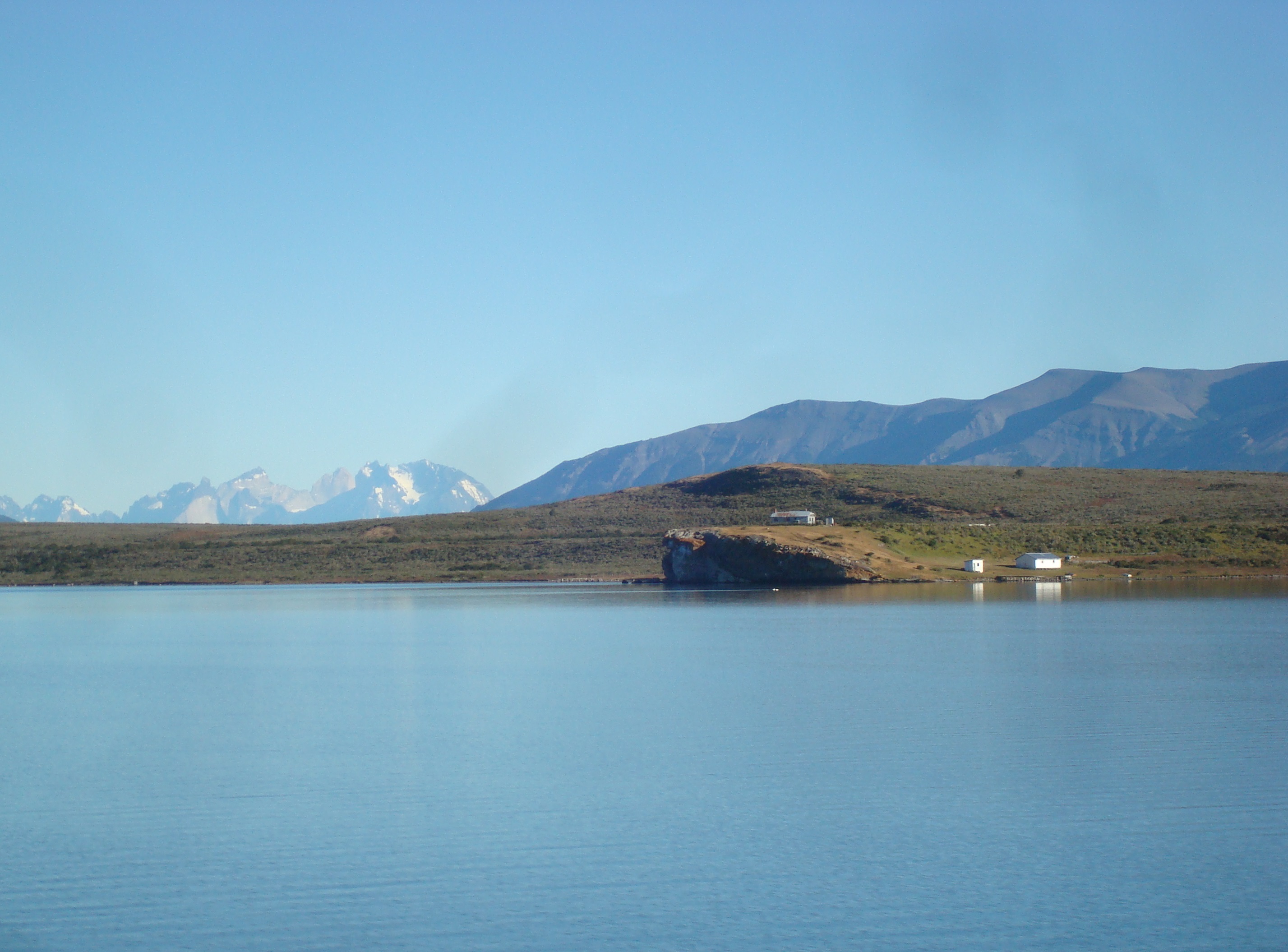
Last Hope Sound
The Spanish called it Última Esperanza - 'Last Hope' - because for the early explorers navigating these fjords, this was the final inlet before the dead end of the Andes. The glaciers and mountains that had blocked every other route blocked this one too. But the name stuck, and now it carries a different meaning: last hope for supplies before the wilderness, last chance for a hot shower before weeks on the trail.
The sound connects to the Gulf of Admiral Montt to the south and, through it, to the Pacific beyond. Flamingos wade in the shallows, improbably pink against the grey water. The Navimag ferry departs from here on its three-day journey through the channels to Puerto Montt, one of the most scenic ferry routes in the world. And at low tide, the old boat cemetery reveals itself - rusting hulls from the days when meatpacking plants lined the shore.
Trekker's Town
The rhythm of Puerto Natales follows the trail seasons. In summer, the hostels fill with an international cast of hikers comparing notes, sharing transport, debating gear. The outdoor shops do brisk business in last-minute equipment. The supermarkets - significantly cheaper than anything in the park - see constant traffic from trekkers stocking up on oatmeal, pasta, and calorie-dense snacks.
The town itself is modest: a plaza, a church, streets of low buildings battered by the wind. But the infrastructure for adventure is excellent. Tour operators run day trips to the park, boat excursions to the glaciers, and multi-day circuits for those who don't want to camp. And after days in the mountains, the cafes and restaurants feel like civilization itself - hot coffee, fresh bread, walls that block the wind.
The Milodón Cave
Before the trekkers came, before the town existed, before humans arrived in South America, a giant ground sloth called the milodón lived in these hills. Mylodon darwinii - named for Darwin, who studied similar creatures - stood three meters tall and grazed the Patagonian steppe. When the first humans arrived 10,000 years ago, the milodón was still here; cave paintings suggest they coexisted, at least briefly.
The Cueva del Milodón, 25 kilometers from town, preserves the site where milodón remains were discovered in 1895. A life-sized replica of the creature stands at the cave entrance, strange and wonderful. The cave itself is vast - 200 meters deep, 80 meters wide - carved by water into the rock. For a moment, standing inside, you can imagine a time when this land was emptier and stranger, when creatures that seem mythical walked the same ground you're walking now.
Gateway to the Glaciers
Torres del Paine gets the fame, but the glaciers of Bernardo O'Higgins National Park are just as spectacular - and far less crowded. Tour boats leave Puerto Natales for the glaciers at the head of Última Esperanza Sound: Balmaceda and Serrano, cascading down from the Southern Ice Field in rivers of blue ice.
The journey itself is part of the experience. The boat threads through the sound, passing forested islands and sheer rock walls. Cormorants and condors wheel overhead. The glacier appears gradually, growing larger, more detailed, more impossibly blue. At the base of Serrano, passengers disembark to walk through forest to the ice's edge, close enough to hear the creaking and groaning of a river of frozen water slowly making its way to the sea.
Chilote Soul
Many of Puerto Natales' residents trace their roots to Chiloé, the island archipelago far to the north. They came as laborers for the meatpacking plants, brought their wooden building traditions, their seafood stews, their particular Catholicism mixed with older beliefs. The 'chilote' influence is visible in the architecture - wooden houses with steep roofs, built to shed rain - and audible in the accent.
Politics here lean left, a legacy of union organizing in the meatpacking days. Conversations about land rights, about workers, about the costs and benefits of tourism in a fragile ecosystem, carry more weight than in many Chilean towns. The locals have seen industries come and go: wool, meat, fishing. Tourism is the latest, and they're realistic about its limits. The mountains will remain when the tourists move on. The wind will keep blowing. The sound will keep reaching toward the glaciers in the north.
From the Air
Located at 51.73°S, 72.52°W on the shores of Última Esperanza Sound in Chilean Patagonia. Puerto Natales has a small airport (PNT) with seasonal flights to Santiago and Puerto Montt - look for the runway 10km north of town on the road to Torres del Paine. The town appears as a compact urban grid along the sound's eastern shore. The Navimag ferry terminal is visible at the waterfront. Última Esperanza Sound opens to Almirante Montt Gulf to the south, connecting eventually to the Pacific through a maze of channels. Torres del Paine National Park lies 112km north - the granite towers visible from altitude in clear weather. The Balmaceda and Serrano glaciers are accessible from the park's southern edge, at the head of the sound. Punta Arenas (PUQ) is 250km south by road, a 3-hour drive. Weather is typical Patagonian - strong winds, rapidly changing conditions, frequent precipitation.