Puerto Vallarta
In 1963, John Huston brought a film crew to a remote fishing village on Mexico's Pacific coast to shoot The Night of the Iguana. Richard Burton came along, and so did Elizabeth Taylor -- who was not in the film but was very much in the headlines. The tabloids chased their affair through the cobblestone streets and jungle-draped hillsides of a place most Americans had never heard of. Within a year, Puerto Vallarta was no longer a secret. Burton and Taylor bought a house. Huston built one on a secluded beach. And a sleepy port named after a nineteenth-century governor of Jalisco began its transformation into one of Mexico's most celebrated resort cities.
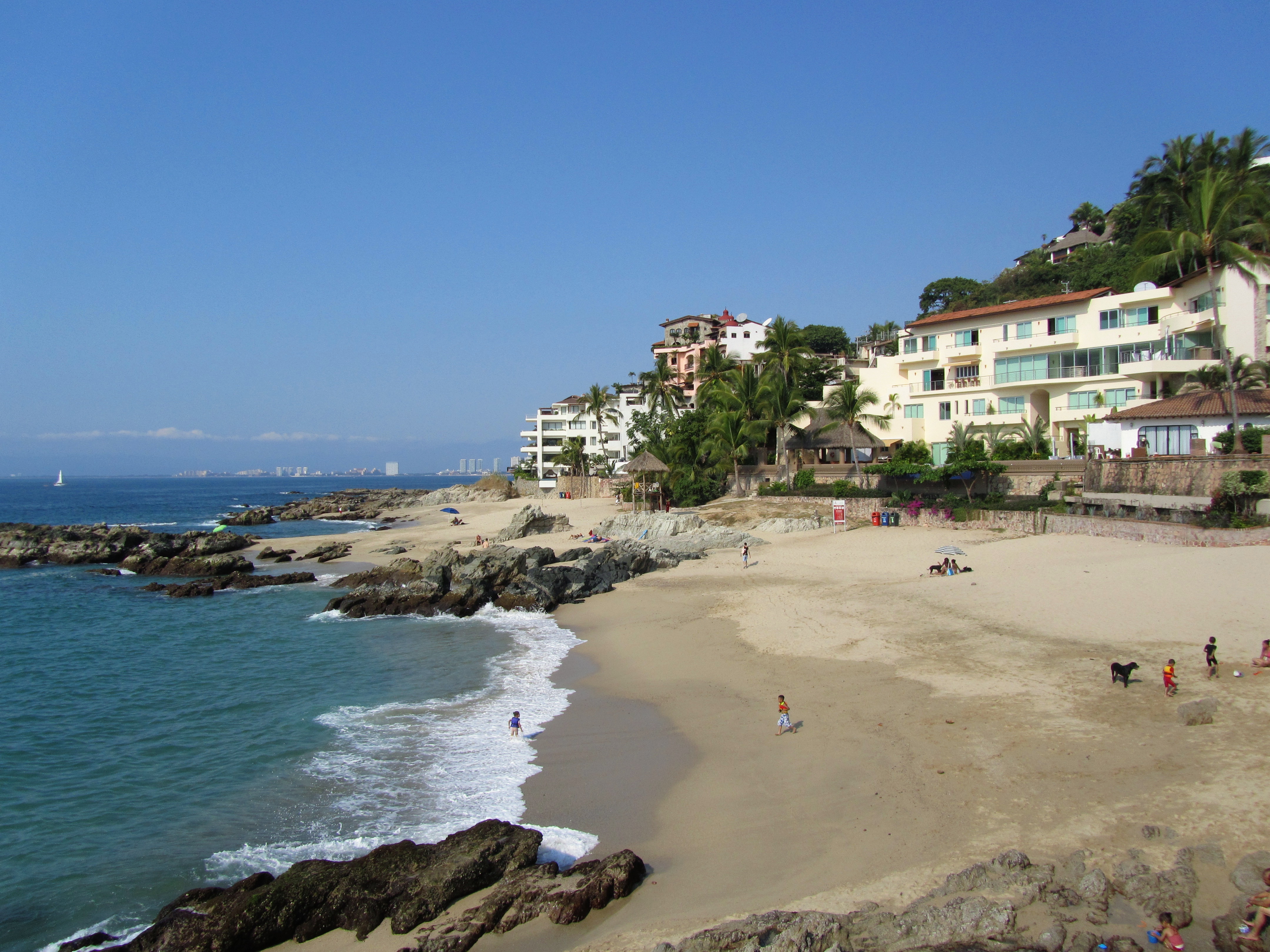
The Bay of Flags and the Beach of the Dead
The bay that cradles Puerto Vallarta carries a name rooted in a sixteenth-century misunderstanding. In 1524, Francisco Cortes de San Buenaventura -- nephew of the more famous Hernan -- marched soldiers into the village of Tintoque. Indigenous warriors surrounded them, weapons raised. A Catholic friar began praying. The warriors lowered their arms, reportedly transfixed by the soldiers' colorful banners. Bahia de Banderas -- the Bay of Flags -- took its name from that moment. Seven years later, Hernan Cortes himself sent ships north from Acapulco to explore the coastline. One wrecked in the bay. All but three crew members perished, and their bodies washed ashore for days. The beach where villagers found the dead sailors became Playa de Los Muertos -- the Beach of the Dead. It remains one of Puerto Vallarta's most popular stretches of sand, its macabre origin now a footnote to sunbathing and vendors selling grilled corn.
From Las Penas to a City of Light
Puerto Vallarta's founding is officially traced to December 12, 1851, when Guadalupe Sanchez Torres and a handful of companions established a settlement called Las Penas de Santa Maria de Guadalupe, named for both the rocky coastline and the patron saint whose feast day it was. The village remained tiny and remote, growing only when mining operations along the Cuale River drew workers in the 1860s. By 1885, the settlement counted roughly 250 homes and 800 people. It took the name Puerto Vallarta in honor of Ignacio Vallarta, a governor of Jalisco, and the pace of change remained slow for decades. Then came the airport, then the cruise terminal -- inaugurated in 1970, making it Jalisco's first harbor town -- and then Huston's cameras. The Mexican government poured investment into highways and infrastructure, and the village that had been a forgotten footnote on nautical charts became a city where the Sierra Madre Occidental meets the Pacific in a collision of green mountains and blue water.
Where the Mountains Meet the Sea
Geography defines Puerto Vallarta as much as its history does. The city sits on a narrow coastal plain at the foot of the Sierras Cuale and San Sebastian, fingers of the Sierra Madre Occidental that plunge directly into the Pacific. Three rivers -- the Cuale, the Pitillal, and the Ameca -- cut through the mountains and empty into the bay. The terrain forced the city into a particular shape: a long, narrow strip hugging the coast, with neighborhoods climbing the hillsides wherever the slope allowed. From above, the pattern is unmistakable -- a ribbon of white and terracotta buildings pressed between jungle-green mountains and the enormous arc of Bahia de Banderas. The bay itself is one of the largest in the Pacific, stretching from Punta de Mita in the north to Cabo Corrientes in the south, a natural amphitheater of warm water that shelters the coast from the open ocean's rougher moods.
A City That Learned to Welcome Everyone
Puerto Vallarta evolved from a conservative fishing village into one of Mexico's most inclusive destinations. Its south-side Zona Romantica became the heart of a vibrant LGBTQ community, with the city sometimes called the "San Francisco of Mexico." The municipal government, once cautious, began actively supporting pride celebrations in 2013, and the annual Vallarta Gay Pride now draws visitors from across the Americas during Memorial Day weekend. This openness coexists with deep Catholic tradition -- the Church of Our Lady of Guadalupe, its crown-topped tower visible from almost anywhere in the city, remains the spiritual anchor of the old town. Along the Malecon, the seaside boardwalk, bronze sculptures by artists like Sergio Bustamante and Alejandro Colunga stand in the salt air. Retirees from the United States and Canada have settled into neighborhoods like Amapas and Conchas Chinas, built into the mountainside above the bay, creating a cosmopolitan layer atop a city that still fries fish on the beach at sunset.
Galleons, Film Stars, and Surf
Before the tourists, Bahia de Banderas was a stop on the Manila galleon route, linking New Spain to Asia. Before the galleons, indigenous peoples of the Aztlan culture inhabited these shores from at least 580 BCE. That depth of history still surfaces unexpectedly -- in archaeological fragments near Ixtapa, in the colonial stones of older buildings, in the name of every street and beach. The Night of the Iguana put Puerto Vallarta on the map, but the city has long since outgrown that origin story. Los Arcos National Marine Park, a cluster of granite arches offshore at Mismaloya, protects breeding colonies of pelicans and boobies. The Vallarta Botanical Gardens showcase native orchids and agaves in the hills south of town. And at Playa de Los Muertos, five centuries after those drowned sailors washed ashore, the waves still come in -- indifferent to the centuries of human drama played out along this extraordinary coast.
From the Air
Located at 20.64°N, 105.22°W on the Pacific coast of Jalisco, Mexico. Bahia de Banderas is a large, visually distinctive bay visible from cruise altitude. The city appears as a narrow coastal strip between jungle-green mountains and the bay. Gustavo Diaz Ordaz International Airport (IATA: PVR, ICAO: MMPR) serves the city. Approach from the west over the bay for the best view of the city against the Sierra Madre Occidental. Best viewed at 3,000-5,000 ft AGL.